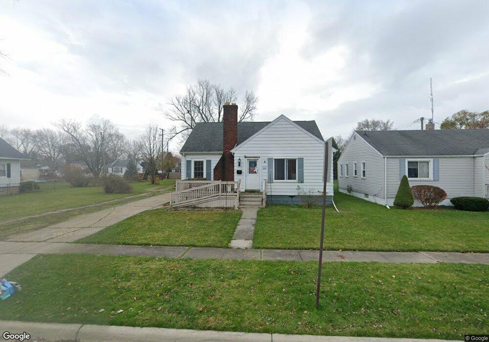
1220 Union St Port Huron, MI 48060
Estimated Value: $141,000 - $155,000
3
Beds
1
Bath
1,057
Sq Ft
$141/Sq Ft
Est. Value
About This Home
This home is located at 1220 Union St, Port Huron, MI 48060 and is currently estimated at $148,971, approximately $140 per square foot. 1220 Union St is a home located in St. Clair County with nearby schools including Woodrow Wilson Elementary School, Central Middle School, and Port Huron High School.
Ownership History
Date
Name
Owned For
Owner Type
Purchase Details
Closed on
Nov 1, 2023
Sold by
Labree Homes Llc
Bought by
Lee Rentals Llc
Current Estimated Value
Purchase Details
Closed on
Feb 12, 2015
Sold by
Mcnichol John and Mcnichol Laurie
Bought by
Labree Homes Llc
Purchase Details
Closed on
Apr 10, 2014
Sold by
Mcnichol John F and Mcnichol Laurie A
Bought by
Labree Homes Llc
Create a Home Valuation Report for This Property
The Home Valuation Report is an in-depth analysis detailing your home's value as well as a comparison with similar homes in the area
Home Values in the Area
Average Home Value in this Area
Purchase History
| Date | Buyer | Sale Price | Title Company |
|---|---|---|---|
| Lee Rentals Llc | -- | None Listed On Document | |
| Lee Rentals Llc | -- | None Listed On Document | |
| Labree Homes Llc | -- | None Available | |
| Labree Homes Llc | $22,889 | None Available |
Source: Public Records
Tax History Compared to Growth
Tax History
| Year | Tax Paid | Tax Assessment Tax Assessment Total Assessment is a certain percentage of the fair market value that is determined by local assessors to be the total taxable value of land and additions on the property. | Land | Improvement |
|---|---|---|---|---|
| 2025 | $4,058 | $64,600 | $0 | $0 |
| 2024 | $3,660 | $62,400 | $0 | $0 |
| 2023 | $1,861 | $55,400 | $0 | $0 |
| 2022 | $1,863 | $50,200 | $0 | $0 |
| 2021 | $1,778 | $42,800 | $0 | $0 |
| 2020 | $1,785 | $37,400 | $37,400 | $0 |
| 2019 | $1,753 | $27,900 | $0 | $0 |
| 2018 | $1,714 | $27,900 | $0 | $0 |
| 2017 | $1,573 | $27,100 | $0 | $0 |
| 2016 | $1,399 | $27,100 | $0 | $0 |
| 2015 | $914 | $26,500 | $26,500 | $0 |
| 2014 | $914 | $25,500 | $25,500 | $0 |
| 2013 | -- | $25,800 | $0 | $0 |
Source: Public Records
Map
Nearby Homes