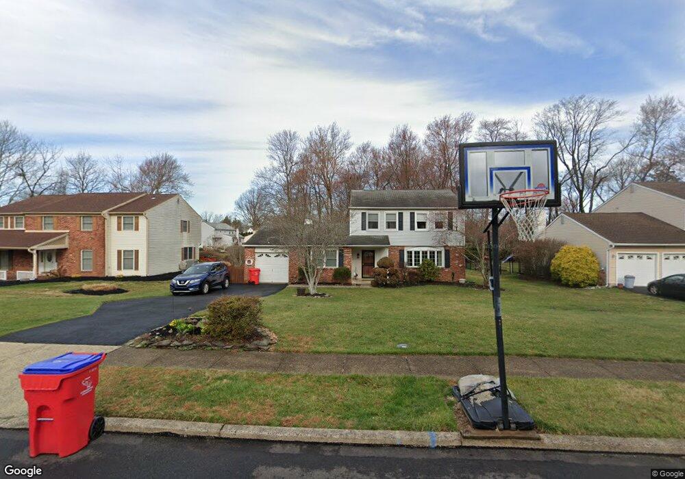
1220 Woodbrook Ln Warminster, PA 18974
Estimated Value: $528,000 - $572,000
3
Beds
3
Baths
2,037
Sq Ft
$272/Sq Ft
Est. Value
About This Home
This home is located at 1220 Woodbrook Ln, Warminster, PA 18974 and is currently estimated at $554,747, approximately $272 per square foot. 1220 Woodbrook Ln is a home located in Bucks County with nearby schools including McDonald Elementary School, Log College Middle School, and William Tennent High School.
Ownership History
Date
Name
Owned For
Owner Type
Purchase Details
Closed on
Apr 4, 2001
Sold by
Steinbach Charles H and Steinbach Patricia J
Bought by
Smith Anderson Q and Smith Lorraine S
Current Estimated Value
Home Financials for this Owner
Home Financials are based on the most recent Mortgage that was taken out on this home.
Original Mortgage
$175,950
Interest Rate
6.88%
Create a Home Valuation Report for This Property
The Home Valuation Report is an in-depth analysis detailing your home's value as well as a comparison with similar homes in the area
Home Values in the Area
Average Home Value in this Area
Purchase History
| Date | Buyer | Sale Price | Title Company |
|---|---|---|---|
| Smith Anderson Q | $207,000 | -- |
Source: Public Records
Mortgage History
| Date | Status | Borrower | Loan Amount |
|---|---|---|---|
| Previous Owner | Smith Anderson Q | $175,950 |
Source: Public Records
Tax History Compared to Growth
Tax History
| Year | Tax Paid | Tax Assessment Tax Assessment Total Assessment is a certain percentage of the fair market value that is determined by local assessors to be the total taxable value of land and additions on the property. | Land | Improvement |
|---|---|---|---|---|
| 2025 | $6,501 | $30,800 | $8,720 | $22,080 |
| 2024 | $6,501 | $30,800 | $8,720 | $22,080 |
| 2023 | $6,301 | $30,800 | $8,720 | $22,080 |
| 2022 | $6,166 | $30,800 | $8,720 | $22,080 |
| 2021 | $6,022 | $30,800 | $8,720 | $22,080 |
| 2020 | $5,938 | $30,800 | $8,720 | $22,080 |
| 2019 | $5,623 | $30,800 | $8,720 | $22,080 |
| 2018 | $5,488 | $30,800 | $8,720 | $22,080 |
| 2017 | $5,327 | $30,800 | $8,720 | $22,080 |
| 2016 | $5,327 | $30,800 | $8,720 | $22,080 |
| 2015 | $5,262 | $30,800 | $8,720 | $22,080 |
| 2014 | $5,262 | $30,800 | $8,720 | $22,080 |
Source: Public Records
Map
Nearby Homes
- 11 Lincoln Ave
- 109 Wilson Ave
- 56 Parry Way
- 55 Parry Way
- 59 Parry Way
- 146 Grandview Dr
- The Addis Plan at The Reserve at Spring Mill
- The Beckett Plan at The Reserve at Spring Mill
- 10 Spring Mill Dr
- 9 Spring Mill Dr
- 11 Spring Mill Dr
- 8 Lacey Ln
- 18 Lacey Ln
- 1297 Twin Streams Dr
- 451 Twin Streams Dr
- 130 E Street Rd
- 667 Arbor Ln
- 675 Cheryl Dr
- 11111 Centennial Station
- 1070 Decker Ln
- 1230 Woodbrook Ln
- 1250 Woodbrook Ln
- 1221 Woodbrook Ln
- 1165 Charter Rd
- 1229 Woodbrook Ln
- 1159 Charter Rd
- 1169 Charter Rd
- 60 Vista Dr
- 71 Vista Dr
- 1179 Charter Rd
- 1185 Jacksonville Rd
- 70 Vista Dr
- 1215 Jacksonville Rd
- 79 Vista Dr
- 1189 Charter Rd
- 1155 Charter Rd
- 1170 Charter Rd
- 80 Vista Dr
- 1175 Jacksonville Rd
- 1160 Charter Rd