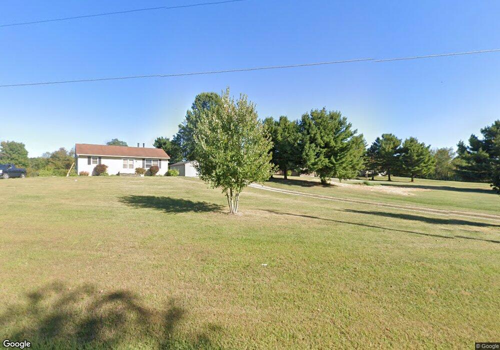
12200 State Route 188 Thornville, OH 43076
Estimated Value: $386,000 - $459,000
3
Beds
2
Baths
2,460
Sq Ft
$172/Sq Ft
Est. Value
About This Home
This home is located at 12200 State Route 188, Thornville, OH 43076 and is currently estimated at $423,842, approximately $172 per square foot. 12200 State Route 188 is a home located in Perry County with nearby schools including Sheridan High School.
Ownership History
Date
Name
Owned For
Owner Type
Purchase Details
Closed on
Jan 15, 2021
Sold by
Hoshor Lois Ann and Hoshor Lois A
Bought by
Shatto Kenneth Andrew
Current Estimated Value
Home Financials for this Owner
Home Financials are based on the most recent Mortgage that was taken out on this home.
Original Mortgage
$259,350
Interest Rate
2.7%
Mortgage Type
New Conventional
Purchase Details
Closed on
Nov 22, 2020
Sold by
Estate Of Gerald W Hoshor
Bought by
Hosher Lois A
Home Financials for this Owner
Home Financials are based on the most recent Mortgage that was taken out on this home.
Original Mortgage
$259,350
Interest Rate
2.7%
Mortgage Type
New Conventional
Purchase Details
Closed on
Nov 10, 2020
Sold by
Hoshor Gerald W and Hoshor Lois Ann
Bought by
Hoshor Lois Ann
Create a Home Valuation Report for This Property
The Home Valuation Report is an in-depth analysis detailing your home's value as well as a comparison with similar homes in the area
Home Values in the Area
Average Home Value in this Area
Purchase History
| Date | Buyer | Sale Price | Title Company |
|---|---|---|---|
| Shatto Kenneth Andrew | $273,000 | Valmer Land Title Agency | |
| Hosher Lois A | -- | None Available | |
| Hoshor Lois Ann | -- | None Available |
Source: Public Records
Mortgage History
| Date | Status | Borrower | Loan Amount |
|---|---|---|---|
| Previous Owner | Shatto Kenneth Andrew | $259,350 |
Source: Public Records
Tax History Compared to Growth
Tax History
| Year | Tax Paid | Tax Assessment Tax Assessment Total Assessment is a certain percentage of the fair market value that is determined by local assessors to be the total taxable value of land and additions on the property. | Land | Improvement |
|---|---|---|---|---|
| 2024 | $3,774 | $98,680 | $12,080 | $86,600 |
| 2023 | $3,774 | $98,680 | $12,080 | $86,600 |
| 2022 | $3,121 | $64,480 | $7,130 | $57,350 |
| 2021 | $2,441 | $64,480 | $7,130 | $57,350 |
| 2020 | $2,388 | $63,330 | $7,130 | $56,200 |
| 2019 | $1,917 | $52,400 | $6,250 | $46,150 |
| 2018 | $1,949 | $52,400 | $6,250 | $46,150 |
| 2017 | $1,957 | $52,400 | $6,250 | $46,150 |
| 2016 | $2,058 | $59,450 | $8,460 | $50,990 |
| 2015 | $206 | $59,450 | $8,460 | $50,990 |
| 2014 | $2,310 | $59,450 | $8,460 | $50,990 |
| 2013 | $1,996 | $59,450 | $8,460 | $50,990 |
| 2012 | -- | $59,450 | $8,460 | $50,990 |
Source: Public Records
Map
Nearby Homes
- 12126 State Route 188
- 12317 State Route 188
- 10472 Township Road 80
- 109 S Church St
- 0 County Rd Unit 2
- 5 S West St
- 11355 Ohio 204
- 11095 High Point Rd
- 73 N West St
- 0 Greenway Rd Unit 223006253
- 148 E Columbus St
- 11655 New Salem Rd NE
- 300 E Columbus St
- 0 Talbott St Unit 224024723
- 10121 Ohio 188
- 14672 Township Road 1062
- 14978 Township Road 403
- 15070 Township Road 412
- 5831 Canal Rd NE
- 1 Shoreline Dr
- 12254 State Route 188
- 12162 State Route 188
- 12279 State Route 188
- 12179 State Route 188
- 12435 Ridenour Rd
- 10436 Township Road 390
- 12359 State Route 188
- 12361 Ridenour Rd
- 12131 Ridenour Rd
- 10492 Township Road 390
- 12279 Ridenour Rd
- 10548 Township Road 390
- 10548 Township Road 390
- 12131 County Road 28
- 12235 Ridenour Rd
- 12321 Ridenour Rd
- 12426 State Route 188
- 12401 State Route 188
- 12401 State Route 188
- 12401 State Route 188