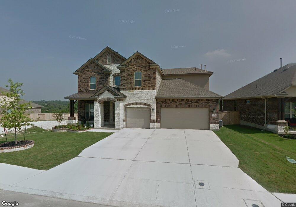
12203 Upton Park San Antonio, TX 78253
Westpointe East NeighborhoodEstimated Value: $531,000 - $688,000
4
Beds
4
Baths
3,558
Sq Ft
$165/Sq Ft
Est. Value
About This Home
This home is located at 12203 Upton Park, San Antonio, TX 78253 and is currently estimated at $585,394, approximately $164 per square foot. 12203 Upton Park is a home with nearby schools including Cole Elementary School, Briscoe Middle School, and Brennan High School.
Ownership History
Date
Name
Owned For
Owner Type
Purchase Details
Closed on
Dec 23, 2015
Sold by
M/I Homes Of San Antonio Llc
Bought by
Lopez Edward G and Lopez Yvonne M
Current Estimated Value
Home Financials for this Owner
Home Financials are based on the most recent Mortgage that was taken out on this home.
Original Mortgage
$360,600
Outstanding Balance
$286,685
Interest Rate
4.03%
Mortgage Type
New Conventional
Estimated Equity
$298,709
Create a Home Valuation Report for This Property
The Home Valuation Report is an in-depth analysis detailing your home's value as well as a comparison with similar homes in the area
Home Values in the Area
Average Home Value in this Area
Purchase History
| Date | Buyer | Sale Price | Title Company |
|---|---|---|---|
| Lopez Edward G | -- | None Available |
Source: Public Records
Mortgage History
| Date | Status | Borrower | Loan Amount |
|---|---|---|---|
| Open | Lopez Edward G | $360,600 |
Source: Public Records
Tax History Compared to Growth
Tax History
| Year | Tax Paid | Tax Assessment Tax Assessment Total Assessment is a certain percentage of the fair market value that is determined by local assessors to be the total taxable value of land and additions on the property. | Land | Improvement |
|---|---|---|---|---|
| 2025 | $8,854 | $602,440 | $95,140 | $507,300 |
| 2024 | $8,854 | $574,872 | $95,140 | $498,980 |
| 2023 | $8,854 | $522,611 | $95,140 | $537,910 |
| 2022 | $9,605 | $475,101 | $79,370 | $506,020 |
| 2021 | $9,078 | $431,910 | $72,110 | $359,800 |
| 2020 | $8,894 | $413,580 | $70,550 | $343,030 |
| 2019 | $9,036 | $406,920 | $70,550 | $336,370 |
| 2018 | $8,967 | $403,490 | $70,550 | $332,940 |
| 2017 | $8,694 | $390,400 | $70,550 | $319,850 |
| 2016 | $8,755 | $393,120 | $70,550 | $322,570 |
| 2015 | -- | $21,300 | $21,300 | $0 |
Source: Public Records
Map
Nearby Homes
- 12211 Upton Park
- 12323 Merritt Villa
- 2114 Derussy Rd
- 12019 Bailey Hills
- 1817 Delafield Rd
- 2042 Buckner Pass
- 1731 Doubleday Ln
- 2130 Knippa
- 11910 Wilby Creek
- 2130 Dalhart
- 1412 Hallettsville
- 12433 Pottsboro
- 12433 Redwater
- 2102 Dalhart Pass
- 2040 Dalhart
- 11935 Devin Chase
- 1822 Knippa
- 12514 Thrall
- 12523 Niederwald
- 12517 Liberty Hill
- 12207 Upton Park
- 12143 Upton Park
- 12139 Upton Park
- 12206 Upton Park
- 12210 Upton Park
- 12215 Upton Park
- 12135 Upton Park
- 12142 Upton Park
- 12214 Upton Park
- 12138 Upton Park
- 12219 Upton Park
- 12131 Upton Park
- 12218 Upton Park
- 12134 Upton Park
- 12303 Merritt Villa
- 12307 Merritt Villa
- 12219 Merritt Villa
- 12311 Merritt Villa
- 12127 Upton Park
- 12223 Upton Park