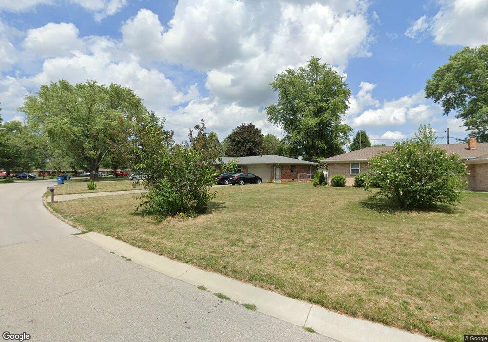
12205 Dunbar Cir S Cumberland, IN 46229
Estimated Value: $202,000 - $217,034
3
Beds
2
Baths
1,200
Sq Ft
$173/Sq Ft
Est. Value
About This Home
This home is located at 12205 Dunbar Cir S, Cumberland, IN 46229 and is currently estimated at $207,759, approximately $173 per square foot. 12205 Dunbar Cir S is a home located in Hancock County with nearby schools including Sugar Creek Elementary School, New Palestine Jr High School, and New Palestine High School.
Ownership History
Date
Name
Owned For
Owner Type
Purchase Details
Closed on
Sep 25, 2015
Sold by
Trevor
Bought by
Christopher
Current Estimated Value
Purchase Details
Closed on
Jun 17, 2011
Sold by
Greenfield Banking Co
Bought by
Dixon Trever C and Branson Amber N
Home Financials for this Owner
Home Financials are based on the most recent Mortgage that was taken out on this home.
Original Mortgage
$73,098
Interest Rate
4.5%
Mortgage Type
FHA
Create a Home Valuation Report for This Property
The Home Valuation Report is an in-depth analysis detailing your home's value as well as a comparison with similar homes in the area
Home Values in the Area
Average Home Value in this Area
Purchase History
| Date | Buyer | Sale Price | Title Company |
|---|---|---|---|
| Christopher | $96,000 | -- | |
| Dixon Trever C | -- | -- |
Source: Public Records
Mortgage History
| Date | Status | Borrower | Loan Amount |
|---|---|---|---|
| Previous Owner | Dixon Trever C | $73,098 |
Source: Public Records
Tax History Compared to Growth
Tax History
| Year | Tax Paid | Tax Assessment Tax Assessment Total Assessment is a certain percentage of the fair market value that is determined by local assessors to be the total taxable value of land and additions on the property. | Land | Improvement |
|---|---|---|---|---|
| 2024 | $1,830 | $183,000 | $49,900 | $133,100 |
| 2023 | $1,830 | $174,700 | $49,900 | $124,800 |
| 2022 | $1,352 | $135,200 | $25,600 | $109,600 |
| 2021 | $1,126 | $112,600 | $25,600 | $87,000 |
| 2020 | $1,037 | $104,800 | $25,600 | $79,200 |
| 2019 | $1,048 | $104,800 | $25,600 | $79,200 |
| 2018 | $974 | $102,300 | $25,600 | $76,700 |
| 2017 | $935 | $98,000 | $25,600 | $72,400 |
| 2016 | $913 | $94,300 | $24,200 | $70,100 |
| 2014 | $892 | $98,600 | $25,700 | $72,900 |
| 2013 | $892 | $100,600 | $25,700 | $74,900 |
Source: Public Records
Map
Nearby Homes
- 12231 Dunbar Cir N
- 624 Washington Cove Way
- 12086 E Harvest Glen Dr
- 7483 Marin Pkwy
- 7681 Marin Pkwy
- 7471 Marin Pkwy
- 7513 Marin Pkwy
- 7447 Marin Pkwy
- Roxbury Plan at Towns at Pennsy
- Trenton Plan at Towns at Pennsy
- 7555 Marin Pkwy
- 7495 Marin Pkwy
- 7525 Marin Pkwy
- 12141 Olivine Ave
- 916 Waring Dr E
- 11610 Whidbey Dr
- Legacy 1572 Plan at Rockridge
- Legacy 2432 Plan at Rockridge
- Legacy 2307 Plan at Rockridge
- Legacy 3536 Plan at Rockridge
- 12215 Dunbar Cir S
- 12207 Dunbar Cir S
- 12223 Dunbar Ct
- 12223 Dunbar Cir S
- 12224 Dunbar Cir S
- 12216 Dunbar Cir S
- 12201 Dunbar Cir S
- 12231 Dunbar Cir S
- 231 Hopkins Rd
- 12232 Dunbar Cir S
- 301 Hopkins Rd
- 225 Hopkins Rd
- 12239 Dunbar Cir S
- 12102 Dunbar Cir N
- 12205 Dunbar Cir N
- 309 Hopkins Rd
- 219 Hopkins Rd
- 12240 Dunbar Cir S
- 12248 Dunbar Cir S
- 323 Hopkins Rd