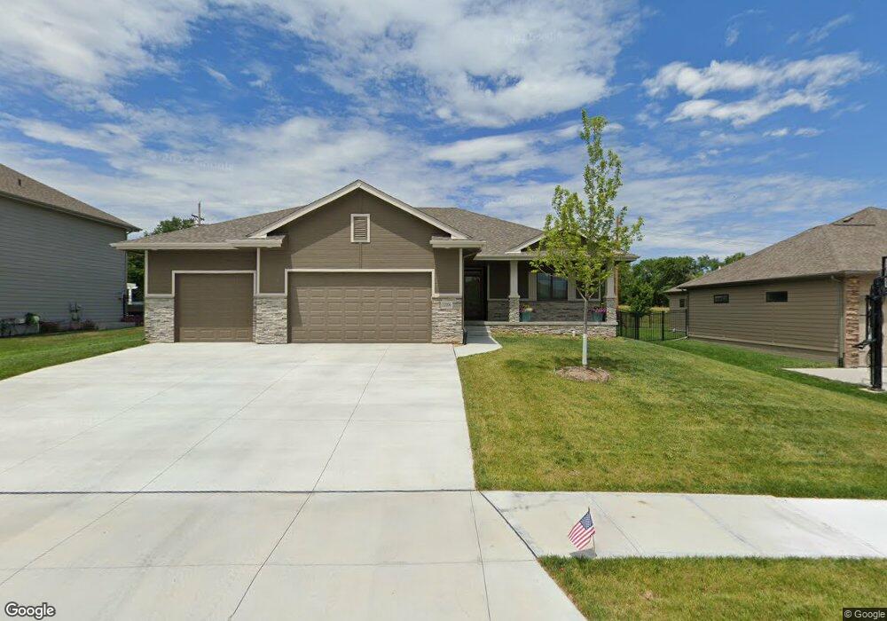
12206 Windward Ave Papillion, NE 68046
Estimated Value: $528,310 - $577,000
3
Beds
2
Baths
1,941
Sq Ft
$289/Sq Ft
Est. Value
About This Home
This home is located at 12206 Windward Ave, Papillion, NE 68046 and is currently estimated at $561,578, approximately $289 per square foot. 12206 Windward Ave is a home located in Sarpy County with nearby schools including Prairie Queen Elementary School, Liberty Middle School, and Papillion La Vista Senior High School.
Ownership History
Date
Name
Owned For
Owner Type
Purchase Details
Closed on
Oct 22, 2021
Sold by
Carson Custom Homes Inc
Bought by
Stringer Michael L and Stringer Jennifer J
Current Estimated Value
Home Financials for this Owner
Home Financials are based on the most recent Mortgage that was taken out on this home.
Original Mortgage
$315,000
Outstanding Balance
$287,251
Interest Rate
2.8%
Mortgage Type
New Conventional
Estimated Equity
$274,327
Purchase Details
Closed on
Dec 17, 2015
Sold by
Lake View 126 Llc
Bought by
Carson Custom Homes
Create a Home Valuation Report for This Property
The Home Valuation Report is an in-depth analysis detailing your home's value as well as a comparison with similar homes in the area
Home Values in the Area
Average Home Value in this Area
Purchase History
| Date | Buyer | Sale Price | Title Company |
|---|---|---|---|
| Stringer Michael L | $418,000 | Omaha National Title | |
| Carson Custom Homes | $49,000 | None Available |
Source: Public Records
Mortgage History
| Date | Status | Borrower | Loan Amount |
|---|---|---|---|
| Open | Stringer Michael L | $315,000 |
Source: Public Records
Tax History Compared to Growth
Tax History
| Year | Tax Paid | Tax Assessment Tax Assessment Total Assessment is a certain percentage of the fair market value that is determined by local assessors to be the total taxable value of land and additions on the property. | Land | Improvement |
|---|---|---|---|---|
| 2025 | $9,402 | $557,730 | $65,000 | $492,730 |
| 2024 | $10,602 | $527,417 | $65,000 | $462,417 |
| 2023 | $10,602 | $482,008 | $63,000 | $419,008 |
| 2022 | $10,390 | $437,132 | $56,000 | $381,132 |
| 2021 | $1,336 | $54,000 | $54,000 | $0 |
| 2020 | $1,322 | $52,000 | $52,000 | $0 |
| 2019 | $1,264 | $49,000 | $49,000 | $0 |
| 2018 | $1,322 | $49,000 | $49,000 | $0 |
| 2017 | $1,277 | $47,000 | $47,000 | $0 |
| 2016 | $1,279 | $47,000 | $47,000 | $0 |
| 2015 | $33 | $1,811 | $1,811 | $0 |
| 2014 | $26 | $1,407 | $1,407 | $0 |
Source: Public Records
Map
Nearby Homes
- 9715 S 123rd Ave
- 12455 Pheasant Run Ln
- 12351 Elk Ridge Cir
- 12106 Montauk Dr
- 12359 Elk Ridge Cir
- 12356 Elk Ridge Cir
- 12121 Montauk Dr
- 12354 Caspian Dr
- 10004 S 118th St
- 10008 S 118th St
- 9956 S 118th St
- 10212 S 118th St
- 10350 S 118th St
- 10105 S 118th St
- The Macee Plan at North Shore II
- The Calvin Plan at North Shore II
- The Cabernet II Plan at North Shore II
- The Carson Plan at North Shore II
- The Williamsburg Plan at North Shore II
- The Palermo Plan at North Shore II
- 12202 Windward Ave
- 12210 Windward Ave
- 12114 Windward Ave
- 12214 Windward Ave
- 12207 Windward Ave
- 12211 Windward Ave
- 12212 Cornhusker Rd
- 12110 Windward Ave
- 12304 Windward Ave
- 12203 Freeboard Dr
- 12215 Windward Ave
- 12207 Freeboard Dr
- 12305 Windward Ave
- 12106 Windward Ave
- 12216 Freeboard Dr
- 12004 Longshore Ave
- 12211 Freeboard Dr
- 12308 Freeboard Dr
- 12309 Windward Ave
- 12008 Longshore Ave