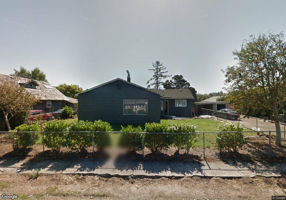
1221 Avenue D Seaside, OR 97138
Estimated Value: $446,000 - $566,720
3
Beds
2
Baths
2,144
Sq Ft
$230/Sq Ft
Est. Value
About This Home
This home is located at 1221 Avenue D, Seaside, OR 97138 and is currently estimated at $492,680, approximately $229 per square foot. 1221 Avenue D is a home located in Clatsop County with nearby schools including Seaside High School.
Ownership History
Date
Name
Owned For
Owner Type
Purchase Details
Closed on
Apr 1, 2010
Sold by
Deutsche Bank National Trust Company
Bought by
Clark Jason A and Clark Angela R
Current Estimated Value
Purchase Details
Closed on
Oct 1, 2009
Sold by
Alcon Tohurs and Alson Griselda
Bought by
Deutsche Bank National Trust Company
Purchase Details
Closed on
Feb 28, 2007
Sold by
Grant Kenneth A
Bought by
Alcon Tohurs and Alcon Griselda
Home Financials for this Owner
Home Financials are based on the most recent Mortgage that was taken out on this home.
Original Mortgage
$251,600
Interest Rate
7.37%
Mortgage Type
Unknown
Create a Home Valuation Report for This Property
The Home Valuation Report is an in-depth analysis detailing your home's value as well as a comparison with similar homes in the area
Home Values in the Area
Average Home Value in this Area
Purchase History
| Date | Buyer | Sale Price | Title Company |
|---|---|---|---|
| Clark Jason A | $135,000 | Pacific Title Company | |
| Deutsche Bank National Trust Company | $216,750 | Pacific Title Company | |
| Alcon Tohurs | $359,500 | Pacific Title Company |
Source: Public Records
Mortgage History
| Date | Status | Borrower | Loan Amount |
|---|---|---|---|
| Previous Owner | Alcon Tohurs | $251,600 |
Source: Public Records
Tax History Compared to Growth
Tax History
| Year | Tax Paid | Tax Assessment Tax Assessment Total Assessment is a certain percentage of the fair market value that is determined by local assessors to be the total taxable value of land and additions on the property. | Land | Improvement |
|---|---|---|---|---|
| 2024 | $3,267 | $227,441 | -- | -- |
| 2023 | $3,171 | $220,817 | $0 | $0 |
| 2022 | $3,084 | $214,386 | $0 | $0 |
| 2021 | $3,019 | $208,142 | $0 | $0 |
| 2020 | $2,948 | $202,080 | $0 | $0 |
| 2019 | $2,868 | $196,195 | $0 | $0 |
| 2018 | $2,754 | $190,481 | $0 | $0 |
| 2017 | $2,628 | $184,934 | $0 | $0 |
| 2016 | $2,312 | $179,548 | $72,180 | $107,368 |
| 2015 | $2,252 | $174,319 | $70,078 | $104,241 |
| 2014 | $1,798 | $140,834 | $0 | $0 |
| 2013 | -- | $141,296 | $0 | $0 |
Source: Public Records
Map
Nearby Homes
- 1265 Avenue D
- 1269 Avenue D
- 405 S Wahanna Rd
- 1653 Lea Way
- 1659 Whispering Pines Dr
- 830 Oceanway St
- 1805 Broadway St
- 720 Avenue G
- 1000 S King St
- 720 740 Avenue G
- 870 S Holladay Dr Unit 3
- 870 S Holladay Dr
- VL Spruce Dr
- 0 Spruce Dr Unit 682748764
- 1299 6th Ave
- 162 Hemlock St
- 218 Necanicum Dr
- 1108 S Holladay Dr Unit 24
- 301 C Ave Unit 301
- 301 C Ave