Estimated Value: $108,000 - $146,000
3
Beds
1
Bath
1,132
Sq Ft
$118/Sq Ft
Est. Value
About This Home
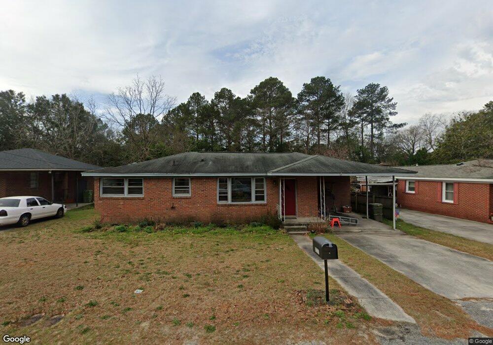
This home is located at 1221 Decatur St, Cayce, SC 29033 and is currently estimated at $133,546, approximately $117 per square foot. 1221 Decatur St is a home located in Lexington County with nearby schools including Cayce Elementary, Cyril B. Busbee Creative Arts Academy, and Brookland-Cayce High School.
Ownership History
Date
Name
Owned For
Owner Type
Purchase Details
Closed on
May 11, 2022
Sold by
Wf Master Reo Llc
Bought by
Cdg Dist 2 Llc
Current Estimated Value
Purchase Details
Closed on
Mar 31, 2022
Sold by
Lexington County
Bought by
Wf Master Reo Llc
Purchase Details
Closed on
Sep 21, 2015
Sold by
Mcguire Jenifer K
Bought by
Chong Waverly N
Create a Home Valuation Report for This Property
The Home Valuation Report is an in-depth analysis detailing your home's value as well as a comparison with similar homes in the area
Home Values in the Area
Average Home Value in this Area
Purchase History
| Date | Buyer | Sale Price | Title Company |
|---|---|---|---|
| Cdg Dist 2 Llc | $79,800 | National Deed Network Inc | |
| Wf Master Reo Llc | $79,000 | None Listed On Document | |
| Chong Waverly N | $211 | -- |
Source: Public Records
Tax History Compared to Growth
Tax History
| Year | Tax Paid | Tax Assessment Tax Assessment Total Assessment is a certain percentage of the fair market value that is determined by local assessors to be the total taxable value of land and additions on the property. | Land | Improvement |
|---|---|---|---|---|
| 2024 | $2,005 | $4,788 | $1,080 | $3,708 |
| 2023 | $1,840 | $2,795 | $720 | $2,075 |
| 2022 | $499 | $2,795 | $720 | $2,075 |
| 2020 | $1,580 | $4,192 | $1,080 | $3,112 |
| 2019 | $1,491 | $4,184 | $1,080 | $3,104 |
| 2018 | $1,419 | $4,184 | $1,080 | $3,104 |
| 2017 | $1,397 | $4,184 | $1,080 | $3,104 |
| 2016 | $1,405 | $4,183 | $1,080 | $3,103 |
| 2014 | $46 | $3,148 | $720 | $2,428 |
| 2013 | -- | $3,150 | $720 | $2,430 |
Source: Public Records
Map
Nearby Homes
- 1210 Decatur St
- TBD Woodfield Jupiter & Daisey Track
- 826 Jefferson St
- 2312 Rainbow Dr
- 1832 Wadsworth Dr
- 2405 Rainbow Dr
- 706 Westside Dr
- 1911 Toole St
- 725 Brooks Ave
- 2024 Platt Springs Rd
- 1800 Dunbar Rd
- 0 Highway 302 Hwy Unit 589442
- 2032 Pinewood St
- 1409 Hazel St
- 153 Cavendish Dr
- 151 Cavendish Dr
- 157 Cavendish Dr
- 1414 Hazel St
- Oak Plan at Faith Hills
- 1112 Pine Croft Dr
- 1223 Decatur St
- 1219 Decatur St
- 1217 Decatur St
- 1225 Decatur St
- 1215 Decatur St
- 1226 Decatur St
- 1228 Decatur St
- 1224 Decatur St
- 108 Dale Ln
- 1230 Decatur St
- 1222 Decatur St
- 1230 Memorial Dr
- 1218 Decatur St
- 1209 Decatur St
- 1216 Decatur St
- 1207 Decatur St
- 100 Dale Ln
- 300 Dale Ln
- 1810 Airport Blvd
- 1001 Brookwood Cir