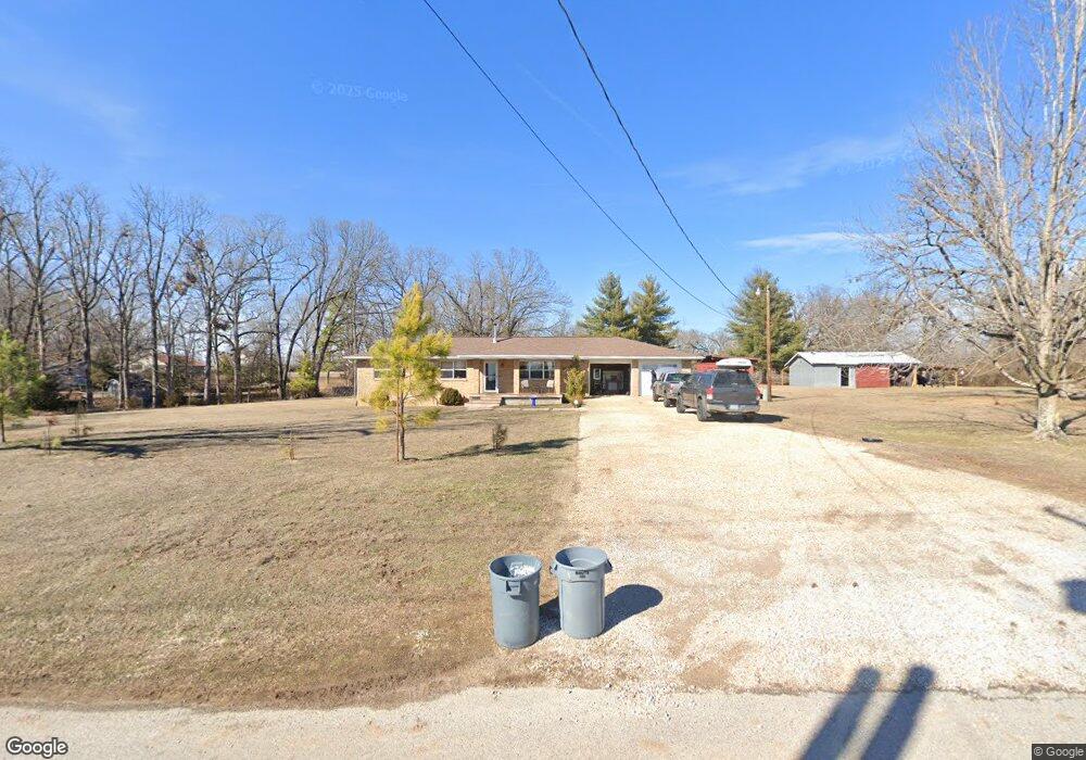
1221 E Necessary Rd Rogers, AR 72758
Estimated Value: $288,518 - $333,000
3
Beds
2
Baths
1,388
Sq Ft
$221/Sq Ft
Est. Value
About This Home
This home is located at 1221 E Necessary Rd, Rogers, AR 72758 and is currently estimated at $306,630, approximately $220 per square foot. 1221 E Necessary Rd is a home located in Benton County with nearby schools including Jones Elementary School, Kirksey Middle School, and Rogers High School.
Ownership History
Date
Name
Owned For
Owner Type
Purchase Details
Closed on
Jul 11, 2013
Sold by
Robinson Jerry L and Snoderly Connie Jo
Bought by
Robinson Jerry L and Robinson Kim M
Current Estimated Value
Purchase Details
Closed on
Oct 29, 2011
Bought by
Dod 10 and Dod 29
Purchase Details
Closed on
Jun 8, 2002
Bought by
Dod 06-08-2002
Purchase Details
Closed on
May 6, 1999
Bought by
Robinson
Purchase Details
Closed on
Nov 16, 1998
Bought by
Robinson Tr
Purchase Details
Closed on
Nov 9, 1998
Bought by
Robinson Family Trust
Purchase Details
Closed on
Jul 3, 1974
Bought by
Robinson
Create a Home Valuation Report for This Property
The Home Valuation Report is an in-depth analysis detailing your home's value as well as a comparison with similar homes in the area
Home Values in the Area
Average Home Value in this Area
Purchase History
| Date | Buyer | Sale Price | Title Company |
|---|---|---|---|
| Robinson Jerry L | -- | None Available | |
| Dod 10 | -- | -- | |
| Dod 06-08-2002 | -- | -- | |
| Robinson | -- | -- | |
| Robinson Tr | -- | -- | |
| Robinson Family Trust | -- | -- | |
| Robinson | -- | -- |
Source: Public Records
Tax History
| Year | Tax Paid | Tax Assessment Tax Assessment Total Assessment is a certain percentage of the fair market value that is determined by local assessors to be the total taxable value of land and additions on the property. | Land | Improvement |
|---|---|---|---|---|
| 2025 | $1,726 | $51,112 | $10,320 | $40,792 |
| 2024 | $1,628 | $51,112 | $10,320 | $40,792 |
| 2023 | $1,628 | $33,851 | $10,320 | $23,531 |
| 2022 | $1,337 | $32,140 | $10,320 | $21,820 |
| 2021 | $1,332 | $32,140 | $10,320 | $21,820 |
| 2020 | $823 | $22,240 | $5,160 | $17,080 |
| 2019 | $823 | $22,240 | $5,160 | $17,080 |
| 2018 | $1,198 | $22,240 | $5,160 | $17,080 |
| 2017 | $832 | $22,240 | $5,160 | $17,080 |
| 2016 | $832 | $22,240 | $5,160 | $17,080 |
| 2015 | $832 | $17,290 | $2,060 | $15,230 |
| 2014 | $882 | $17,290 | $2,060 | $15,230 |
Source: Public Records
Map
Nearby Homes
- 1306 E Kara Ln
- Tract 3 Pinewoods Dr
- 1221 E New Hope Rd
- 1813 S J St
- 2011 & 2013 S G St
- 603 E Sandalwood St
- 1105 E Linden St
- 1009 E Linden St
- 1006 E Longview Dr
- 1909 & 1911 S F St
- 3.48AC Mccann Rd
- 2402 S D St
- 0 E Graham Ln
- 1818 S H St
- 1705 S K Place
- 818 E Kiwi St
- 811 E Southern Trace Dr
- 1809 S G St
- 429 E Mccann Rd
- 0 Graham Ln
- 1345 E Necessary Rd
- 1215 E Necessary Rd
- 1215 Hardwood Dr
- 1400 Hardwood Dr
- 1400 Hardwood Rd
- 1213 E Necessary Rd
- 1218 E Necessary Rd
- 2403 S M St
- 1400 E Necessary Rd
- 1400 E Necessary Rd
- 2305 S M St
- 1110 E Necessary Rd
- 1201 E Hardwood Dr
- 2401 S M St
- 2205 S M St
- 1197 Hardwood Dr
- 2400 S M St
- 2304 S M St
- 2402 S M St
- 0 Hardwood Dr Unit 1026545
Your Personal Tour Guide
Ask me questions while you tour the home.