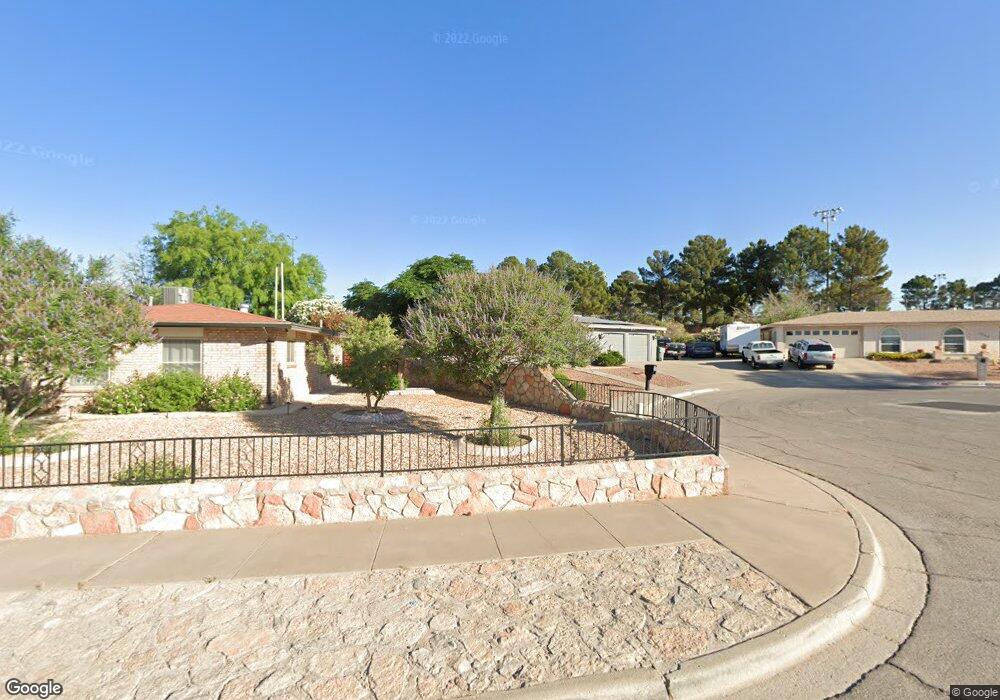
1221 Lonewood Dr El Paso, TX 79925
Travis White NeighborhoodEstimated Value: $269,000 - $305,000
--
Bed
2
Baths
1,963
Sq Ft
$147/Sq Ft
Est. Value
About This Home
This home is located at 1221 Lonewood Dr, El Paso, TX 79925 and is currently estimated at $288,512, approximately $146 per square foot. 1221 Lonewood Dr is a home located in El Paso County with nearby schools including Eastwood Heights Elementary School, Eastwood High School, and St. Raphael School.
Ownership History
Date
Name
Owned For
Owner Type
Purchase Details
Closed on
Aug 28, 2024
Sold by
Franco Steve and Franco Marie
Bought by
Franco Family Living Trust and Franco
Current Estimated Value
Purchase Details
Closed on
Jul 6, 2001
Sold by
Franco Daniel
Bought by
Franco Steve and Franco Marie
Home Financials for this Owner
Home Financials are based on the most recent Mortgage that was taken out on this home.
Original Mortgage
$75,000
Interest Rate
7.16%
Mortgage Type
Seller Take Back
Purchase Details
Closed on
Oct 12, 1998
Sold by
Block Don Theron
Bought by
Block Margaret
Create a Home Valuation Report for This Property
The Home Valuation Report is an in-depth analysis detailing your home's value as well as a comparison with similar homes in the area
Home Values in the Area
Average Home Value in this Area
Purchase History
| Date | Buyer | Sale Price | Title Company |
|---|---|---|---|
| Franco Family Living Trust | -- | None Listed On Document | |
| Franco Steve | -- | -- | |
| Block Margaret | -- | -- |
Source: Public Records
Mortgage History
| Date | Status | Borrower | Loan Amount |
|---|---|---|---|
| Previous Owner | Franco Steve | $75,000 |
Source: Public Records
Tax History Compared to Growth
Tax History
| Year | Tax Paid | Tax Assessment Tax Assessment Total Assessment is a certain percentage of the fair market value that is determined by local assessors to be the total taxable value of land and additions on the property. | Land | Improvement |
|---|---|---|---|---|
| 2025 | $3,761 | $293,796 | -- | -- |
| 2024 | $3,761 | $267,087 | -- | -- |
| 2023 | $3,672 | $242,806 | $0 | $0 |
| 2022 | $6,855 | $220,733 | $0 | $0 |
| 2021 | $6,523 | $218,116 | $33,435 | $184,681 |
| 2020 | $5,762 | $182,424 | $26,748 | $155,676 |
| 2018 | $5,580 | $179,446 | $26,748 | $152,698 |
| 2017 | $5,321 | $174,090 | $26,748 | $147,342 |
| 2016 | $5,321 | $174,090 | $26,748 | $147,342 |
| 2015 | $4,340 | $174,090 | $26,748 | $147,342 |
| 2014 | $4,340 | $177,721 | $26,748 | $150,973 |
Source: Public Records
Map
Nearby Homes
- 10481 Deepwood Ct
- 7936 Dogwood St
- 10412 Chinaberry Dr
- 7921 Candlewood Ave
- 10401 Springwood Dr
- 10212 Garwood Ct
- 10463 Davwood Ln
- 10617 Candlewood Ave
- 10533 Springwood Dr
- 1207 Bois d Arc Dr
- 10233 Byway Dr
- 9801 Eastridge Dr
- 7761 Maverick Ave
- 10844 Sombra Verde Dr
- 7922 Parral Dr
- 10313 Byway Dr
- 7832 Ranchland Dr
- 740 Draco Place
- 1909 Crow Dr
- 844 Santa Barbara Dr
- 1225 Lonewood Dr
- 1217 Lonewood Dr
- 1229 Lonewood Dr
- 1213 Lonewood Dr
- 1218 Lonewood Dr
- 1226 Lonewood Dr
- 1214 Lonewood Dr
- 1233 Lonewood Dr
- 1209 Lonewood Dr
- 1230 Lonewood Dr
- 1210 Lonewood Dr
- 1301 Lonewood Dr
- 1217 Trawood Dr
- 1213 Trawood Dr
- 10470 Deepwood Ct
- 1221 Trawood Dr
- 1205 Lonewood Dr
- 1209 Trawood Dr
- 1225 Trawood Dr
- 1206 Lonewood Dr