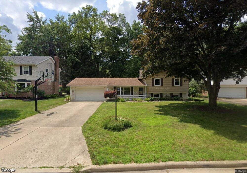
1221 Lynhurst Cir SW North Canton, OH 44720
Mount Vernon NeighborhoodEstimated Value: $234,283 - $254,000
3
Beds
2
Baths
1,136
Sq Ft
$212/Sq Ft
Est. Value
About This Home
This home is located at 1221 Lynhurst Cir SW, North Canton, OH 44720 and is currently estimated at $241,071, approximately $212 per square foot. 1221 Lynhurst Cir SW is a home located in Stark County with nearby schools including Orchard Hill Intermediate School, North Canton Middle School, and Hoover High School.
Ownership History
Date
Name
Owned For
Owner Type
Purchase Details
Closed on
Nov 27, 1999
Sold by
Pfancuff Judith S and Stephen Pfancuff J
Bought by
Snyder William D and Witzel Melanie A
Current Estimated Value
Home Financials for this Owner
Home Financials are based on the most recent Mortgage that was taken out on this home.
Original Mortgage
$60,000
Outstanding Balance
$18,939
Interest Rate
7.97%
Mortgage Type
Purchase Money Mortgage
Estimated Equity
$222,132
Purchase Details
Closed on
May 30, 1995
Sold by
Patricia A Barclay Trst
Bought by
Pfancuff Judith S and Pfancuff J S
Home Financials for this Owner
Home Financials are based on the most recent Mortgage that was taken out on this home.
Original Mortgage
$90,700
Interest Rate
8.4%
Mortgage Type
New Conventional
Purchase Details
Closed on
Aug 5, 1992
Create a Home Valuation Report for This Property
The Home Valuation Report is an in-depth analysis detailing your home's value as well as a comparison with similar homes in the area
Home Values in the Area
Average Home Value in this Area
Purchase History
| Date | Buyer | Sale Price | Title Company |
|---|---|---|---|
| Snyder William D | $118,000 | -- | |
| Pfancuff Judith S | $95,500 | -- | |
| -- | -- | -- |
Source: Public Records
Mortgage History
| Date | Status | Borrower | Loan Amount |
|---|---|---|---|
| Open | Snyder William D | $60,000 | |
| Closed | Pfancuff Judith S | $90,700 |
Source: Public Records
Tax History Compared to Growth
Tax History
| Year | Tax Paid | Tax Assessment Tax Assessment Total Assessment is a certain percentage of the fair market value that is determined by local assessors to be the total taxable value of land and additions on the property. | Land | Improvement |
|---|---|---|---|---|
| 2025 | -- | $79,520 | $18,550 | $60,970 |
| 2024 | -- | $79,520 | $18,550 | $60,970 |
| 2023 | $2,804 | $52,430 | $13,160 | $39,270 |
| 2022 | $2,695 | $52,430 | $13,160 | $39,270 |
| 2021 | $2,600 | $52,430 | $13,160 | $39,270 |
| 2020 | $2,606 | $47,190 | $11,450 | $35,740 |
| 2019 | $2,432 | $47,190 | $11,450 | $35,740 |
| 2018 | $2,522 | $47,190 | $11,450 | $35,740 |
| 2017 | $2,241 | $44,040 | $9,490 | $34,550 |
| 2016 | $2,250 | $44,040 | $9,490 | $34,550 |
| 2015 | $2,258 | $44,040 | $9,490 | $34,550 |
| 2014 | $408 | $43,860 | $9,450 | $34,410 |
| 2013 | $1,208 | $43,860 | $9,450 | $34,410 |
Source: Public Records
Map
Nearby Homes
- 218 Bonnett St SW
- 236 Rose Lane St SW
- 139 Maplecrest St SW
- 326 Bachtel St SW
- 500 Heatherwood St SW
- 1381 Circle Hill Rd SE
- 256 Everhard Rd SW
- 1321 Clinton Ave SE
- 1138 Lindy Lane Ave SW
- 1126 Overridge Ave SE
- 1118 Overridge Ave SE
- 1603 S Main St Unit B
- 727 Lorena St SW
- 701 Edgewood St SE
- 0 Elberta Ave SW
- 1293 Westview Cir SE
- 1276 Linwood Ave SW
- 1034 Schneider St SE
- 1480 Northfield Ave SE
- 1653 Greenway Rd SE Unit 202
- 1227 Lynhurst Cir SW
- 1213 Lynhurst Cir SW
- 281 Bonnett St SW
- 1222 Lynhurst Cir SW
- 1209 Lynhurst Cir SW
- 258 Bonnett St SW
- 247 Bonnett St SW
- 284 James St SW
- 1206 Lynhurst Cir SW
- 260 Bonnett St SW
- 287 Bonnett St SW
- 256 Bonnett St SW
- 252 Bonnett St SW
- 272 Bonnett St SW
- 1210 Lynhurst Cir SW
- 290 James St SW
- 237 Bonnett St SW
- 248 Bonnett St SW
- 286 Bonnett St SW
- 255 James St SW