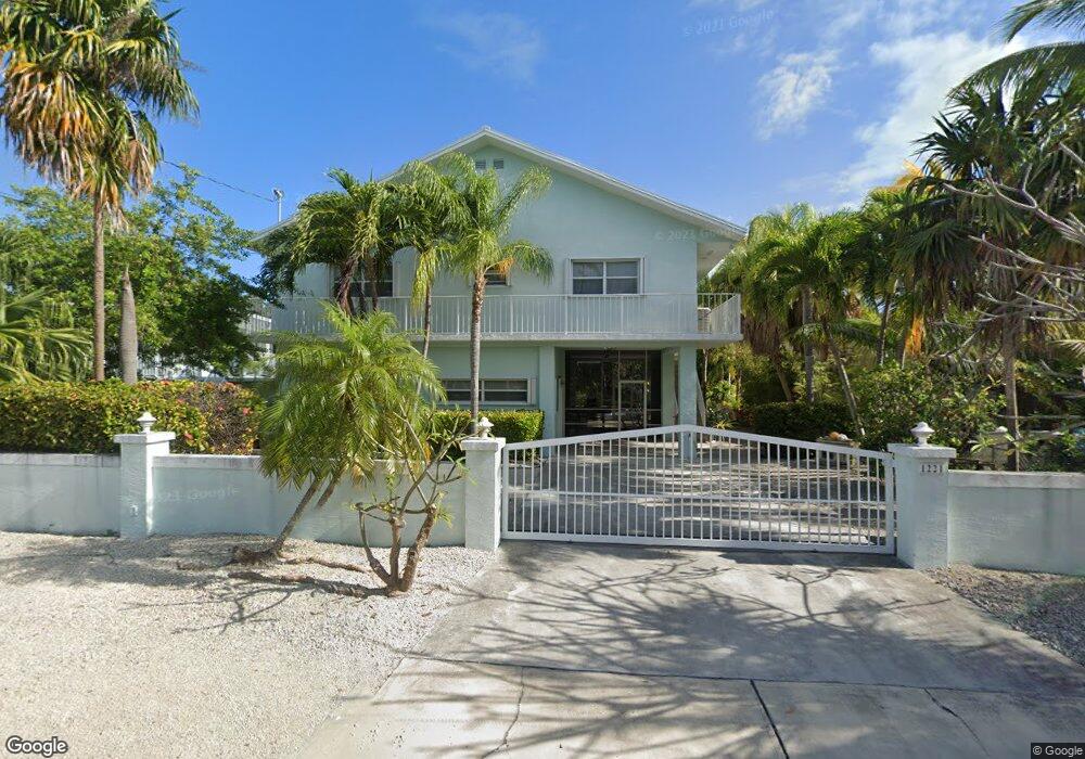
1221 Mockingbird Rd Key Largo, FL 33037
Estimated Value: $1,630,281 - $2,057,000
4
Beds
3
Baths
2,432
Sq Ft
$749/Sq Ft
Est. Value
About This Home
This home is located at 1221 Mockingbird Rd, Key Largo, FL 33037 and is currently estimated at $1,821,820, approximately $749 per square foot. 1221 Mockingbird Rd is a home located in Monroe County with nearby schools including Key Largo School, Coral Shores High School, and Ocean Studies Charter School.
Ownership History
Date
Name
Owned For
Owner Type
Purchase Details
Closed on
Feb 22, 2020
Sold by
Ginory Alfredo L and Ginory Marieta
Bought by
Ginory Marieta and Marieta Ginory Revocable Trust
Current Estimated Value
Purchase Details
Closed on
Dec 18, 2009
Sold by
Porreca Michael H
Bought by
Ginory Alfredo L and Ginory Marieta
Purchase Details
Closed on
May 22, 2007
Sold by
Porreca Michael H and Borkowski Mary Ann
Bought by
Porreca Michael H
Purchase Details
Closed on
Oct 24, 2005
Sold by
Azzarello Steven M and Azzarello Christine M
Bought by
Porreca Michael H and Borkowski Mary Ann
Home Financials for this Owner
Home Financials are based on the most recent Mortgage that was taken out on this home.
Original Mortgage
$856,000
Interest Rate
5.76%
Mortgage Type
Fannie Mae Freddie Mac
Purchase Details
Closed on
Jan 16, 1998
Sold by
Neville Stephen and Neville Susana
Bought by
Azzarello Steven M and Azzarello Christine M
Home Financials for this Owner
Home Financials are based on the most recent Mortgage that was taken out on this home.
Original Mortgage
$170,000
Interest Rate
7.16%
Mortgage Type
New Conventional
Purchase Details
Closed on
Apr 12, 1994
Sold by
Neville Stella
Bought by
Neville Stephen and Neville Susana
Home Financials for this Owner
Home Financials are based on the most recent Mortgage that was taken out on this home.
Original Mortgage
$220,000
Interest Rate
7.61%
Purchase Details
Closed on
Apr 1, 1994
Sold by
Neville Dennis
Bought by
Neville Stephen and Neville Susana
Home Financials for this Owner
Home Financials are based on the most recent Mortgage that was taken out on this home.
Original Mortgage
$220,000
Interest Rate
7.61%
Purchase Details
Closed on
Oct 15, 1993
Sold by
Neville William H
Bought by
Neville Stella A
Purchase Details
Closed on
Apr 1, 1992
Bought by
Ginory Alfredo L and Ginory Marieta
Purchase Details
Closed on
Dec 1, 1979
Bought by
Ginory Alfredo L and Ginory Marieta
Create a Home Valuation Report for This Property
The Home Valuation Report is an in-depth analysis detailing your home's value as well as a comparison with similar homes in the area
Home Values in the Area
Average Home Value in this Area
Purchase History
| Date | Buyer | Sale Price | Title Company |
|---|---|---|---|
| Ginory Marieta | -- | Accommodation | |
| Ginory Alfredo L | $620,000 | Attorney | |
| Porreca Michael H | -- | None Available | |
| Porreca Michael H | $1,070,000 | -- | |
| Azzarello Steven M | $285,000 | -- | |
| Neville Stephen | $220,000 | -- | |
| Neville Stephen | -- | -- | |
| Neville Stephen | $20,000 | -- | |
| Neville Stella A | -- | -- | |
| Ginory Alfredo L | $50,000 | -- | |
| Ginory Alfredo L | $22,000 | -- |
Source: Public Records
Mortgage History
| Date | Status | Borrower | Loan Amount |
|---|---|---|---|
| Previous Owner | Porreca Michael H | $856,000 | |
| Previous Owner | Azzarello Steven M | $170,000 | |
| Previous Owner | Neville Stephen | $220,000 | |
| Previous Owner | Neville Stephen | $220,000 |
Source: Public Records
Tax History
| Year | Tax Paid | Tax Assessment Tax Assessment Total Assessment is a certain percentage of the fair market value that is determined by local assessors to be the total taxable value of land and additions on the property. | Land | Improvement |
|---|---|---|---|---|
| 2025 | $9,336 | $1,520,583 | $1,176,450 | $344,133 |
| 2024 | $8,836 | $1,493,955 | $1,155,000 | $338,955 |
| 2023 | $8,836 | $1,459,925 | $1,131,900 | $328,025 |
| 2022 | $6,967 | $997,407 | $660,000 | $337,407 |
| 2021 | $5,847 | $629,022 | $343,200 | $285,822 |
| 2020 | $5,552 | $588,235 | $297,000 | $291,235 |
| 2019 | $5,405 | $568,902 | $272,250 | $296,652 |
| 2018 | $5,512 | $570,427 | $272,250 | $298,177 |
| 2017 | $5,546 | $578,869 | $0 | $0 |
| 2016 | $5,262 | $521,318 | $0 | $0 |
| 2015 | $5,408 | $566,396 | $0 | $0 |
| 2014 | $5,045 | $492,598 | $0 | $0 |
Source: Public Records
Map
Nearby Homes
- 1218 Mockingbird Rd
- 917 Red Bird Rd
- 1202 Mockingbird Rd
- 946 S Topaz Ave
- 1022 Dove Rd
- 915 S 915 Emerald Dr
- 914 S Emerald Dr
- 918 S Ruby Dr
- 95480 & 90 Overseas Hwy
- 95351 Overseas Hwy
- 95410 Overseas Hwy
- 95325 Overseas Hwy
- 902 S Ruby Dr
- 818 S Emerald Dr
- 1032 Snapper Ln
- 1 Sunset Rd
- 1018 Snapper Ln
- 814 S Emerald Dr
- 812 S Silver Cir
- 811 S Emerald Dr
- 1219 Mockingbird Rd
- 1223 Mockingbird Rd
- 1217 Mockingbird Rd
- 95525 Overseas Hwy
- 95525B Overseas Hwy
- 918 Red Bird Rd Unit A
- 1220 Mockingbird Rd Unit B
- 1220 Mockingbird Rd Unit A
- 1215 Mockingbird Rd
- 1227 Mockingbird Rd
- 916 Red Bird Rd
- 1216 Mockingbird Rd
- 1313 Mockingbird Rd
- 1213 Mockingbird Rd
- 1214 Mockingbird Rd
- 1211 Mockingbird Rd
- 915 Red Bird Rd
- 1212 Mockingbird Rd
- 1123 Heron Rd
- 1121 Heron Rd
Your Personal Tour Guide
Ask me questions while you tour the home.