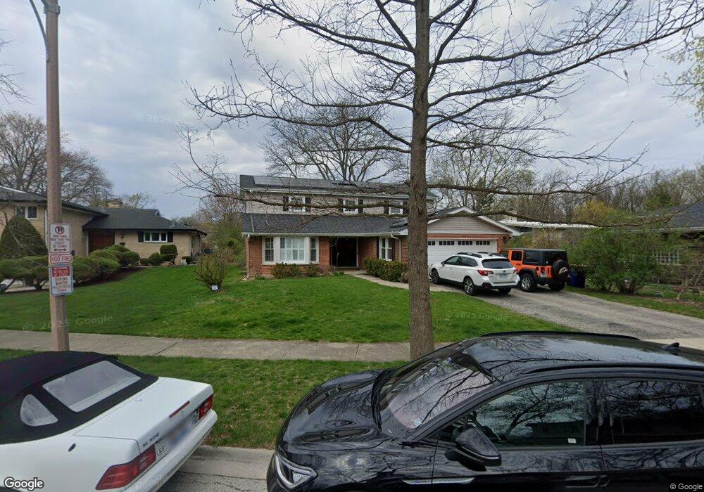
1221 N Branch Rd Wilmette, IL 60091
Estimated Value: $839,000 - $890,000
4
Beds
3
Baths
2,788
Sq Ft
$307/Sq Ft
Est. Value
About This Home
This home is located at 1221 N Branch Rd, Wilmette, IL 60091 and is currently estimated at $856,521, approximately $307 per square foot. 1221 N Branch Rd is a home located in Cook County with nearby schools including Marie Murphy School, Avoca West Elementary School, and New Trier Township High School - Northfield.
Ownership History
Date
Name
Owned For
Owner Type
Purchase Details
Closed on
Aug 1, 2008
Sold by
Anson Rita
Bought by
Seiple Dorse O and Cepuritis Anita M
Current Estimated Value
Home Financials for this Owner
Home Financials are based on the most recent Mortgage that was taken out on this home.
Original Mortgage
$350,000
Outstanding Balance
$230,727
Interest Rate
6.42%
Mortgage Type
Purchase Money Mortgage
Estimated Equity
$625,794
Purchase Details
Closed on
Dec 30, 1999
Sold by
Anson Rita
Bought by
Anson Rita and Declaration Of Trust Of Rita D Anson
Create a Home Valuation Report for This Property
The Home Valuation Report is an in-depth analysis detailing your home's value as well as a comparison with similar homes in the area
Home Values in the Area
Average Home Value in this Area
Purchase History
| Date | Buyer | Sale Price | Title Company |
|---|---|---|---|
| Seiple Dorse O | $645,000 | Chicago Title Insurance Co | |
| Anson Rita | -- | -- |
Source: Public Records
Mortgage History
| Date | Status | Borrower | Loan Amount |
|---|---|---|---|
| Open | Seiple Dorse O | $350,000 |
Source: Public Records
Tax History Compared to Growth
Tax History
| Year | Tax Paid | Tax Assessment Tax Assessment Total Assessment is a certain percentage of the fair market value that is determined by local assessors to be the total taxable value of land and additions on the property. | Land | Improvement |
|---|---|---|---|---|
| 2024 | $13,425 | $63,000 | $18,432 | $44,568 |
| 2023 | $12,730 | $63,000 | $18,432 | $44,568 |
| 2022 | $12,730 | $63,000 | $18,432 | $44,568 |
| 2021 | $13,054 | $55,551 | $13,248 | $42,303 |
| 2020 | $12,886 | $55,551 | $13,248 | $42,303 |
| 2019 | $12,651 | $61,045 | $13,248 | $47,797 |
| 2018 | $13,967 | $64,080 | $10,944 | $53,136 |
| 2017 | $13,649 | $64,080 | $10,944 | $53,136 |
| 2016 | $13,078 | $64,080 | $10,944 | $53,136 |
| 2015 | $12,074 | $53,491 | $8,928 | $44,563 |
| 2014 | $11,886 | $53,491 | $8,928 | $44,563 |
| 2013 | $11,702 | $55,117 | $8,928 | $46,189 |
Source: Public Records
Map
Nearby Homes
- 1133 Manor Dr
- 3507 Greenwood Ave
- 5020 Arbor Ln Unit 203
- 3030 Arbor Ln Unit 203
- 5040 Arbor Ln Unit 303
- 228 Mark Dr
- 32 Meadowview Dr
- 828 Lavergne Ave
- 4072 Bunker Ln
- 15 Landmark
- 1656 Harding Rd
- 726 Lawler Ave
- 711 Becker Rd
- 62 Woodley Rd
- 1201 Harms Rd
- 737 Becker Rd
- 1115 Hunter Rd
- 185 Happ Rd
- 120 Riverside Dr
- 805 Hibbard Rd
- 1215 N Branch Rd
- 3525 Riverside Dr
- 3529 Riverside Dr
- 1225 N Branch Rd
- 1211 N Branch Rd
- 1220 Manor Dr
- 1317 N Branch Rd Unit Lot R14
- 1317 N Branch Rd Unit F01
- 1317 N Branch Rd Unit Lot B14
- 1317 N Branch Rd Unit Lot A16
- 1317 N Branch Rd Unit Lot B02
- 1214 Manor Dr
- 1226 Manor Dr
- 1207 N Branch Rd
- 1210 Manor Dr
- 3535 Riverside Dr
- 1224 N Branch Rd
- 1214 N Branch Rd Unit S
- 1220 N Branch Rd
- 1206 Manor Dr