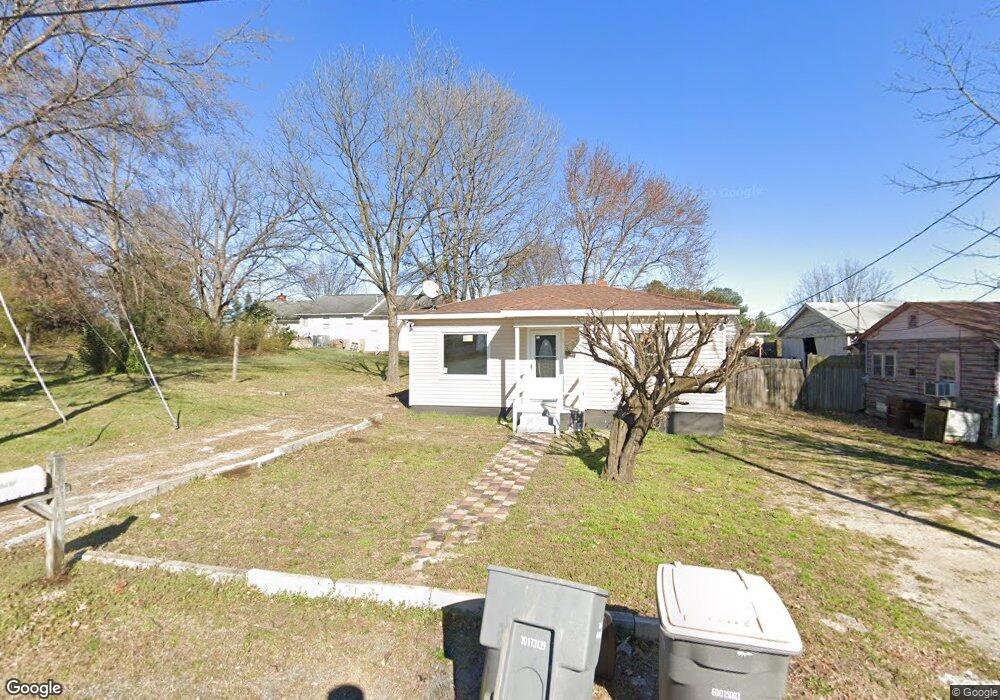
1221 Opal St Kannapolis, NC 28083
Estimated Value: $98,000 - $248,000
2
Beds
1
Bath
720
Sq Ft
$252/Sq Ft
Est. Value
About This Home
This home is located at 1221 Opal St, Kannapolis, NC 28083 and is currently estimated at $181,621, approximately $252 per square foot. 1221 Opal St is a home located in Cabarrus County with nearby schools including Forest Park Elementary School, Kannapolis Middle, and A.L. Brown High School.
Ownership History
Date
Name
Owned For
Owner Type
Purchase Details
Closed on
Oct 12, 2000
Sold by
Cook C K and Cook Geraldine C
Bought by
Shivers Larry D
Current Estimated Value
Home Financials for this Owner
Home Financials are based on the most recent Mortgage that was taken out on this home.
Original Mortgage
$29,500
Outstanding Balance
$10,789
Interest Rate
7.96%
Estimated Equity
$170,832
Create a Home Valuation Report for This Property
The Home Valuation Report is an in-depth analysis detailing your home's value as well as a comparison with similar homes in the area
Home Values in the Area
Average Home Value in this Area
Purchase History
| Date | Buyer | Sale Price | Title Company |
|---|---|---|---|
| Shivers Larry D | $28,000 | -- |
Source: Public Records
Mortgage History
| Date | Status | Borrower | Loan Amount |
|---|---|---|---|
| Open | Shivers Larry D | $29,500 |
Source: Public Records
Tax History Compared to Growth
Tax History
| Year | Tax Paid | Tax Assessment Tax Assessment Total Assessment is a certain percentage of the fair market value that is determined by local assessors to be the total taxable value of land and additions on the property. | Land | Improvement |
|---|---|---|---|---|
| 2025 | $971 | $85,530 | $50,000 | $35,530 |
| 2024 | $971 | $85,530 | $50,000 | $35,530 |
| 2023 | $712 | $51,960 | $32,930 | $19,030 |
| 2022 | $712 | $51,960 | $32,930 | $19,030 |
| 2021 | $712 | $51,960 | $32,930 | $19,030 |
| 2020 | $712 | $51,960 | $32,930 | $19,030 |
| 2019 | $444 | $32,380 | $18,000 | $14,380 |
| 2018 | $437 | $32,380 | $18,000 | $14,380 |
| 2017 | $431 | $32,380 | $18,000 | $14,380 |
| 2016 | -- | $34,790 | $18,000 | $16,790 |
| 2015 | $438 | $34,790 | $18,000 | $16,790 |
| 2014 | $438 | $34,790 | $18,000 | $16,790 |
Source: Public Records
Map
Nearby Homes
- 1365 Eagle Claw Dr
- 512 Villa St
- 1013 Kansas St Unit A
- 1013 Kansas St Unit B
- 2485 Acadia Ct
- 1768 Concord Lake Rd
- 2458 Saguaro Ln
- 2245 Heritage Ct Unit 2
- 1010 Tennessee St
- 614 Breckenridge Rd Unit 17
- 1200 Grace Ave
- 2416 Forrestbrook Dr
- 1699 Mission Oaks St
- 14 Knowles St
- 2405 Forrestbrook Dr
- 1025 Michigan St
- 503 Eddleman Rd
- 1050 Mclain Rd
- 2990 Dale Earnhardt Blvd
- 1052 Mclain Rd
- 1223 Opal St
- 1606 Concord Lake Rd
- 1225 Opal St
- 1608 Concord Lake Rd
- 1219 Opal St
- 1217 Opal St
- 1610 Concord Lake Rd
- 1234 Opal St
- 1612 Concord Lake Rd
- 1236 Opal St
- 1652 Garnet St
- 1607 Concord Lake Rd
- 1614 Concord Lake Rd
- 1656 Garnet St
- 1616 Concord Lake Rd
- 1618 Concord Lake Rd
- 1225 Holland St
- 1223 Holland St
- 1605 & 1607 Concord Lake Rd
- 1219 Holland St