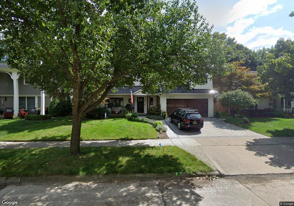
1221 Palmer St Plymouth, MI 48170
Estimated Value: $492,000 - $682,000
4
Beds
4
Baths
2,394
Sq Ft
$250/Sq Ft
Est. Value
About This Home
This home is located at 1221 Palmer St, Plymouth, MI 48170 and is currently estimated at $598,433, approximately $249 per square foot. 1221 Palmer St is a home located in Wayne County with nearby schools including Canton High School, Smith Elementary School, and West Middle School.
Ownership History
Date
Name
Owned For
Owner Type
Purchase Details
Closed on
Jul 20, 2012
Sold by
Vincens Adam J and Vincens Magda S
Bought by
Vincens Adam J and Vincens Magda S
Current Estimated Value
Purchase Details
Closed on
Dec 23, 2005
Sold by
Dettore Anthony J and Dettore Meghan
Bought by
Vincens Adam J and Vincens Magda S
Purchase Details
Closed on
Apr 30, 2004
Sold by
Detorre Anthony J and Gerigk Meghan A
Bought by
Dettore Anthony J and Dettore Meghan
Home Financials for this Owner
Home Financials are based on the most recent Mortgage that was taken out on this home.
Original Mortgage
$156,300
Interest Rate
4.62%
Mortgage Type
New Conventional
Create a Home Valuation Report for This Property
The Home Valuation Report is an in-depth analysis detailing your home's value as well as a comparison with similar homes in the area
Home Values in the Area
Average Home Value in this Area
Purchase History
| Date | Buyer | Sale Price | Title Company |
|---|---|---|---|
| Vincens Adam J | -- | None Available | |
| Vincens Adam J | $290,000 | Multiple | |
| Dettore Anthony J | -- | -- |
Source: Public Records
Mortgage History
| Date | Status | Borrower | Loan Amount |
|---|---|---|---|
| Previous Owner | Dettore Anthony J | $156,300 |
Source: Public Records
Tax History Compared to Growth
Tax History
| Year | Tax Paid | Tax Assessment Tax Assessment Total Assessment is a certain percentage of the fair market value that is determined by local assessors to be the total taxable value of land and additions on the property. | Land | Improvement |
|---|---|---|---|---|
| 2025 | $6,591 | $265,300 | $0 | $0 |
| 2024 | $6,591 | $256,400 | $0 | $0 |
| 2023 | $6,419 | $223,700 | $0 | $0 |
| 2022 | $6,804 | $210,100 | $0 | $0 |
| 2021 | $6,593 | $205,600 | $0 | $0 |
| 2020 | $6,576 | $201,500 | $0 | $0 |
| 2019 | $5,790 | $199,600 | $0 | $0 |
| 2018 | $4,953 | $166,700 | $0 | $0 |
| 2017 | $1,049 | $163,700 | $0 | $0 |
| 2016 | $5,396 | $157,100 | $0 | $0 |
| 2015 | $12,359 | $136,060 | $0 | $0 |
| 2013 | $11,973 | $135,140 | $0 | $0 |
| 2011 | -- | $113,850 | $0 | $0 |
Source: Public Records
Map
Nearby Homes
- 1125 Sutherland St
- 1199 S Sheldon Rd Unit 77
- 1338 S Harvey St
- 844 Ross St
- 638 S Harvey St
- 44571 Clare Blvd
- 685 Ross St
- 9453 Brookline Ave
- 9405 Northern Ave
- 775 Deer Ct Unit 104
- 44736 Lynn Dr
- 553 Jener Place
- 44750 Erin Dr Unit 40
- 44703 Erin Dr
- 9264 Brookline Ave
- 44872 Lynn Dr
- 10839 Brookwood Dr
- 9230 Brookline Ave
- 44877 Erin Dr Unit 2
- 684 Harding St
- 1201 Palmer St
- 1241 Palmer St
- 1250 Hartsough St
- 1261 Palmer St
- 1300 Hartsough St
- 1200 Hartsough St
- 1220 Palmer St
- 1310 Hartsough St Unit Bldg-Unit
- 1310 Hartsough St
- 1200 Palmer St
- 1240 Palmer St
- 1281 Palmer St
- 1184 Palmer St
- 1260 Palmer St
- 1320 Hartsough St Unit Bldg-Unit
- 1320 Hartsough St
- 1179 Palmer St Unit Bldg-Unit
- 1179 Palmer St
- 1191 Sutherland St
- 1175 Sutherland St