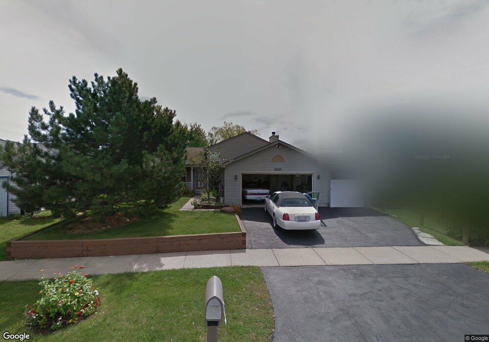
1221 Pheasant Run Zion, IL 60099
West Zion NeighborhoodEstimated Value: $298,000 - $308,000
3
Beds
2
Baths
1,104
Sq Ft
$274/Sq Ft
Est. Value
About This Home
This home is located at 1221 Pheasant Run, Zion, IL 60099 and is currently estimated at $302,416, approximately $273 per square foot. 1221 Pheasant Run is a home located in Lake County with nearby schools including Newport Elementary School, Beach Park Middle School, and Zion-Benton Township High School.
Ownership History
Date
Name
Owned For
Owner Type
Purchase Details
Closed on
May 31, 2005
Sold by
Hopkins Jason W and Hopkins Rebecca M
Bought by
Bell Sammy L and Bell Betty A
Current Estimated Value
Home Financials for this Owner
Home Financials are based on the most recent Mortgage that was taken out on this home.
Original Mortgage
$41,600
Interest Rate
5.87%
Mortgage Type
Stand Alone Second
Purchase Details
Closed on
Oct 8, 1999
Sold by
Bank Of Waukegan
Bought by
Hopkins Jason W and Hopkins Rebecca M
Home Financials for this Owner
Home Financials are based on the most recent Mortgage that was taken out on this home.
Original Mortgage
$141,718
Interest Rate
7.78%
Mortgage Type
FHA
Create a Home Valuation Report for This Property
The Home Valuation Report is an in-depth analysis detailing your home's value as well as a comparison with similar homes in the area
Home Values in the Area
Average Home Value in this Area
Purchase History
| Date | Buyer | Sale Price | Title Company |
|---|---|---|---|
| Bell Sammy L | $208,000 | -- | |
| Hopkins Jason W | $143,000 | -- |
Source: Public Records
Mortgage History
| Date | Status | Borrower | Loan Amount |
|---|---|---|---|
| Closed | Bell Sammy L | $41,600 | |
| Previous Owner | Hopkins Jason W | $141,718 |
Source: Public Records
Tax History Compared to Growth
Tax History
| Year | Tax Paid | Tax Assessment Tax Assessment Total Assessment is a certain percentage of the fair market value that is determined by local assessors to be the total taxable value of land and additions on the property. | Land | Improvement |
|---|---|---|---|---|
| 2024 | $8,401 | $82,727 | $11,006 | $71,721 |
| 2023 | $7,438 | $73,758 | $9,813 | $63,945 |
| 2022 | $7,438 | $63,007 | $8,076 | $54,931 |
| 2021 | $7,322 | $59,106 | $7,576 | $51,530 |
| 2020 | $7,052 | $55,593 | $7,126 | $48,467 |
| 2019 | $6,849 | $51,787 | $6,638 | $45,149 |
| 2018 | $6,138 | $46,289 | $6,026 | $40,263 |
| 2017 | $6,011 | $42,940 | $5,590 | $37,350 |
| 2016 | $5,550 | $38,979 | $5,074 | $33,905 |
| 2015 | $5,301 | $35,368 | $4,604 | $30,764 |
| 2014 | $5,047 | $34,622 | $5,032 | $29,590 |
| 2012 | $5,501 | $36,871 | $5,359 | $31,512 |
Source: Public Records
Map
Nearby Homes
- 1210 Lorelei Dr
- 1305 Reed Rd
- 4014 Ridge Rd
- 4004 Gregory Dr
- 1524 Anderson Trail
- 4108 Douglas Dr
- 3903 9th St
- 1712 Dusk Dr
- 4539 Illinois 173
- 4533 Illinois 173
- 11778 W 12th St
- 1907 Dawn Ln
- 1521 Southport Ct
- 1405 Lewis Ave
- 42908 N Lewis Ave
- 12434 W Van Ct
- 4109 Sarah Dr
- 1814 Jethro Ave
- 2407 Phillip Dr
- 2407 Miriam Ave
- 1219 Pheasant Run
- 1223 Pheasant Run
- 4202 Highland Rd
- 4204 Highland Rd
- 1217 Pheasant Run
- 1225 Pheasant Run
- 4200 Highland Rd
- 4206 Highland Rd
- 1215 Pheasant Run
- 1227 Pheasant Run
- 1220 Pheasant Run
- 4208 Highland Rd
- 1222 Pheasant Run
- 1213 Pheasant Run
- 1224 Pheasant Run
- 1215 Butterfield Ln
- 4205 Highland Rd
- 4203 Highland Rd
- 4210 Highland Rd
- 4201 Highland Rd