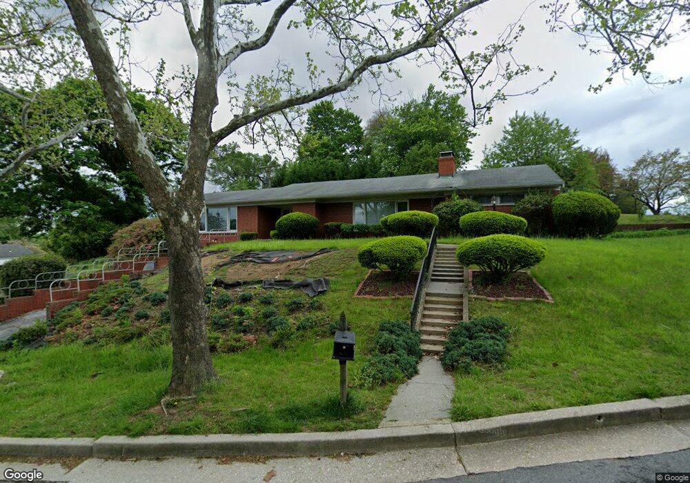
1221 Saint Andrews Way Baltimore, MD 21239
Estimated Value: $401,000 - $462,355
--
Bed
2
Baths
2,172
Sq Ft
$200/Sq Ft
Est. Value
About This Home
This home is located at 1221 Saint Andrews Way, Baltimore, MD 21239 and is currently estimated at $433,839, approximately $199 per square foot. 1221 Saint Andrews Way is a home located in Baltimore County with nearby schools including Halstead Academy, Loch Raven Technical Academy, and Towson High Law & Public Policy.
Ownership History
Date
Name
Owned For
Owner Type
Purchase Details
Closed on
Aug 21, 2019
Sold by
Grainger Patricia C
Bought by
Grainger Patricia C and Grainger Arthur Lawrence
Current Estimated Value
Purchase Details
Closed on
Jul 8, 1999
Sold by
Huang Shi and Huang Shung
Bought by
Grainger Arthur D and Grainger Patricia C
Purchase Details
Closed on
Nov 12, 1970
Sold by
Piccinini Anthony
Bought by
Huang Shi-Shung
Create a Home Valuation Report for This Property
The Home Valuation Report is an in-depth analysis detailing your home's value as well as a comparison with similar homes in the area
Home Values in the Area
Average Home Value in this Area
Purchase History
| Date | Buyer | Sale Price | Title Company |
|---|---|---|---|
| Grainger Patricia C | -- | None Available | |
| Grainger Arthur D | $184,900 | -- | |
| Huang Shi-Shung | $46,000 | -- |
Source: Public Records
Tax History Compared to Growth
Tax History
| Year | Tax Paid | Tax Assessment Tax Assessment Total Assessment is a certain percentage of the fair market value that is determined by local assessors to be the total taxable value of land and additions on the property. | Land | Improvement |
|---|---|---|---|---|
| 2025 | $4,884 | $368,000 | $98,900 | $269,100 |
| 2024 | $4,884 | $345,700 | $0 | $0 |
| 2023 | $2,361 | $323,400 | $0 | $0 |
| 2022 | $4,712 | $301,100 | $87,300 | $213,800 |
| 2021 | $4,555 | $296,633 | $0 | $0 |
| 2020 | $4,633 | $292,167 | $0 | $0 |
| 2019 | $3,487 | $287,700 | $87,300 | $200,400 |
| 2018 | $4,588 | $285,667 | $0 | $0 |
| 2017 | $4,084 | $283,633 | $0 | $0 |
| 2016 | $3,760 | $281,600 | $0 | $0 |
| 2015 | $3,760 | $281,600 | $0 | $0 |
| 2014 | $3,760 | $281,600 | $0 | $0 |
Source: Public Records
Map
Nearby Homes
- 1204 Saint Andrews Way
- 6931 Summit Cir
- 6923 Summit Cir
- 6702 Queens Ferry Rd
- 1108 Litchfield Rd
- 908 Stevenson Ln
- 12 Stone Ridge Ct
- 28 Stone Ridge Ct
- 701 Hillen Rd
- 703 Hillen Rd
- 6415 Falkirk Rd
- 625 Yarmouth Rd
- 664 Regester Ave
- 612 Coventry Rd
- 500 Fairway Ct
- 6216 Falkirk Rd
- 1235 Walker Ave
- 6204 Falkirk Rd
- 1283 Gittings Ave
- 1211 Dalton Rd
- 1219 Saint Andrews Way
- 1301 Glendale Rd
- 1217 Saint Andrews Way
- 1303 Glendale Rd
- 1230 Saint Andrews Way
- 1228 Saint Andrews Way
- 1300 Heather Hill Rd
- 1222 Saint Andrews Way
- 1226 Saint Andrews Way
- 1220 Saint Andrews Way
- 1305 Glendale Rd
- 1234 Saint Andrews Way
- 1224 Saint Andrews Way
- 1302 Heather Hill Rd
- 1218 Saint Andrews Way
- 1211 Brixton Rd
- 1209 Brixton Rd
- 1307 Glendale Rd
- 1207 Brixton Rd
- 1205 Brixton Rd