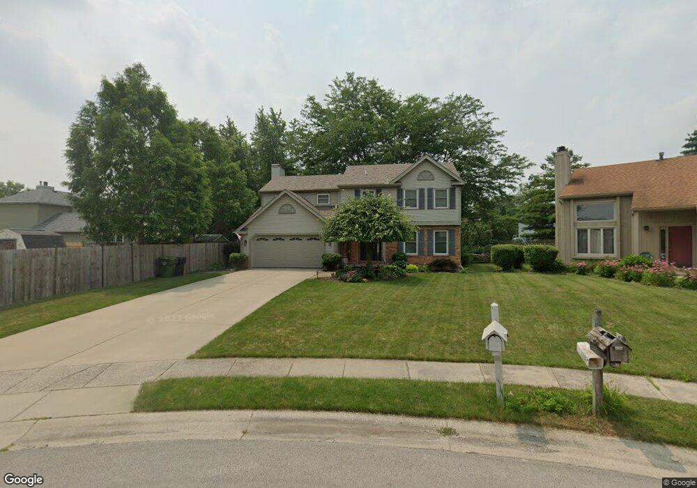
1221 Shaker Dr Maumee, OH 43537
Estimated Value: $326,000 - $372,000
5
Beds
3
Baths
2,123
Sq Ft
$165/Sq Ft
Est. Value
About This Home
This home is located at 1221 Shaker Dr, Maumee, OH 43537 and is currently estimated at $350,144, approximately $164 per square foot. 1221 Shaker Dr is a home located in Lucas County with nearby schools including Fairfield Elementary School, Maumee Intermediate School, and Maumee Middle School.
Ownership History
Date
Name
Owned For
Owner Type
Purchase Details
Closed on
Dec 8, 2022
Sold by
Freeman Carl A and Freeman Kelly R
Bought by
Wonnell Lorri Sue and Parker Amanda
Current Estimated Value
Home Financials for this Owner
Home Financials are based on the most recent Mortgage that was taken out on this home.
Original Mortgage
$125,000
Outstanding Balance
$121,338
Interest Rate
7.08%
Mortgage Type
New Conventional
Estimated Equity
$228,806
Purchase Details
Closed on
Oct 28, 2002
Sold by
Horn David M and Horn Jane M
Bought by
Freeman Carl A and Freeman Kelly R
Home Financials for this Owner
Home Financials are based on the most recent Mortgage that was taken out on this home.
Original Mortgage
$124,000
Interest Rate
6.18%
Purchase Details
Closed on
Jul 5, 1988
Create a Home Valuation Report for This Property
The Home Valuation Report is an in-depth analysis detailing your home's value as well as a comparison with similar homes in the area
Home Values in the Area
Average Home Value in this Area
Purchase History
| Date | Buyer | Sale Price | Title Company |
|---|---|---|---|
| Wonnell Lorri Sue | $323,000 | None Listed On Document | |
| Freeman Carl A | $174,000 | -- | |
| -- | $104,400 | -- |
Source: Public Records
Mortgage History
| Date | Status | Borrower | Loan Amount |
|---|---|---|---|
| Open | Wonnell Lorri Sue | $125,000 | |
| Previous Owner | Freeman Carl A | $124,000 |
Source: Public Records
Tax History Compared to Growth
Tax History
| Year | Tax Paid | Tax Assessment Tax Assessment Total Assessment is a certain percentage of the fair market value that is determined by local assessors to be the total taxable value of land and additions on the property. | Land | Improvement |
|---|---|---|---|---|
| 2024 | $3,757 | $116,480 | $14,840 | $101,640 |
| 2023 | $6,025 | $79,485 | $11,200 | $68,285 |
| 2022 | $5,357 | $79,485 | $11,200 | $68,285 |
| 2021 | $5,656 | $79,485 | $11,200 | $68,285 |
| 2020 | $5,518 | $69,160 | $9,625 | $59,535 |
| 2019 | $5,380 | $69,160 | $9,625 | $59,535 |
| 2018 | $5,066 | $69,160 | $9,625 | $59,535 |
| 2017 | $4,848 | $61,775 | $11,095 | $50,680 |
| 2016 | $4,795 | $176,500 | $31,700 | $144,800 |
| 2015 | $4,772 | $176,500 | $31,700 | $144,800 |
| 2014 | $4,439 | $60,590 | $10,890 | $49,700 |
| 2013 | $4,439 | $60,590 | $10,890 | $49,700 |
Source: Public Records
Map
Nearby Homes
- 1539 Cass Rd
- 611 Greenfield Dr
- 1301 Cass Rd
- 1409 Bradshaw Ct
- 541 Fairfield Park Dr
- 1213 Hunt St
- 538 Cambridge Park S
- 422 Chesterfield Ln
- 1441 Bradshaw Ct
- 1172 Shelly Ave
- 54 Homestead Place Unit 54
- 1138 Holgate Ave
- 652 Mcintyre Ln
- 4501 Thackeray Rd
- 911 River Rd
- 706 Waite Ave
- 306 Clinton St
- 1466 Wilderness Dr
- 1036 River Rd
- 716 Farrer St
- 1225 Shaker Dr
- 515 Arlene Dr
- 511 Arlene Dr
- 521 Arlene Dr
- 1248 Westfield Dr
- 1244 Westfield Dr
- 1252 Westfield Dr
- 1240 Westfield Dr
- 505 Arlene Dr
- 1229 Shaker Dr
- 1256 Westfield Dr
- 1236 Westfield Dr
- 1260 Westfield Dr
- 1230 Shaker Dr
- 601 Arlene Dr
- 1224 Shaker Dr
- 1232 Westfield Dr
- 1264 Westfield Dr
- 524 Arlene Dr
- 520 Arlene Dr