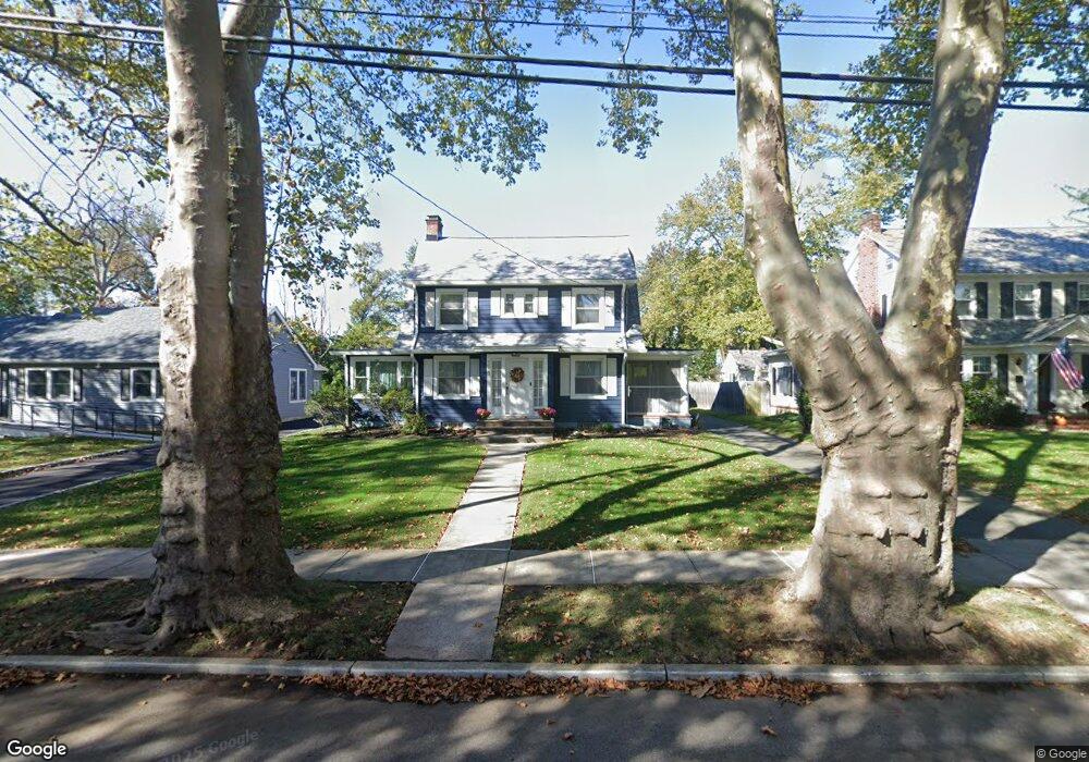
1221 Thornton Ave Unit 23 Plainfield, NJ 07060
Estimated Value: $525,000 - $628,000
--
Bed
--
Bath
1,867
Sq Ft
$318/Sq Ft
Est. Value
About This Home
This home is located at 1221 Thornton Ave Unit 23, Plainfield, NJ 07060 and is currently estimated at $594,314, approximately $318 per square foot. 1221 Thornton Ave Unit 23 is a home located in Union County with nearby schools including Evergreen Elementary School, Maxson Middle School, and Plainfield High School.
Ownership History
Date
Name
Owned For
Owner Type
Purchase Details
Closed on
Aug 23, 1993
Sold by
Citicorp Mortgage Inc
Bought by
Davenport Reginald O and Davenport Stephanie R
Current Estimated Value
Home Financials for this Owner
Home Financials are based on the most recent Mortgage that was taken out on this home.
Original Mortgage
$138,000
Interest Rate
7.16%
Create a Home Valuation Report for This Property
The Home Valuation Report is an in-depth analysis detailing your home's value as well as a comparison with similar homes in the area
Home Values in the Area
Average Home Value in this Area
Purchase History
| Date | Buyer | Sale Price | Title Company |
|---|---|---|---|
| Davenport Reginald O | $145,000 | -- | |
| Davenport Reginald O | $145,000 | -- |
Source: Public Records
Mortgage History
| Date | Status | Borrower | Loan Amount |
|---|---|---|---|
| Closed | Davenport Reginald O | $138,000 |
Source: Public Records
Tax History Compared to Growth
Tax History
| Year | Tax Paid | Tax Assessment Tax Assessment Total Assessment is a certain percentage of the fair market value that is determined by local assessors to be the total taxable value of land and additions on the property. | Land | Improvement |
|---|---|---|---|---|
| 2025 | $12,906 | $147,800 | $53,500 | $94,300 |
| 2024 | $12,779 | $147,800 | $53,500 | $94,300 |
| 2023 | $12,779 | $147,800 | $53,500 | $94,300 |
| 2022 | $12,502 | $147,800 | $53,500 | $94,300 |
| 2021 | $12,393 | $147,800 | $53,500 | $94,300 |
| 2020 | $12,358 | $147,800 | $53,500 | $94,300 |
| 2019 | $12,358 | $147,800 | $53,500 | $94,300 |
| 2018 | $12,099 | $147,800 | $53,500 | $94,300 |
| 2017 | $11,803 | $147,800 | $53,500 | $94,300 |
| 2016 | $11,562 | $147,800 | $53,500 | $94,300 |
| 2015 | $11,221 | $147,800 | $53,500 | $94,300 |
| 2014 | -- | $147,800 | $53,500 | $94,300 |
Source: Public Records
Map
Nearby Homes
- 1143 Stilford Ave Unit 45
- 1143-45 Stilford Ave
- 1354 Chetwynd Ave Unit 58
- 115 Ellsworth Ct Unit 17
- 1358 Marlborough Ave Unit 60
- 1215 Prospect Ave Unit 19
- 1358 Prospect Ave Unit 64
- 1028 Evergreen Ave
- 1019-23 Prospect Ave
- 954 Kensington Ave
- 1208 Moffett Ave Unit 12
- 933 Cedarbrook Rd
- 941 Carnegie Ave Unit 43
- 1200-06 Watchung Ave
- 1339 Park Ave Unit 41
- 818-20 2nd Place
- 1349 Park Ave Unit 53
- 819 Kensington Ave Unit 25
- 1454 S End Pkwy Unit 56
- 1112 Putnam Ave Unit 14
- 1225 Thornton Ave Unit 27
- 1229 Thornton Ave Unit 33
- 1231 Thornton Ave
- 1216 Thornton Ave Unit 22
- 1220 Thornton Ave
- 1207 Thornton Ave Unit 13
- 1209 Thornton Ave
- 1228 Thornton Ave Unit 32
- 1212 Thornton Ave Unit 14
- 1201 Thornton Ave Unit 5
- 1092 Hillside Ave Unit 96
- 1088 Hillside Ave Unit 90
- 1108 Stilford Ave
- 1210 Martine Ave Unit 12
- 1084 Hillside Ave Unit 86
- 1208 Thornton Ave Unit 10
- 1214 Martine Ave Unit 20
- 1226 Martine Ave Unit 28
- 1101 Kensington Ave Unit 7
- 1204 Martine Ave Unit 8