

1221 W Green Tree Ln Bloomington, IN 47403
Estimated payment $1,420/month
Highlights
- 1-Story Property
- Bloomington High School South Rated A
- Central Air
About This Home
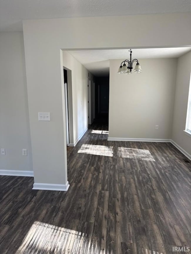
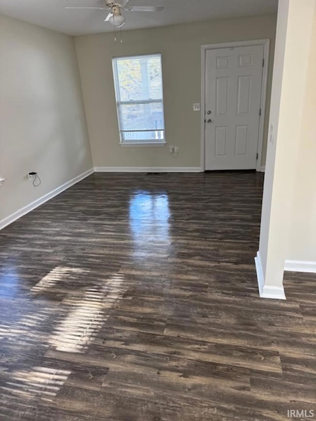
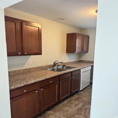
Great house in a great location. 3 beds 1.5 baths. Fresh paint throughout. Move in ready.
Listing Agent
FC Tucker/Bloomington REALTORS Brokerage Email: justin.ellis@homefinder.org Listed on: 11/11/2025

Home Details
Home Type
- Single Family
Est. Annual Taxes
- $1,948
Year Built
- Built in 2015
Lot Details
- 5,663 Sq Ft Lot
Home Design
- Vinyl Construction Material
Interior Spaces
- 1-Story Property
Bedrooms and Bathrooms
- 3 Bedrooms
Basement
- Block Basement Construction
- Crawl Space
Parking
- Driveway
- Off-Street Parking
Schools
- Templeton Elementary School
- Jackson Creek Middle School
- Bloomington South High School
Utilities
- Central Air
- Heating System Uses Gas
Community Details
- West Pointe Estates Subdivision
Listing and Financial Details
- Assessor Parcel Number 53-08-05-303-013.000-009
- Seller Concessions Not Offered
Map
Home Values in the Area
Average Home Value in this Area
Tax History
| Year | Tax Paid | Tax Assessment Tax Assessment Total Assessment is a certain percentage of the fair market value that is determined by local assessors to be the total taxable value of land and additions on the property. | Land | Improvement |
|---|---|---|---|---|
| 2024 | $3,898 | $190,400 | $29,200 | $161,200 |
| 2023 | $1,873 | $177,000 | $29,200 | $147,800 |
| 2022 | $3,225 | $159,300 | $25,400 | $133,900 |
| 2021 | $2,643 | $127,500 | $18,100 | $109,400 |
| 2020 | $2,584 | $125,000 | $18,100 | $106,900 |
| 2019 | $911 | $118,500 | $18,100 | $100,400 |
| 2018 | $1,045 | $128,000 | $17,600 | $110,400 |
| 2017 | $961 | $121,700 | $17,600 | $104,100 |
| 2016 | $856 | $115,300 | $17,600 | $97,700 |
| 2014 | $208 | $100 | $100 | $0 |
| 2013 | $208 | $100 | $100 | $0 |
Property History
| Date | Event | Price | List to Sale | Price per Sq Ft |
|---|---|---|---|---|
| 11/11/2025 11/11/25 | For Sale | $239,900 | -- | $204 / Sq Ft |
Purchase History
| Date | Type | Sale Price | Title Company |
|---|---|---|---|
| Sheriffs Deed | $70,000 | None Available | |
| Warranty Deed | -- | None Available | |
| Interfamily Deed Transfer | -- | None Available |
Source: Indiana Regional MLS
MLS Number: 202545624
APN: 53-08-05-303-013.000-009
Disclaimer: Certain information contained herein is derived from information provided by parties other than Homes.com. All information provided is deemed reliable, but is not guaranteed to be accurate and should be independently verified.
![]() IDX information is provided exclusively for personal, non-commercial use, and may not be used for any purpose other than to identify prospective properties consumers may be interested in purchasing. Information is deemed reliable but not guaranteed.
IDX information is provided exclusively for personal, non-commercial use, and may not be used for any purpose other than to identify prospective properties consumers may be interested in purchasing. Information is deemed reliable but not guaranteed.
- 1201 W Allen St
- 1375 W Allen Unit F2 St Unit F2
- 1020 W Allen St
- 717 W Allen St
- 827 W 1st St
- 825 W 1st St
- 614 W Dixie St
- 925 W 2nd St
- 515 W Allen St
- 1100 S Rogers St
- 808 W 2nd St
- 1112 S Madison St
- 1209 S Madison St
- 601 W Howe St
- 339 S Fairview St
- 405 W Hillside Dr
- 700 S College Ave
- 1511 S Arbor Ridge Ct
- 1006 S Walnut St
- 750 S Walnut St
- 525 S Patterson Dr
- 1105 S Rogers St Unit A
- 1101 S Rogers St
- 1101 S Rogers St
- 1101 S Rogers St
- 1521 Isaac Dr
- 327-329 W 1st St
- 909 S Morton St
- 819 S Morton St
- 421 S Madison St Unit 421 S Madison
- 222 S Rogers St
- 1314 W Kirkwood Ave
- 532 S Walnut St
- 722 W Kirkwood Ave Unit 722
- 809 S Washington St
- 614 W Kirkwood Ave
- 515 W Kirkwood Ave
- 718 S Lincoln St
- 413-429 S Walnut St
- 1106 W Countryside Ln