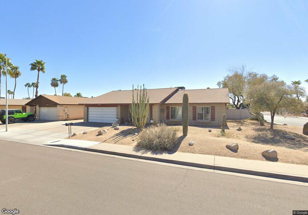
1221 W Loughlin Dr Chandler, AZ 85224
Amberwood NeighborhoodEstimated Value: $400,105 - $545,000
--
Bed
2
Baths
1,762
Sq Ft
$274/Sq Ft
Est. Value
About This Home
This home is located at 1221 W Loughlin Dr, Chandler, AZ 85224 and is currently estimated at $482,776, approximately $273 per square foot. 1221 W Loughlin Dr is a home located in Maricopa County with nearby schools including Pomeroy Elementary School, Franklin at Brimhall Elementary School, and Summit Academy Elementary.
Ownership History
Date
Name
Owned For
Owner Type
Purchase Details
Closed on
Aug 23, 2024
Sold by
Platz Mark A and Platz Carol A
Bought by
Platz Family Living Trust and Platz
Current Estimated Value
Purchase Details
Closed on
Dec 8, 2011
Sold by
Figueroa Jose A
Bought by
453 E 10Th Dr Llc
Purchase Details
Closed on
Feb 11, 1999
Sold by
Omalley Patrick J
Bought by
Platz Mark A and Platz Carol A
Home Financials for this Owner
Home Financials are based on the most recent Mortgage that was taken out on this home.
Original Mortgage
$91,850
Interest Rate
6.79%
Mortgage Type
New Conventional
Create a Home Valuation Report for This Property
The Home Valuation Report is an in-depth analysis detailing your home's value as well as a comparison with similar homes in the area
Home Values in the Area
Average Home Value in this Area
Purchase History
| Date | Buyer | Sale Price | Title Company |
|---|---|---|---|
| Platz Family Living Trust | -- | Final Title Support | |
| 453 E 10Th Dr Llc | -- | Security Title Agency | |
| Platz Mark A | $122,500 | -- |
Source: Public Records
Mortgage History
| Date | Status | Borrower | Loan Amount |
|---|---|---|---|
| Previous Owner | Platz Mark A | $91,850 | |
| Closed | Platz Mark A | $18,375 |
Source: Public Records
Tax History Compared to Growth
Tax History
| Year | Tax Paid | Tax Assessment Tax Assessment Total Assessment is a certain percentage of the fair market value that is determined by local assessors to be the total taxable value of land and additions on the property. | Land | Improvement |
|---|---|---|---|---|
| 2025 | $1,561 | $18,306 | -- | -- |
| 2024 | $1,576 | $17,434 | -- | -- |
| 2023 | $1,576 | $35,630 | $7,120 | $28,510 |
| 2022 | $1,533 | $26,660 | $5,330 | $21,330 |
| 2021 | $1,541 | $24,050 | $4,810 | $19,240 |
| 2020 | $1,524 | $22,210 | $4,440 | $17,770 |
| 2019 | $1,404 | $20,460 | $4,090 | $16,370 |
| 2018 | $1,363 | $18,770 | $3,750 | $15,020 |
| 2017 | $1,311 | $17,450 | $3,490 | $13,960 |
| 2016 | $1,282 | $16,950 | $3,390 | $13,560 |
| 2015 | $1,206 | $15,120 | $3,020 | $12,100 |
Source: Public Records
Map
Nearby Homes
- 1309 W Marlboro Dr
- 1203 W Alamo Dr
- 1224 W Mesquite St
- 2609 N Pleasant Dr
- 1511 W Mesquite St
- 1126 W Elliot Rd Unit 1040
- 1126 W Elliot Rd Unit 1010
- 1805 W Cheyenne Dr
- 1807 W Mission Dr
- 916 W Loughlin Dr
- 1821 W Mission Dr
- 812 W Rosal Place
- 3009 N Pleasant Dr
- 2201 N Comanche Dr Unit 1080
- 2201 N Comanche Dr Unit 1104
- 2201 N Comanche Dr Unit 1018
- 2201 N Comanche Dr Unit 1002
- 2712 N Evergreen St
- 2615 N Yucca St
- 800 W Marlboro Dr
- 1219 W Loughlin Dr
- 1220 W Palo Verde Dr
- 2709 N Central Dr Unit ID1247651P
- 2709 N Central Dr
- 1217 W Loughlin Dr
- 2720 N Central Dr
- 1218 W Palo Verde Dr
- 2716 N Central Dr
- 1228 W Cheyenne Dr
- 2724 N Central Dr
- 2712 N Central Dr
- 2713 N Central Dr
- 1215 W Loughlin Dr
- 1216 W Palo Verde Dr
- 1226 W Cheyenne Dr
- 2728 N Central Dr
- 2708 N Central Dr
- 2717 N Central Dr
- 2732 N Central Dr
- 1213 W Loughlin Dr