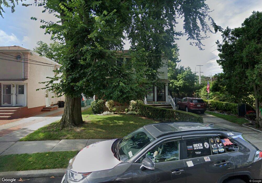
1221 Whiteside Ave Franklin Square, NY 11010
Estimated Value: $948,000
--
Bed
3
Baths
2,250
Sq Ft
$421/Sq Ft
Est. Value
About This Home
This home is located at 1221 Whiteside Ave, Franklin Square, NY 11010 and is currently estimated at $948,000, approximately $421 per square foot. 1221 Whiteside Ave is a home located in Nassau County with nearby schools including St Anne's School.
Ownership History
Date
Name
Owned For
Owner Type
Purchase Details
Closed on
Nov 9, 2021
Sold by
Neves Richard J and Neves Eugenie
Bought by
Savasta Nancy B and Neves Richard J
Current Estimated Value
Home Financials for this Owner
Home Financials are based on the most recent Mortgage that was taken out on this home.
Original Mortgage
$417,000
Interest Rate
3.55%
Mortgage Type
New Conventional
Purchase Details
Closed on
Feb 5, 2002
Purchase Details
Closed on
Oct 29, 1998
Sold by
Neves Richard J
Bought by
Neves Richard J and Neves Eugenie
Create a Home Valuation Report for This Property
The Home Valuation Report is an in-depth analysis detailing your home's value as well as a comparison with similar homes in the area
Home Values in the Area
Average Home Value in this Area
Purchase History
| Date | Buyer | Sale Price | Title Company |
|---|---|---|---|
| Savasta Nancy B | $225,000 | Stewart Title | |
| -- | -- | -- | |
| Neves Richard J | $52,500 | -- |
Source: Public Records
Mortgage History
| Date | Status | Borrower | Loan Amount |
|---|---|---|---|
| Previous Owner | Savasta Nancy B | $417,000 |
Source: Public Records
Tax History Compared to Growth
Tax History
| Year | Tax Paid | Tax Assessment Tax Assessment Total Assessment is a certain percentage of the fair market value that is determined by local assessors to be the total taxable value of land and additions on the property. | Land | Improvement |
|---|---|---|---|---|
| 2025 | $18,276 | $695 | $292 | $403 |
| 2024 | $5,847 | $695 | $292 | $403 |
| 2023 | $16,614 | $736 | $343 | $393 |
| 2022 | $16,614 | $695 | $292 | $403 |
| 2021 | $19,048 | $779 | $328 | $451 |
| 2020 | $15,151 | $899 | $616 | $283 |
| 2019 | $6,000 | $1,069 | $732 | $337 |
| 2018 | $9,936 | $1,069 | $0 | $0 |
| 2017 | $9,067 | $1,069 | $732 | $337 |
| 2016 | $14,524 | $1,069 | $732 | $337 |
| 2015 | $5,072 | $1,069 | $732 | $337 |
| 2014 | $5,072 | $1,069 | $732 | $337 |
| 2013 | $4,757 | $1,069 | $732 | $337 |
Source: Public Records
Map
Nearby Homes
- 120 Barrymore Blvd
- 178 Farnum Blvd
- 62 Herman Blvd
- 44 Catherine Ave
- 163 Herman Blvd
- 9 Court St
- 31 Evans Ave
- 1319 Journal Ave
- 700 Tulip Ave
- 162 Crown Ave
- 261 Fernwood Terrace
- 0 Journal Ave Unit ONE3527047
- 1098 Russell St
- 89 Hunnewell Ave
- 51 Pacific St
- 182 Lexington Ave
- 1134 Rosegold St
- 163 Crest Ave
- 217 Elton Rd
- 1041 Russell St
- 1223 Whiteside Ave
- 67 Farnum Blvd
- 67 Farnum Blvd Unit 2
- 63 Farnum Blvd
- 75 Farnum Blvd
- 59 Farnum Blvd
- 86 Averill Blvd
- 1206 Whiteside Ave
- 55 Farnum Blvd
- 89 Farnum Blvd
- 98 Averill Blvd
- 51 Farnum Blvd
- 1201 Whiteside Ave
- 70 Farnum Blvd
- 97 Farnum Blvd
- 64 Farnum Blvd
- 60 Farnum Blvd
- 102 Averill Blvd
- 1202 Whiteside Ave
- 47 Farnum Blvd