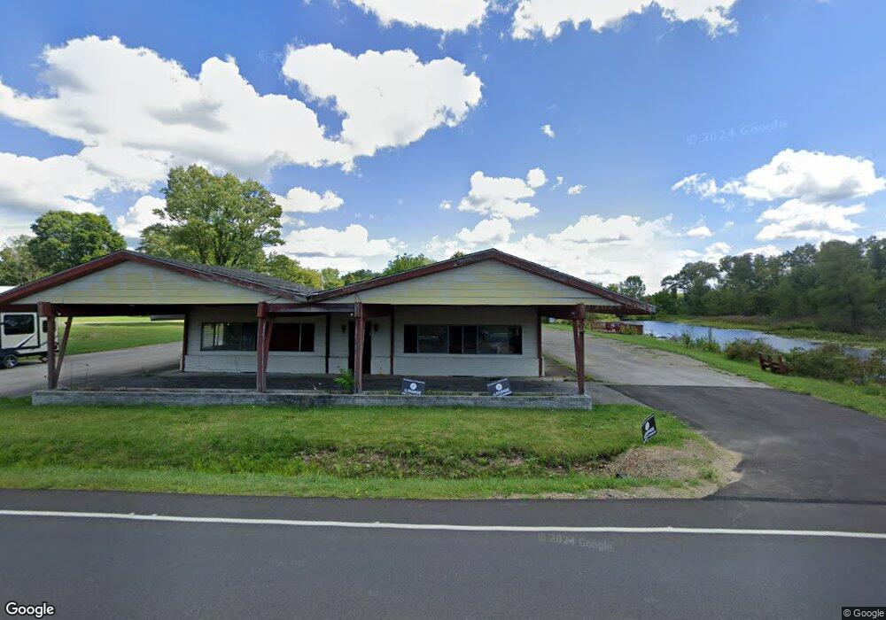
12210 State Highway 618 Conneaut Lake, PA 16316
Estimated Value: $701,122
--
Bed
--
Bath
--
Sq Ft
2
Acres
About This Home
This home is located at 12210 State Highway 618, Conneaut Lake, PA 16316 and is currently estimated at $701,122. 12210 State Highway 618 is a home located in Crawford County with nearby schools including Conneaut Lake-Sadsbury Elementary School, Conneaut Lake Middle School, and Conneaut Area Senior High School.
Ownership History
Date
Name
Owned For
Owner Type
Purchase Details
Closed on
Aug 29, 2006
Sold by
Pearlstein Robert
Bought by
Clark James D and Clark Elizabeth
Current Estimated Value
Home Financials for this Owner
Home Financials are based on the most recent Mortgage that was taken out on this home.
Original Mortgage
$285,000
Outstanding Balance
$171,526
Interest Rate
6.71%
Mortgage Type
Future Advance Clause Open End Mortgage
Estimated Equity
$529,596
Purchase Details
Closed on
Mar 13, 2005
Sold by
Wang Helen
Bought by
Pearlstein Robert
Create a Home Valuation Report for This Property
The Home Valuation Report is an in-depth analysis detailing your home's value as well as a comparison with similar homes in the area
Home Values in the Area
Average Home Value in this Area
Purchase History
| Date | Buyer | Sale Price | Title Company |
|---|---|---|---|
| Clark James D | $380,000 | None Available | |
| Pearlstein Robert | -- | None Available |
Source: Public Records
Mortgage History
| Date | Status | Borrower | Loan Amount |
|---|---|---|---|
| Open | Clark James D | $285,000 |
Source: Public Records
Tax History Compared to Growth
Tax History
| Year | Tax Paid | Tax Assessment Tax Assessment Total Assessment is a certain percentage of the fair market value that is determined by local assessors to be the total taxable value of land and additions on the property. | Land | Improvement |
|---|---|---|---|---|
| 2025 | $2,609 | $97,162 | $22,950 | $74,212 |
| 2024 | $7,618 | $97,162 | $22,950 | $74,212 |
| 2023 | $6,767 | $86,315 | $22,950 | $63,365 |
| 2022 | $6,203 | $79,115 | $22,950 | $56,165 |
| 2021 | $6,395 | $82,098 | $22,950 | $59,148 |
| 2020 | $6,395 | $82,098 | $22,950 | $59,148 |
| 2019 | $6,395 | $82,098 | $22,950 | $59,148 |
| 2018 | $6,088 | $82,098 | $22,950 | $59,148 |
| 2017 | $6,047 | $82,098 | $22,950 | $59,148 |
| 2016 | $1,876 | $82,098 | $22,950 | $59,148 |
| 2015 | $1,876 | $82,098 | $22,950 | $59,148 |
| 2014 | -- | $82,098 | $22,950 | $59,148 |
Source: Public Records
Map
Nearby Homes
- 0 Charlotte Ave
- 12255 Center St W
- 12691 Reed Ave
- 12838 Reed Ave
- 12975 Reed Ave
- 10672 Center Ave
- 10868 Woodman St
- 13035 State Highway 618
- 11216 Aldina Dr
- 11504 N Shore Dr
- 12269 Pennsylvania 18
- 0 Bay Dr Unit 187630
- 11850 Morningshore Dr
- 9532 U S 6
- 11694 Oakfield Rd
- 12807 Birch St
- 00 Oakwood Rd
- 10756 Aldina Dr
- 11894 Shady Ave
- 12013 Teifer Ave
- 12210 State Highway 618
- 12213 Highway 618
- 12268 State Highway 618
- 12183 Blair St
- 12278 State Highway 618
- 12171 Blair St
- 12181 Blair St
- 12260 Pennsylvania 618
- 12260 State Highway 618
- 12191 Blair St
- 12245 Blair St
- 12268 State Hwy 618
- 10420 Sunset Ave
- 10430 Sunset St
- 10420 Sunset St
- 10440 Sunset St
- 10440 Sunset Ave
- 10458 Sunset St
- 12284 State Highway 618
- 10451 Ellis Rd