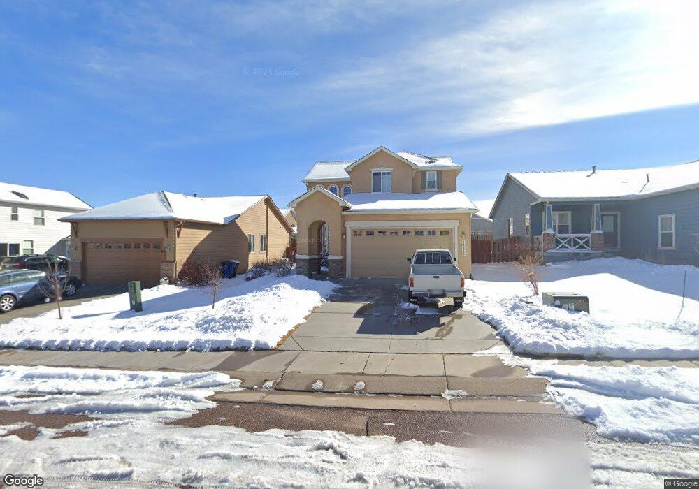
12215 Anacostia Dr Peyton, CO 80831
Falcon NeighborhoodEstimated Value: $450,000 - $503,000
4
Beds
4
Baths
1,605
Sq Ft
$294/Sq Ft
Est. Value
About This Home
This home is located at 12215 Anacostia Dr, Peyton, CO 80831 and is currently estimated at $472,249, approximately $294 per square foot. 12215 Anacostia Dr is a home located in El Paso County with nearby schools including Woodmen Hills Elementary School, Falcon Middle School, and Falcon High School.
Ownership History
Date
Name
Owned For
Owner Type
Purchase Details
Closed on
Sep 22, 2017
Sold by
Behnke Richard H and Behnke Joan
Bought by
English William Hood and English Frances Davis
Current Estimated Value
Home Financials for this Owner
Home Financials are based on the most recent Mortgage that was taken out on this home.
Original Mortgage
$150,000
Outstanding Balance
$125,261
Interest Rate
3.9%
Mortgage Type
New Conventional
Estimated Equity
$346,988
Purchase Details
Closed on
Oct 4, 2006
Sold by
Wl Homes Llc
Bought by
Behnke Richard H and Behnke Joan
Home Financials for this Owner
Home Financials are based on the most recent Mortgage that was taken out on this home.
Original Mortgage
$150,000
Interest Rate
6.12%
Mortgage Type
Unknown
Create a Home Valuation Report for This Property
The Home Valuation Report is an in-depth analysis detailing your home's value as well as a comparison with similar homes in the area
Home Values in the Area
Average Home Value in this Area
Purchase History
| Date | Buyer | Sale Price | Title Company |
|---|---|---|---|
| English William Hood | $299,999 | Land Title Guarantee Co | |
| Behnke Richard H | $263,800 | Stewart Title Of Co Inc |
Source: Public Records
Mortgage History
| Date | Status | Borrower | Loan Amount |
|---|---|---|---|
| Open | English William Hood | $150,000 | |
| Previous Owner | Behnke Richard H | $150,000 |
Source: Public Records
Tax History Compared to Growth
Tax History
| Year | Tax Paid | Tax Assessment Tax Assessment Total Assessment is a certain percentage of the fair market value that is determined by local assessors to be the total taxable value of land and additions on the property. | Land | Improvement |
|---|---|---|---|---|
| 2025 | $2,768 | $30,310 | -- | -- |
| 2024 | $2,647 | $30,820 | $7,200 | $23,620 |
| 2022 | $2,171 | $21,510 | $5,910 | $15,600 |
| 2021 | $2,250 | $22,130 | $6,080 | $16,050 |
| 2020 | $2,175 | $19,830 | $5,510 | $14,320 |
| 2019 | $2,162 | $19,830 | $5,510 | $14,320 |
| 2018 | $2,027 | $18,400 | $5,040 | $13,360 |
| 2017 | $1,917 | $18,400 | $5,040 | $13,360 |
| 2016 | $1,919 | $18,860 | $5,570 | $13,290 |
| 2015 | $1,921 | $18,860 | $5,570 | $13,290 |
| 2014 | $1,768 | $17,150 | $4,780 | $12,370 |
Source: Public Records
Map
Nearby Homes
- 12256 Chimney Smoke Dr
- 12209 Anacostia Dr
- 12216 Chimney Smoke Dr
- 12272 Isle Royale Dr
- 9880 Everglades Dr
- 12252 Point Reyes Dr
- 12523 Granite Springs Place
- 12547 Stone Valley Dr
- 9689 Beryl Dr
- 12548 Stone Valley Dr
- 9773 Beryl Dr
- 12238 Sleeping Bear Rd
- 10025 Beryl Dr
- 10335 Antler Creek Dr
- 10223 Capital Peak Way
- 9449 Beryl Dr
- 11956 Eagle Crest Ct
- 9812 Fairway Glen Dr
- 12053 Eagle Crest Ct
- 10402 Capital Peak Way
- 12221 Anacostia Dr
- 12227 Anacostia Dr
- 12203 Anacostia Dr
- 12224 Chimney Smoke Dr
- 12232 Chimney Smoke Dr
- 12233 Anacostia Dr
- 12208 Chimney Smoke Dr
- 11216 Chimney Smoke Dr
- 12214 Anacostia Dr
- 12208 Anacostia Dr
- 12240 Chimney Smoke Dr
- 12226 Anacostia Dr
- 12239R Anacostia Dr
- 12202 Anacostia Dr
- 12239 Anacostia Dr
- 12232 Anacostia Dr
- 12248 Chimney Smoke Dr
- 12245 Anacostia Dr
- 10102 Angeles Rd
- 9971 Everglades Dr