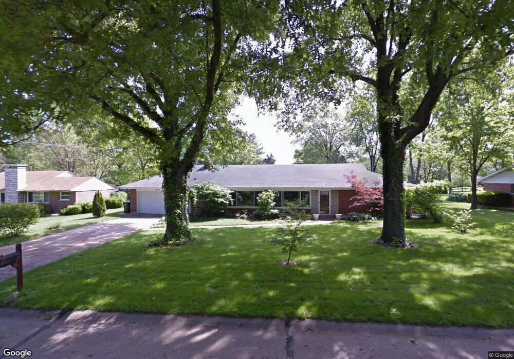
12216 Blackhall Dr Saint Louis, MO 63128
Sappington NeighborhoodEstimated Value: $402,000 - $453,647
2
Beds
3
Baths
2,269
Sq Ft
$186/Sq Ft
Est. Value
About This Home
This home is located at 12216 Blackhall Dr, Saint Louis, MO 63128 and is currently estimated at $420,912, approximately $185 per square foot. 12216 Blackhall Dr is a home located in St. Louis County with nearby schools including Concord Elementary School, Sperreng Middle School, and Lindbergh High School.
Ownership History
Date
Name
Owned For
Owner Type
Purchase Details
Closed on
Aug 12, 2002
Sold by
Reiner Robert F
Bought by
Hlaca Daniel F and Hlaca Linda S
Current Estimated Value
Home Financials for this Owner
Home Financials are based on the most recent Mortgage that was taken out on this home.
Original Mortgage
$134,400
Interest Rate
6.6%
Purchase Details
Closed on
Jun 12, 2001
Sold by
Reiner Robert F
Bought by
Reiner Robert F and The Reiner Living Trust
Create a Home Valuation Report for This Property
The Home Valuation Report is an in-depth analysis detailing your home's value as well as a comparison with similar homes in the area
Home Values in the Area
Average Home Value in this Area
Purchase History
| Date | Buyer | Sale Price | Title Company |
|---|---|---|---|
| Hlaca Daniel F | $168,000 | -- | |
| Reiner Robert F | -- | -- |
Source: Public Records
Mortgage History
| Date | Status | Borrower | Loan Amount |
|---|---|---|---|
| Closed | Hlaca Daniel F | $134,400 | |
| Closed | Hlaca Daniel F | $16,800 |
Source: Public Records
Tax History Compared to Growth
Tax History
| Year | Tax Paid | Tax Assessment Tax Assessment Total Assessment is a certain percentage of the fair market value that is determined by local assessors to be the total taxable value of land and additions on the property. | Land | Improvement |
|---|---|---|---|---|
| 2025 | $4,250 | $64,860 | $23,520 | $41,340 |
| 2024 | $4,250 | $65,370 | $21,380 | $43,990 |
| 2023 | $4,250 | $65,370 | $21,380 | $43,990 |
| 2022 | $3,401 | $50,240 | $25,650 | $24,590 |
| 2021 | $3,280 | $50,240 | $25,650 | $24,590 |
| 2020 | $3,484 | $51,510 | $15,960 | $35,550 |
| 2019 | $3,475 | $51,510 | $15,960 | $35,550 |
| 2018 | $3,983 | $53,770 | $11,060 | $42,710 |
| 2017 | $3,940 | $53,770 | $11,060 | $42,710 |
| 2016 | $2,586 | $33,390 | $9,010 | $24,380 |
| 2015 | $2,547 | $33,390 | $9,010 | $24,380 |
| 2014 | $2,534 | $32,890 | $8,610 | $24,280 |
Source: Public Records
Map
Nearby Homes
- 10727 Roxanna Dr
- 10627 Leebur Dr
- 10652 Roanna Ln
- 10124 Carolynne Dr
- 10508 Stephenson Dr
- 10315 Kennerly Rd
- 20 Oleander Dr
- 10010 Chardin Way Unit 2
- 10140 Sakura Dr
- 10000 Hilltop Dr
- 10117 Sakura Dr Unit F
- 10831 Carroll Wood Way
- 10819 Carroll Wood Way
- 10080 Sakura Dr Unit 8
- 10080 Sakura Dr Unit 1
- 10573 Carroll Wood Way
- 10682 Carroll Wood Way Unit 3
- 10525 Carroll Wood Way
- 9862 Gerald Dr
- 10622 Carroll Wood Way
- 12208 Blackhall Dr
- 12224 Blackhall Dr
- 12200 Blackhall Dr
- 12205 Renwick Dr
- 12217 Renwick Dr
- 12215 Blackhall Dr
- 12209 Blackhall Dr
- 12225 Blackhall Dr
- 12162 Blackhall Dr
- 10550 Tamara Dr
- 10536 Renwick Dr
- 12201 Renwick Dr
- 12233 Blackhall Dr
- 10544 Renwick Dr
- 10550 Renwick Dr
- 12154 Blackhall Dr
- 10530 Renwick Dr
- 10551 Tamara Dr
- 10524 Renwick Dr
- 10539 Liberty Trail Dr W