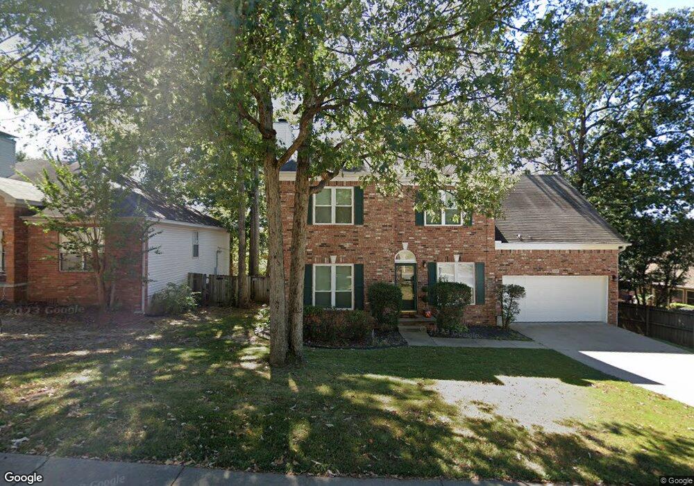
12217 Cherryside Dr Little Rock, AR 72211
Western Little Rock NeighborhoodEstimated Value: $291,829 - $327,000
About This Home
This home is located at 12217 Cherryside Dr, Little Rock, AR 72211 and is currently estimated at $309,457, approximately $130 per square foot. 12217 Cherryside Dr is a home located in Pulaski County with nearby schools including Terry Elementary School, Pinnacle View Middle School, and LISA Academy West Elementary School.
Ownership History
We collect this data history from publicly available records. To have your information removed, we recommend requesting removal directly through your county’s website.
Purchase Details
Home Financials for this Owner
Home Financials are based on the most recent Mortgage that was taken out on this home.Purchase Details
Home Financials for this Owner
Home Financials are based on the most recent Mortgage that was taken out on this home.Purchase Details
Home Financials for this Owner
Home Financials are based on the most recent Mortgage that was taken out on this home.Purchase Details
Home Financials for this Owner
Home Financials are based on the most recent Mortgage that was taken out on this home.Home Values in the Area
Average Home Value in this Area
Purchase History
We collect this data history from publicly available records. To have your information removed, we recommend requesting removal directly through your county’s website.
| Date | Buyer | Sale Price | Title Company |
|---|---|---|---|
| $212,000 | Pulaski County Title | ||
| $200,000 | West Little Rock Title Co | ||
| -- | American Abstract & Title Co | ||
| $159,000 | American Abstract & Title Co |
Mortgage History
We collect this data history from publicly available records. To have your information removed, we recommend requesting removal directly through your county’s website.
| Date | Status | Borrower | Loan Amount |
|---|---|---|---|
| Open | $201,400 | ||
| Previous Owner | $130,000 | ||
| Previous Owner | $148,000 | ||
| Previous Owner | $151,050 |
Tax History
We collect this data history from publicly available records. To have your information removed, we recommend requesting removal directly through your county’s website.
| Year | Tax Paid | Tax Assessment Tax Assessment Total Assessment is a certain percentage of the fair market value that is determined by local assessors to be the total taxable value of land and additions on the property. | Land | Improvement |
|---|---|---|---|---|
| 2025 | $2,917 | $43,802 | $5,800 | $38,002 |
| 2024 | $2,673 | $43,802 | $5,800 | $38,002 |
| 2023 | $2,673 | $43,802 | $5,800 | $38,002 |
| 2022 | $2,552 | $43,802 | $5,800 | $38,002 |
| 2021 | $2,447 | $34,710 | $7,200 | $27,510 |
| 2020 | $2,055 | $34,710 | $7,200 | $27,510 |
| 2019 | $2,055 | $34,710 | $7,200 | $27,510 |
| 2018 | $2,080 | $34,710 | $7,200 | $27,510 |
| 2017 | $2,080 | $34,710 | $7,200 | $27,510 |
| 2016 | $2,027 | $33,960 | $5,000 | $28,960 |
| 2015 | $2,381 | $33,960 | $5,000 | $28,960 |
| 2014 | $2,381 | $33,960 | $5,000 | $28,960 |
Map
- 1910 Cherrybend Dr
- 2015 Brookford Dr
- 1907 Cherrybend Dr
- 12201 Cherryside Dr
- 12 Cherryhill Cove
- 2623 Bowman Rd
- 11701 Shady Creek Dr
- 1814 Calgary Trail
- 1715 Gamble Rd
- 2300 Hickorynut Ct
- 1408 S Bowman Rd
- 6 Wagon Wheel Ct
- 2905 Woodsgate Dr
- 2900 Mossy Creek Dr
- 2908 Mossy Creek Dr
- 12908 Westglen Dr
- 10 Cherrywood Ct
- 127 Point West Cir
- 12725 Meadows Edge Ln
- 2317 Peach Tree Dr
- 1906 Cherrybend Dr
- 1912 Cherrybend Dr
- 2011 Brookford Dr
- 2007 Brookford Dr
- 1904 Cherrybend Dr
- 1914 Cherrybend Dr
- 1911 Cherrybend Dr
- 2019 Brookford Dr
- 1901 Cherrybend Dr
- 1916 Cherrybend Dr
- 1917 Cherrybend Dr
- 12305 Cherryside Dr
- 1919 Brookford Dr
- 2018 Brookford Dr
- 1918 Cherrybend Dr
- 12213 Cherryside Dr
- 2001 Cherrybend Dr
- 2014 Brookford Dr
- 12317 Cherryside Dr
- 2010 Brookford Dr
Ask me questions while you tour the home.