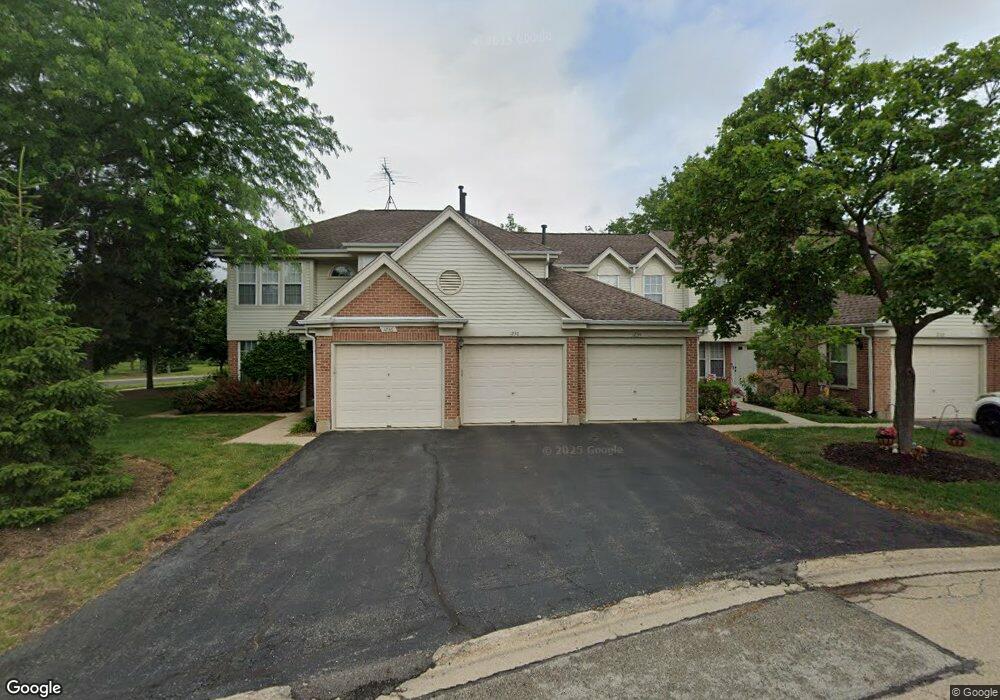
1222 Clearview Ct Buffalo Grove, IL 60089
Estimated Value: $292,116 - $311,000
--
Bed
1
Bath
1,131
Sq Ft
$269/Sq Ft
Est. Value
About This Home
This home is located at 1222 Clearview Ct, Buffalo Grove, IL 60089 and is currently estimated at $304,779, approximately $269 per square foot. 1222 Clearview Ct is a home located in Lake County with nearby schools including Meridian Middle School, Tripp Elementary School, and Aptakisic Junior High School.
Ownership History
Date
Name
Owned For
Owner Type
Purchase Details
Closed on
Jul 31, 2003
Sold by
Todd Patrick M and Todd Kathryn M
Bought by
Rosenbaum Ila
Current Estimated Value
Home Financials for this Owner
Home Financials are based on the most recent Mortgage that was taken out on this home.
Original Mortgage
$60,000
Outstanding Balance
$27,495
Interest Rate
6.18%
Mortgage Type
Unknown
Estimated Equity
$277,284
Purchase Details
Closed on
Jun 29, 2001
Sold by
Lantolf Heather J and Farlee Heather J
Bought by
Todd Patrick M and Todd Kathryn M
Purchase Details
Closed on
Sep 26, 1996
Sold by
Goldzweig Steve A
Bought by
Lantolf Heather J
Home Financials for this Owner
Home Financials are based on the most recent Mortgage that was taken out on this home.
Original Mortgage
$99,200
Interest Rate
7.5%
Create a Home Valuation Report for This Property
The Home Valuation Report is an in-depth analysis detailing your home's value as well as a comparison with similar homes in the area
Home Values in the Area
Average Home Value in this Area
Purchase History
| Date | Buyer | Sale Price | Title Company |
|---|---|---|---|
| Rosenbaum Ila | $202,500 | Ticor Title Insurance Compan | |
| Todd Patrick M | $174,500 | -- | |
| Lantolf Heather J | $124,000 | Attorneys Natl Title Network |
Source: Public Records
Mortgage History
| Date | Status | Borrower | Loan Amount |
|---|---|---|---|
| Open | Rosenbaum Ila | $60,000 | |
| Previous Owner | Lantolf Heather J | $99,200 |
Source: Public Records
Tax History Compared to Growth
Tax History
| Year | Tax Paid | Tax Assessment Tax Assessment Total Assessment is a certain percentage of the fair market value that is determined by local assessors to be the total taxable value of land and additions on the property. | Land | Improvement |
|---|---|---|---|---|
| 2024 | $6,707 | $77,492 | $22,124 | $55,368 |
| 2023 | $6,127 | $73,120 | $20,876 | $52,244 |
| 2022 | $6,127 | $68,713 | $19,618 | $49,095 |
| 2021 | $5,906 | $67,972 | $19,406 | $48,566 |
| 2020 | $5,792 | $68,204 | $19,472 | $48,732 |
| 2019 | $5,642 | $67,952 | $19,400 | $48,552 |
| 2018 | $4,427 | $54,609 | $21,087 | $33,522 |
| 2017 | $4,366 | $53,335 | $20,595 | $32,740 |
| 2016 | $4,198 | $51,072 | $19,721 | $31,351 |
| 2015 | $4,090 | $47,762 | $18,443 | $29,319 |
| 2014 | $3,403 | $40,349 | $14,857 | $25,492 |
| 2012 | $4,596 | $53,907 | $19,849 | $34,058 |
Source: Public Records
Map
Nearby Homes
- 148 White Branch Ct
- 1157 Russellwood Ct
- 60 E Fabish Dr
- 381 Bentley Place
- 15 Thompson Ct
- 1272 Sandhurst Dr
- 1012 Hobson Dr
- 51 W Fabish Dr
- 16202 W Aptakisic Rd
- 12 Aberdeen Ct
- 938 Hidden Lake Dr
- 22118 N Prairie Rd
- 1113 Lockwood Dr
- 720 Dunhill Dr
- 620 Cobblestone Ln
- 20665 N Weiland Rd
- 20772 N William Ave
- 1118 Larraway Dr
- 625 Marseilles Cir
- 455 Thorndale Dr
- 1220 Clearview Ct
- 1224 Clearview Ct Unit 12-24
- 1226 Clearview Ct
- 1228 Clearview Ct
- 1230 Clearview Ct
- 1234 Clearview Ct
- 1236 Clearview Ct
- 1238 Clearview Ct
- 241 E Fabish Dr
- 1218 Clearview Ct
- 243 E Fabish Dr
- 1216 Clearview Ct Unit 2-25-F
- 1216 Clearview Ct
- 1214 Clearview Ct
- 245 E Fabish Dr
- 1212 Clearview Ct
- 1210 Clearview Ct
- 247 E Fabish Dr
- 1208 Clearview Ct
- 251 E Fabish Dr