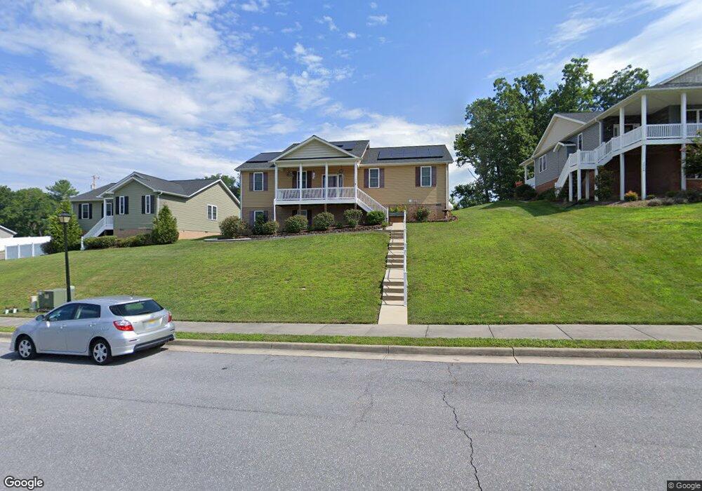
1222 Landon Dr Harrisonburg, VA 22801
Estimated Value: $349,000 - $412,000
3
Beds
2
Baths
1,607
Sq Ft
$242/Sq Ft
Est. Value
About This Home
This home is located at 1222 Landon Dr, Harrisonburg, VA 22801 and is currently estimated at $389,279, approximately $242 per square foot. 1222 Landon Dr is a home located in Harrisonburg City with nearby schools including Stone Spring Elementary School, Skyline Middle School, and Harrisonburg High School.
Ownership History
Date
Name
Owned For
Owner Type
Purchase Details
Closed on
Mar 2, 2016
Sold by
Greendale Road Llc
Bought by
Taylor Sam E
Current Estimated Value
Home Financials for this Owner
Home Financials are based on the most recent Mortgage that was taken out on this home.
Original Mortgage
$84,000
Outstanding Balance
$34,657
Interest Rate
2.93%
Mortgage Type
New Conventional
Estimated Equity
$354,622
Create a Home Valuation Report for This Property
The Home Valuation Report is an in-depth analysis detailing your home's value as well as a comparison with similar homes in the area
Home Values in the Area
Average Home Value in this Area
Purchase History
| Date | Buyer | Sale Price | Title Company |
|---|---|---|---|
| Taylor Sam E | $259,000 | West View Title Agency Inc |
Source: Public Records
Mortgage History
| Date | Status | Borrower | Loan Amount |
|---|---|---|---|
| Open | Taylor Sam E | $84,000 |
Source: Public Records
Tax History Compared to Growth
Tax History
| Year | Tax Paid | Tax Assessment Tax Assessment Total Assessment is a certain percentage of the fair market value that is determined by local assessors to be the total taxable value of land and additions on the property. | Land | Improvement |
|---|---|---|---|---|
| 2025 | $3,534 | $354,400 | $71,500 | $282,900 |
| 2024 | $3,534 | $349,900 | $71,500 | $278,400 |
| 2023 | $3,046 | $317,300 | $71,500 | $245,800 |
| 2022 | $2,706 | $291,000 | $65,000 | $226,000 |
| 2021 | $2,458 | $273,100 | $65,000 | $208,100 |
| 2020 | $2,183 | $250,300 | $55,000 | $195,300 |
| 2019 | $2,159 | $247,600 | $55,000 | $192,600 |
| 2018 | $397 | $239,200 | $55,000 | $184,200 |
| 2017 | $397 | $230,900 | $55,000 | $175,900 |
| 2016 | $397 | $229,900 | $55,000 | $174,900 |
| 2015 | $397 | $55,200 | $55,200 | $0 |
| 2014 | -- | $55,200 | $55,200 | $0 |
Source: Public Records
Map
Nearby Homes
- 2758 Dorval Rd
- 1205 Greendale Rd
- 1583 Ridgedale Rd
- 1771 Marble Ridge Dr
- 1141 Decca Dr
- 1271 King Edwards Way
- 1311 Little Sorrell Dr
- TBD Autumn Ln
- 2154 Port Republic Rd
- 3010 Woodberry Cir
- 2370 Meadow Ct
- 521 Hickory Grove Cir
- 1193 Nelson Dr
- 2414 Millwood Loop Unit 15
- 210 W Mosby Rd
- 3195 Joppa Ct
- 2161 Secrist Ln
- 3200 Joppa Ct
- 1309 Bradley Dr
- 1229 Woodcrest Cir
- 1228 Landon Dr
- 1210 Landon Dr
- 2560 Ramblewood Rd
- 1242 Landon Dr
- 0 Landon Dr Unit 182993
- 0 Landon Dr Unit 183145
- 1219 Landon Dr
- 1190 Landon Dr
- 1211 Landon Dr
- 1227 Landon Dr
- 2558 Ramblewood Rd
- 1235 Landon Dr
- 1182 Landon Dr
- 1191 Landon Dr
- 1243 Landon Dr
- 2550 Ramblewood Rd
- 2551 Ramblewood Rd
- 1174 Landon Dr
- 1183 Landon Dr
- 1209 Greendale Rd