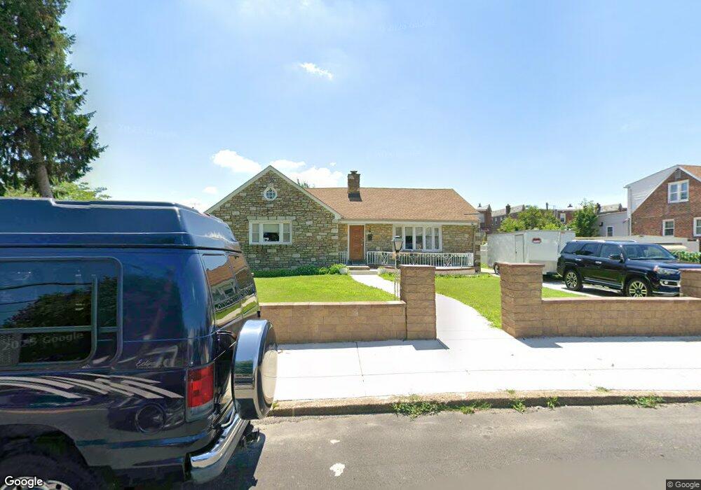
1222 Longshore Ave Philadelphia, PA 19111
Castor Gardens NeighborhoodEstimated Value: $412,029 - $485,000
3
Beds
3
Baths
1,970
Sq Ft
$222/Sq Ft
Est. Value
About This Home
This home is located at 1222 Longshore Ave, Philadelphia, PA 19111 and is currently estimated at $437,257, approximately $221 per square foot. 1222 Longshore Ave is a home located in Philadelphia County with nearby schools including J. Hampton Moore School, Castor Gardens Middle School, and Northeast High School.
Ownership History
Date
Name
Owned For
Owner Type
Purchase Details
Closed on
Jul 28, 2008
Sold by
Bari Bashar and Bari Manal
Bought by
Leal Neida
Current Estimated Value
Home Financials for this Owner
Home Financials are based on the most recent Mortgage that was taken out on this home.
Original Mortgage
$287,018
Outstanding Balance
$189,024
Interest Rate
6.4%
Mortgage Type
FHA
Estimated Equity
$248,233
Purchase Details
Closed on
Oct 26, 1998
Sold by
Kogan David and Kogan Harry
Bought by
Bari Bashar and Bari Manal
Create a Home Valuation Report for This Property
The Home Valuation Report is an in-depth analysis detailing your home's value as well as a comparison with similar homes in the area
Home Values in the Area
Average Home Value in this Area
Purchase History
| Date | Buyer | Sale Price | Title Company |
|---|---|---|---|
| Leal Neida | $290,000 | None Available | |
| Bari Bashar | $110,000 | -- |
Source: Public Records
Mortgage History
| Date | Status | Borrower | Loan Amount |
|---|---|---|---|
| Open | Leal Neida | $287,018 |
Source: Public Records
Tax History Compared to Growth
Tax History
| Year | Tax Paid | Tax Assessment Tax Assessment Total Assessment is a certain percentage of the fair market value that is determined by local assessors to be the total taxable value of land and additions on the property. | Land | Improvement |
|---|---|---|---|---|
| 2025 | $4,376 | $375,500 | $75,100 | $300,400 |
| 2024 | $4,376 | $375,500 | $75,100 | $300,400 |
| 2023 | $4,376 | $312,600 | $62,520 | $250,080 |
| 2022 | $3,189 | $312,600 | $62,520 | $250,080 |
| 2021 | $3,189 | $0 | $0 | $0 |
| 2020 | $3,189 | $0 | $0 | $0 |
| 2019 | $3,180 | $0 | $0 | $0 |
| 2018 | $2,945 | $0 | $0 | $0 |
| 2017 | $2,945 | $0 | $0 | $0 |
| 2016 | $2,945 | $0 | $0 | $0 |
| 2015 | $2,819 | $0 | $0 | $0 |
| 2014 | -- | $210,400 | $154,316 | $56,084 |
| 2012 | -- | $30,624 | $14,187 | $16,437 |
Source: Public Records
Map
Nearby Homes
- 6839 Summerdale Ave
- 1202 Disston St
- 1238 Glenview St
- 1305 Glenview St
- 1300 Glenview St
- 1216 Knorr St
- 1133 Knorr St
- 1336 Longshore Ave
- 1136 Kerper St
- 1114 Brighton St
- 1117 Unruh Ave
- 1341 Tyson Ave
- 7004 Loretto Ave
- 1227 Fanshawe St
- 1324 Unruh Ave
- 1055 Tyson Ave
- 1116 Unruh Ave
- 1217 Princeton Ave
- 1131 Fanshawe St
- 1304 Fanshawe St
- 1228 Longshore Ave
- 1204 Longshore Ave
- 1219 Glenview St
- 1217 Glenview St
- 1221 Glenview St
- 1223 Glenview St
- 1215 Glenview St
- 1213 Glenview St
- 1225 Glenview St
- 1202 Longshore Ave
- 1238 Longshore Ave
- 1227 Glenview St
- 1211 Glenview St
- 1209 Glenview St
- 1221 Longshore Ave
- 1215 Longshore Ave
- 1223 Longshore Ave
- 1229 Glenview St
- 1231 Glenview St
- 1207 Glenview St