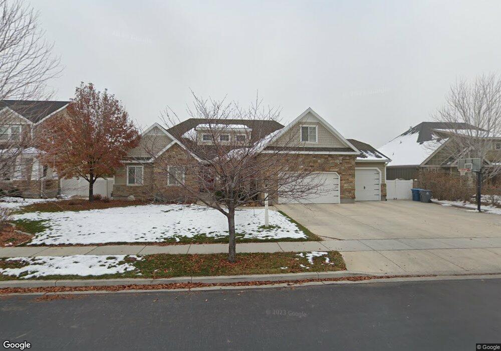
1222 N 1050 E American Fork, UT 84003
Estimated Value: $786,000 - $854,740
5
Beds
4
Baths
4,208
Sq Ft
$195/Sq Ft
Est. Value
About This Home
This home is located at 1222 N 1050 E, American Fork, UT 84003 and is currently estimated at $818,580, approximately $194 per square foot. 1222 N 1050 E is a home located in Utah County with nearby schools including Deerfield Elementary School, Mountain Ridge Junior High School, and American Fork High School.
Ownership History
Date
Name
Owned For
Owner Type
Purchase Details
Closed on
May 9, 2022
Sold by
Craig Mathis
Bought by
C & R Mathis Family Trust
Current Estimated Value
Purchase Details
Closed on
Aug 29, 2012
Sold by
Stone Ridge Financial Llc
Bought by
Mathis Craig and Mathis Rebecca T
Home Financials for this Owner
Home Financials are based on the most recent Mortgage that was taken out on this home.
Original Mortgage
$275,483
Interest Rate
3.49%
Mortgage Type
New Conventional
Purchase Details
Closed on
Mar 5, 2012
Sold by
Pemberton Properties Llc
Bought by
Stone Ridge Financial Llc
Create a Home Valuation Report for This Property
The Home Valuation Report is an in-depth analysis detailing your home's value as well as a comparison with similar homes in the area
Home Values in the Area
Average Home Value in this Area
Purchase History
| Date | Buyer | Sale Price | Title Company |
|---|---|---|---|
| C & R Mathis Family Trust | -- | Invictus Title | |
| Mathis Craig | -- | Select Title Insurance Inc | |
| Stone Ridge Financial Llc | -- | Select Title |
Source: Public Records
Mortgage History
| Date | Status | Borrower | Loan Amount |
|---|---|---|---|
| Previous Owner | Mathis Craig | $275,483 |
Source: Public Records
Tax History
| Year | Tax Paid | Tax Assessment Tax Assessment Total Assessment is a certain percentage of the fair market value that is determined by local assessors to be the total taxable value of land and additions on the property. | Land | Improvement |
|---|---|---|---|---|
| 2025 | $3,514 | $416,020 | -- | -- |
| 2024 | $3,514 | $390,445 | $0 | $0 |
| 2023 | $3,343 | $393,800 | $0 | $0 |
| 2022 | $3,388 | $393,855 | $0 | $0 |
| 2021 | $2,972 | $539,600 | $175,900 | $363,700 |
| 2020 | $2,892 | $509,300 | $162,900 | $346,400 |
| 2019 | $2,734 | $497,900 | $151,500 | $346,400 |
| 2018 | $2,779 | $483,900 | $144,000 | $339,900 |
| 2017 | $2,744 | $257,950 | $0 | $0 |
| 2016 | $2,534 | $221,265 | $0 | $0 |
| 2015 | $2,670 | $221,265 | $0 | $0 |
| 2014 | $2,681 | $219,175 | $0 | $0 |
Source: Public Records
Map
Nearby Homes
- 1125 N 1270 E
- 1077 N 950 E
- 1045 N 930 E Unit 58
- 9587 N 4500 W
- 4568 W Temple Shadows Dr
- 3518 N 1450 W
- 4552 W Windsor Cir
- 9752 N Dorchester Dr
- 4531 W Cambridge Dr
- 4979 W Willowbank Dr
- 5032 W Northwood Ln
- 4968 W Evergreen Ln
- 5061 W Evergreen Ln
- 1121 E 580 N
- 9506 N 4000 W
- 5092 Elmfield Way
- 5093 W Crimson Oak Ln
- 5093 Crimson Oak Ln
- 4814 W Washoe Ct
- 467 N 1120 E
- 1238 N 1050 E
- 1196 N 1050 E
- 1217 N 1100 E
- 1239 N 1100 E
- 1195 N 1100 E
- 1258 N 1050 E
- 1217 N 1050 E
- 1217 N 1050 E Unit 2
- 1235 N 1050 E
- 1235 N 1050 E Unit 3
- 1251 N 1100 E
- 1191 N 1050 E Unit 1
- 1253 N 1050 E
- 1276 N 1050 E
- 1216 N 1100 E
- 1173 N 1100 E
- 1194 N 1100 E
- 1238 N 1100 E
- 1179 N 1050 E
- 1096 E 1280 N
Your Personal Tour Guide
Ask me questions while you tour the home.