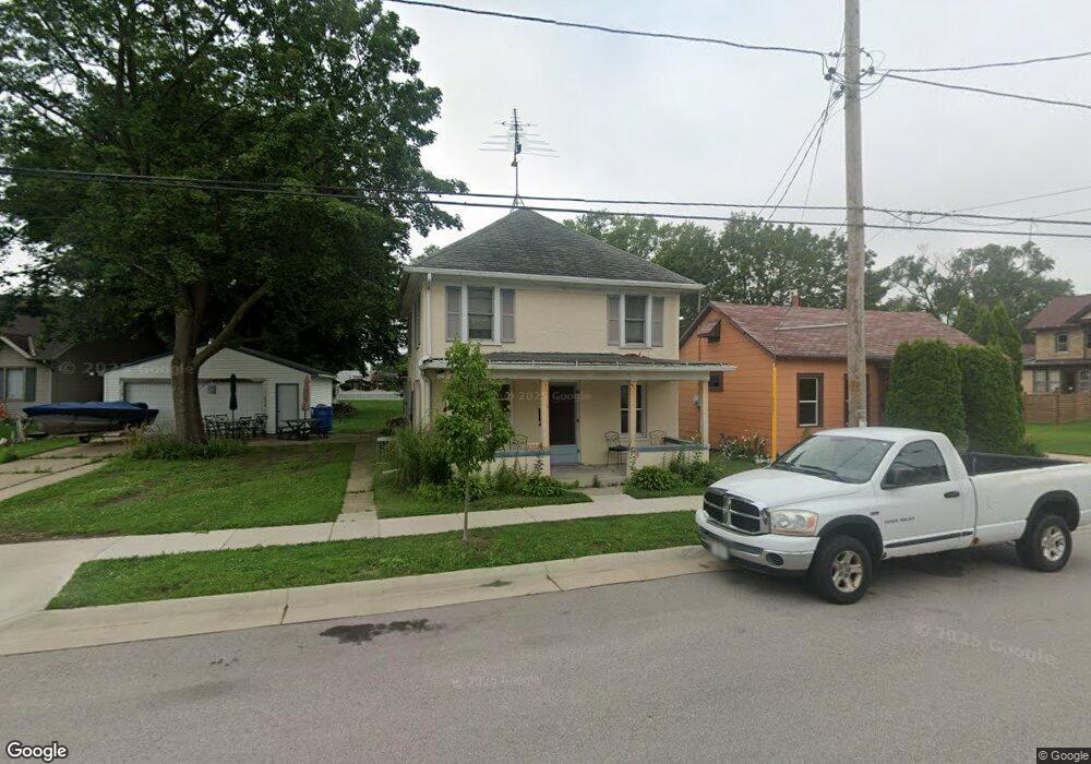
1222 S 3rd St Watertown, WI 53094
Estimated Value: $234,000 - $252,000
--
Bed
--
Bath
--
Sq Ft
0.26
Acres
About This Home
This home is located at 1222 S 3rd St, Watertown, WI 53094 and is currently estimated at $245,550. 1222 S 3rd St is a home located in Jefferson County with nearby schools including Watertown High School, eCampus Academy Charter School, and Trinity-St. Luke's Lutheran Elementary School.
Ownership History
Date
Name
Owned For
Owner Type
Purchase Details
Closed on
Apr 27, 2007
Sold by
Fannie Mae
Bought by
Schroeder Charles A
Current Estimated Value
Home Financials for this Owner
Home Financials are based on the most recent Mortgage that was taken out on this home.
Original Mortgage
$126,117
Outstanding Balance
$76,755
Interest Rate
6.18%
Mortgage Type
FHA
Estimated Equity
$168,795
Purchase Details
Closed on
Dec 29, 2006
Sold by
Mullins Matthew M and Mullins Alta J
Bought by
Federal National Mortgage Association
Create a Home Valuation Report for This Property
The Home Valuation Report is an in-depth analysis detailing your home's value as well as a comparison with similar homes in the area
Home Values in the Area
Average Home Value in this Area
Purchase History
| Date | Buyer | Sale Price | Title Company |
|---|---|---|---|
| Schroeder Charles A | -- | None Available | |
| Federal National Mortgage Association | $128,560 | None Available |
Source: Public Records
Mortgage History
| Date | Status | Borrower | Loan Amount |
|---|---|---|---|
| Open | Schroeder Charles A | $126,117 |
Source: Public Records
Tax History Compared to Growth
Tax History
| Year | Tax Paid | Tax Assessment Tax Assessment Total Assessment is a certain percentage of the fair market value that is determined by local assessors to be the total taxable value of land and additions on the property. | Land | Improvement |
|---|---|---|---|---|
| 2024 | $3,052 | $205,700 | $51,600 | $154,100 |
| 2023 | $3,042 | $172,400 | $45,600 | $126,800 |
| 2022 | $2,850 | $172,400 | $45,600 | $126,800 |
| 2021 | $2,239 | $97,800 | $26,500 | $71,300 |
| 2020 | $2,292 | $97,800 | $26,500 | $71,300 |
| 2019 | $2,214 | $97,800 | $26,500 | $71,300 |
| 2018 | $2,172 | $97,800 | $26,500 | $71,300 |
| 2017 | $2,102 | $97,800 | $26,500 | $71,300 |
| 2016 | $2,067 | $97,800 | $26,500 | $71,300 |
| 2015 | $2,155 | $97,800 | $26,500 | $71,300 |
| 2014 | $2,184 | $97,800 | $26,500 | $71,300 |
| 2013 | $2,224 | $97,800 | $26,500 | $71,300 |
Source: Public Records
Map
Nearby Homes
- 1301 Utah St
- 1215 Utah St
- 1313 Utah St
- 1418 S 9th St
- 913 S 3rd St
- 1330 S 10th St
- 1314 Waldron St
- 901 S 8th St
- 908 Franklin St
- 1507 S 10th St
- 601 S 6th St
- 131 Cedar Ct
- 709 S 10th St
- 623 S 12th St
- The Saybrook Plan at Rock River Ridge
- The Atwater Plan at Rock River Ridge
- The Hudson Plan at Rock River Ridge
- The Coral Plan at Rock River Ridge
- The Drake Plan at Rock River Ridge
- The Addison Plan at Rock River Ridge