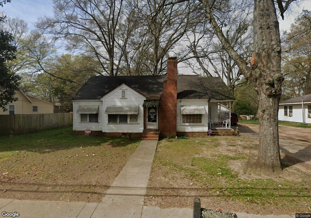
1222 S Main St Cedartown, GA 30125
Estimated Value: $84,000 - $130,000
2
Beds
1
Bath
1,216
Sq Ft
$85/Sq Ft
Est. Value
About This Home
This home is located at 1222 S Main St, Cedartown, GA 30125 and is currently estimated at $102,842, approximately $84 per square foot. 1222 S Main St is a home located in Polk County with nearby schools including Cedar Christian School and Vineyard Harvester Christian Academy.
Ownership History
Date
Name
Owned For
Owner Type
Purchase Details
Closed on
Apr 16, 2004
Sold by
J S T Investments Inc
Bought by
Worthington Steve
Current Estimated Value
Purchase Details
Closed on
Aug 14, 2000
Sold by
Nichols Shelby G Brooke G Jackson
Bought by
J S T Investments Inc
Purchase Details
Closed on
Apr 27, 2000
Sold by
Goss Tom B
Bought by
Goss Tom Bradley Shelby Goss Nicho
Purchase Details
Closed on
Dec 1, 1979
Sold by
Warren Lucile B
Bought by
Goss Tom B
Purchase Details
Closed on
Mar 28, 1973
Sold by
Babb M L
Bought by
Warren Lucile B
Purchase Details
Closed on
Jul 17, 1948
Bought by
Babb M L
Create a Home Valuation Report for This Property
The Home Valuation Report is an in-depth analysis detailing your home's value as well as a comparison with similar homes in the area
Home Values in the Area
Average Home Value in this Area
Purchase History
| Date | Buyer | Sale Price | Title Company |
|---|---|---|---|
| Worthington Steve | $37,100 | -- | |
| J S T Investments Inc | $40,600 | -- | |
| Goss Tom Bradley Shelby Goss Nicho | -- | -- | |
| Goss Tom B | -- | -- | |
| Warren Lucile B | -- | -- | |
| Babb M L | -- | -- |
Source: Public Records
Tax History Compared to Growth
Tax History
| Year | Tax Paid | Tax Assessment Tax Assessment Total Assessment is a certain percentage of the fair market value that is determined by local assessors to be the total taxable value of land and additions on the property. | Land | Improvement |
|---|---|---|---|---|
| 2024 | $740 | $23,414 | $1,872 | $21,542 |
| 2023 | $545 | $15,714 | $1,872 | $13,842 |
| 2022 | $327 | $13,792 | $1,872 | $11,920 |
| 2021 | $332 | $13,792 | $1,872 | $11,920 |
| 2020 | $332 | $13,792 | $1,872 | $11,920 |
| 2019 | $371 | $13,826 | $1,800 | $12,026 |
| 2018 | $358 | $12,992 | $1,350 | $11,642 |
| 2017 | $354 | $12,992 | $1,350 | $11,642 |
| 2016 | $361 | $13,254 | $1,350 | $11,904 |
| 2015 | $366 | $13,398 | $1,350 | $12,048 |
| 2014 | $368 | $13,398 | $1,350 | $12,048 |
Source: Public Records
Map
Nearby Homes
- 0 Philpot Springs Unit 10626665
- 129 W Ellawood Ave
- 149 Irwin St
- 151 W Ellawood Ave
- 234 Brooks St
- 729 S College St
- 117 Cason Rd
- 129 Thompson St
- 325 Fairview Ave
- 226 Central St
- 634 Georgia Ave
- 634 Georgia Ave Unit 123
- 2460 Hidden Creek Rd
- 217 E Gibson St
- 203 Cason Rd
- 205 Pinecrest Rd
- 1003 Fairview Ave
- 427 Park St
- 328 330 Stubbs
- 00 Juliette St