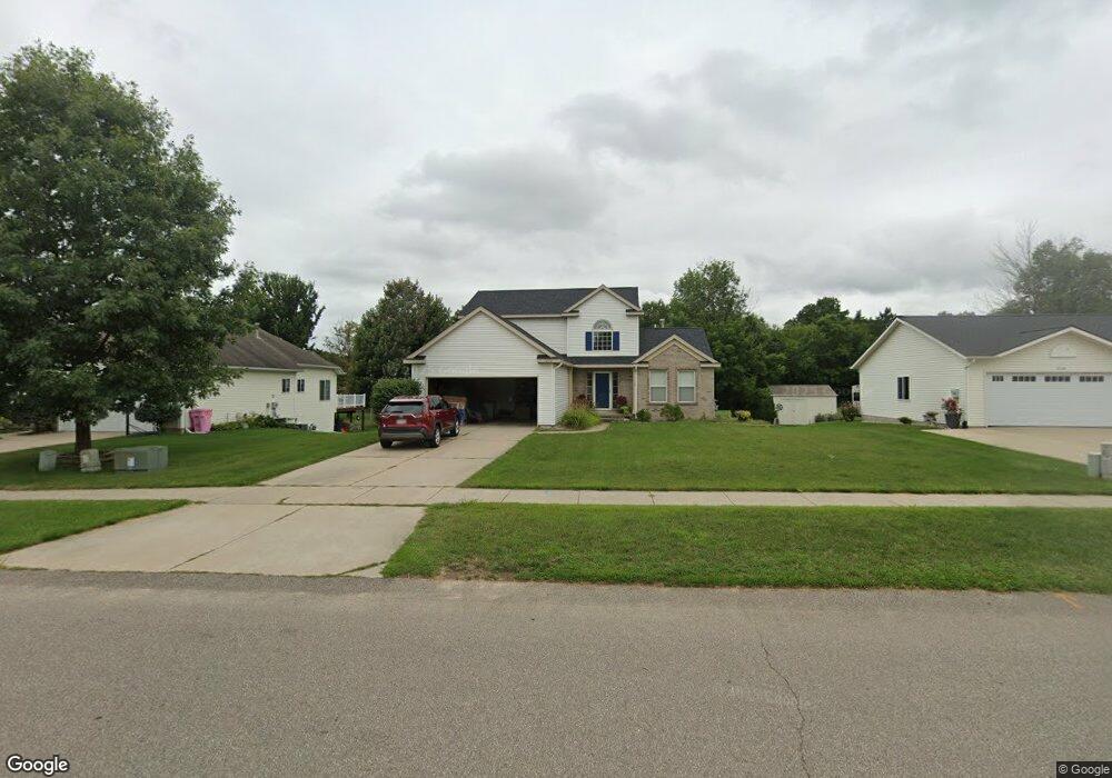
1222 Woodspointe Dr SW Byron Center, MI 49315
Estimated Value: $408,000 - $544,000
3
Beds
3
Baths
1,950
Sq Ft
$240/Sq Ft
Est. Value
About This Home
This home is located at 1222 Woodspointe Dr SW, Byron Center, MI 49315 and is currently estimated at $467,444, approximately $239 per square foot. 1222 Woodspointe Dr SW is a home located in Kent County with nearby schools including Marshall Elementary School, Robert L. Nickels Intermediate School, and Byron Center West Middle School.
Ownership History
Date
Name
Owned For
Owner Type
Purchase Details
Closed on
May 16, 2005
Sold by
Clink Joseph and Clink Erin A
Bought by
Nguyen Xuan V and Bui Hanh N
Current Estimated Value
Home Financials for this Owner
Home Financials are based on the most recent Mortgage that was taken out on this home.
Original Mortgage
$140,000
Outstanding Balance
$74,072
Interest Rate
6.07%
Mortgage Type
Fannie Mae Freddie Mac
Estimated Equity
$393,372
Create a Home Valuation Report for This Property
The Home Valuation Report is an in-depth analysis detailing your home's value as well as a comparison with similar homes in the area
Home Values in the Area
Average Home Value in this Area
Purchase History
| Date | Buyer | Sale Price | Title Company |
|---|---|---|---|
| Nguyen Xuan V | $200,000 | Metropolitan Title Company |
Source: Public Records
Mortgage History
| Date | Status | Borrower | Loan Amount |
|---|---|---|---|
| Open | Nguyen Xuan V | $140,000 |
Source: Public Records
Tax History Compared to Growth
Tax History
| Year | Tax Paid | Tax Assessment Tax Assessment Total Assessment is a certain percentage of the fair market value that is determined by local assessors to be the total taxable value of land and additions on the property. | Land | Improvement |
|---|---|---|---|---|
| 2025 | $2,375 | $211,700 | $0 | $0 |
| 2024 | $2,375 | $205,800 | $0 | $0 |
| 2023 | $2,271 | $151,800 | $0 | $0 |
| 2022 | $3,165 | $142,000 | $0 | $0 |
| 2021 | $3,081 | $125,200 | $0 | $0 |
| 2020 | $2,090 | $122,700 | $0 | $0 |
| 2019 | $3,006 | $118,200 | $0 | $0 |
| 2018 | $2,945 | $114,400 | $19,000 | $95,400 |
| 2017 | $2,865 | $107,100 | $0 | $0 |
| 2016 | $2,762 | $102,700 | $0 | $0 |
| 2015 | $2,715 | $102,700 | $0 | $0 |
| 2013 | -- | $88,600 | $0 | $0 |
Source: Public Records
Map
Nearby Homes
- 6540 Kingtree Dr SW
- 6455 Silverton Dr
- 1171 Runway Place SW
- 6696 Highmeadow Dr SW
- 6450 Estate Dr SW
- 6455 Estate Dr SW
- 6471 Estate Dr SW
- 6787 Sunfield Dr SW
- 906 60th St SW
- 1010 Bellview Meadow Dr SW Unit 68
- 1012 Bellview Meadow Dr SW
- 907 Amber View Dr SW
- 6559 Burlingame Ave SW
- 825 Amber Ridge Dr SW
- 1058 Amberwood West Dr SW
- 924 Amberwood West Dr SW
- 1493 Dexter Dr SW Unit 34
- 1501 Dexter St SW Unit 35
- 1531 Dexter Dr SW Unit 37
- 6840 Burlingame Ave SW
- 1210 Woodspointe Dr SW
- 1234 Woodspointe Dr SW
- 1198 Woodspointe Dr SW
- 1000 64th St SW
- 1050 64th St SW
- 1186 Woodspointe Dr SW
- 1193 Woodspointe Dr SW
- 1045 64th St SW
- 1098 64th St SW
- 1055 64th St SW
- 1174 Woodspointe Dr SW
- 1113 64th St SW
- 1007 Northpointe Dr SW
- 1007 Northpointe Dr SW
- 6442 Byron Woods Dr SW
- 1162 Woodspointe Dr SW
- 1100 64th St SW
- 6430 Byron Woods Dr SW
- 1022 Northpointe Dr SW
- 993 Northpointe Dr SW