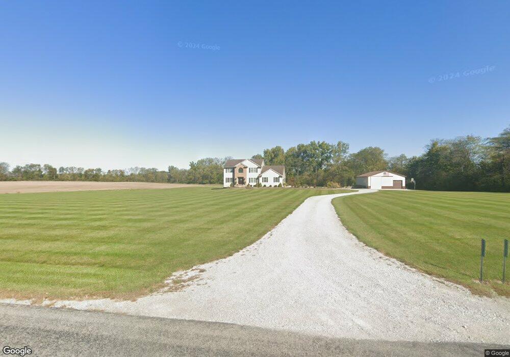
12221 Canning Factory Rd Wapakoneta, OH 45895
Estimated Value: $390,000 - $564,297
4
Beds
3
Baths
2,834
Sq Ft
$163/Sq Ft
Est. Value
About This Home
This home is located at 12221 Canning Factory Rd, Wapakoneta, OH 45895 and is currently estimated at $461,432, approximately $162 per square foot. 12221 Canning Factory Rd is a home located in Auglaize County with nearby schools including Wapakoneta Elementary School, Wapakoneta High School, and Wapakoneta Middle School.
Ownership History
Date
Name
Owned For
Owner Type
Purchase Details
Closed on
Nov 30, 2020
Sold by
Kinstle Michael C
Bought by
Kinstle Michael C and Kinstle Kelly M
Current Estimated Value
Home Financials for this Owner
Home Financials are based on the most recent Mortgage that was taken out on this home.
Original Mortgage
$161,000
Outstanding Balance
$90,117
Interest Rate
2.8%
Mortgage Type
New Conventional
Estimated Equity
$371,315
Purchase Details
Closed on
Jun 5, 2012
Sold by
Kinstle Christine R
Bought by
Kinstle Michael C
Purchase Details
Closed on
May 28, 2006
Sold by
Kostelac James M and Kostelac Susan M
Bought by
Kinstle Michael C and Kinstle Christine R
Purchase Details
Closed on
Apr 16, 2004
Sold by
Presar David Bert
Bought by
Kostelac James M
Create a Home Valuation Report for This Property
The Home Valuation Report is an in-depth analysis detailing your home's value as well as a comparison with similar homes in the area
Home Values in the Area
Average Home Value in this Area
Purchase History
| Date | Buyer | Sale Price | Title Company |
|---|---|---|---|
| Kinstle Michael C | -- | Superior Title | |
| Kinstle Michael C | -- | Attorney | |
| Kinstle Michael C | $75,000 | None Available | |
| Kostelac James M | $50,000 | -- |
Source: Public Records
Mortgage History
| Date | Status | Borrower | Loan Amount |
|---|---|---|---|
| Open | Kinstle Michael C | $161,000 |
Source: Public Records
Tax History Compared to Growth
Tax History
| Year | Tax Paid | Tax Assessment Tax Assessment Total Assessment is a certain percentage of the fair market value that is determined by local assessors to be the total taxable value of land and additions on the property. | Land | Improvement |
|---|---|---|---|---|
| 2024 | $7,720 | $155,190 | $21,710 | $133,480 |
| 2023 | $4,982 | $149,920 | $21,710 | $128,210 |
| 2022 | $3,963 | $109,890 | $18,090 | $91,800 |
| 2021 | $3,944 | $109,890 | $18,090 | $91,800 |
| 2020 | $1,986 | $109,894 | $18,092 | $91,802 |
| 2019 | $3,365 | $90,077 | $14,830 | $75,247 |
| 2018 | $3,376 | $90,077 | $14,830 | $75,247 |
| 2017 | $3,357 | $90,077 | $14,830 | $75,247 |
| 2016 | $3,025 | $81,600 | $14,123 | $67,477 |
| 2015 | $3,023 | $81,600 | $14,123 | $67,477 |
| 2014 | $3,005 | $81,600 | $14,123 | $67,477 |
| 2013 | $3,081 | $81,600 | $14,123 | $67,477 |
Source: Public Records
Map
Nearby Homes
- 12245 Canning Factory Rd
- 12146 Canning Factory Rd
- 11979 Canning Factory Rd
- 12258 Canning Factory Rd
- 11895 Canning Factory Rd
- 11885 Canning Factory Rd
- 11835 Canning Factory Rd
- 12634 Canning Factory Rd
- 14500 Presar Rd
- 12502 Presar Rd
- 1103 W Auglaize St
- 12808 Canning Factory Rd
- 1107 W Auglaize St
- 934 Dearbaugh Ave
- 932 Dearbaugh Ave
- 930 Dearbaugh Ave
- 926 Dearbaugh Ave
- 924 Dearbaugh Ave