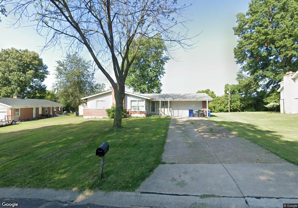
12225 Space Dr Florissant, MO 63033
Estimated Value: $187,227 - $215,000
3
Beds
2
Baths
1,470
Sq Ft
$137/Sq Ft
Est. Value
About This Home
This home is located at 12225 Space Dr, Florissant, MO 63033 and is currently estimated at $201,557, approximately $137 per square foot. 12225 Space Dr is a home located in St. Louis County with nearby schools including Townsend Elementary School, Central Middle School, and Hazelwood Central High School.
Ownership History
Date
Name
Owned For
Owner Type
Purchase Details
Closed on
Dec 18, 2007
Sold by
Wachovia Bank Na
Bought by
Davis Michael B
Current Estimated Value
Home Financials for this Owner
Home Financials are based on the most recent Mortgage that was taken out on this home.
Original Mortgage
$77,900
Outstanding Balance
$48,718
Interest Rate
6.07%
Mortgage Type
Purchase Money Mortgage
Estimated Equity
$152,839
Purchase Details
Closed on
Jul 18, 2000
Sold by
Carroll Lonzie
Bought by
Carroll Lonzie and Carroll Bini Doris Ann
Create a Home Valuation Report for This Property
The Home Valuation Report is an in-depth analysis detailing your home's value as well as a comparison with similar homes in the area
Home Values in the Area
Average Home Value in this Area
Purchase History
| Date | Buyer | Sale Price | Title Company |
|---|---|---|---|
| Davis Michael B | $82,000 | None Available | |
| Carroll Lonzie | -- | -- |
Source: Public Records
Mortgage History
| Date | Status | Borrower | Loan Amount |
|---|---|---|---|
| Open | Davis Michael B | $77,900 |
Source: Public Records
Tax History Compared to Growth
Tax History
| Year | Tax Paid | Tax Assessment Tax Assessment Total Assessment is a certain percentage of the fair market value that is determined by local assessors to be the total taxable value of land and additions on the property. | Land | Improvement |
|---|---|---|---|---|
| 2025 | $2,660 | $31,370 | $3,950 | $27,420 |
| 2024 | $2,660 | $29,410 | $3,950 | $25,460 |
| 2023 | $2,651 | $29,410 | $3,950 | $25,460 |
| 2022 | $2,359 | $23,260 | $7,890 | $15,370 |
| 2021 | $2,232 | $23,260 | $7,890 | $15,370 |
| 2020 | $2,310 | $22,440 | $5,910 | $16,530 |
| 2019 | $2,292 | $22,440 | $5,910 | $16,530 |
| 2018 | $2,112 | $19,100 | $4,010 | $15,090 |
| 2017 | $2,110 | $19,100 | $4,010 | $15,090 |
| 2016 | $1,872 | $16,640 | $3,230 | $13,410 |
| 2015 | $1,812 | $16,640 | $3,230 | $13,410 |
| 2014 | $1,716 | $15,670 | $4,120 | $11,550 |
Source: Public Records
Map
Nearby Homes
- 12136 La Padera Ln
- 12095 El Camara Dr
- 12320 Missile Ln
- 6250 Pennyrich Ct
- 12065 El Camara Dr
- 12292 Jerries Ln
- 12455 Jerries Ln
- 5432 Trailbend Dr
- 5348 Trailoaks Dr
- 6480 Hadden Bay Dr
- 6320 Hadden Bay Dr
- 5372 Trailbend Dr
- 11951 Jerries Ln
- 5239 Trailoaks Dr
- 5226 Suntrail Dr
- 6587 Dolphin Cir E Unit 110B
- 11760 Sheffield Dr
- 6595 Dolphin Cir E Unit 131A
- 11774 El Somo Ct
- 12582 Springtrail Dr
- 12245 Space Dr
- 6105 Parker Rd
- 6125 Parker Rd
- 12255 Space Dr
- 12250 Space Dr
- 12199 El Camara Dr
- 12280 Space Dr
- 12198 El Camara Dr
- 6145 Parker Rd
- 12188 Red Lion Dr
- 6140 Rocket Dr
- 12189 El Camara Dr
- 12188 El Camara Dr
- 6105 Pennyrich Ct
- 6125 Rocket Dr
- 6165 Parker Rd
- 12179 El Camara Dr
- 12285 Space Dr
- 12178 Red Lion Dr
- 12178 El Camara Dr