Estimated Value: $320,000 - $839,107
4
Beds
2
Baths
2,806
Sq Ft
$207/Sq Ft
Est. Value
About This Home
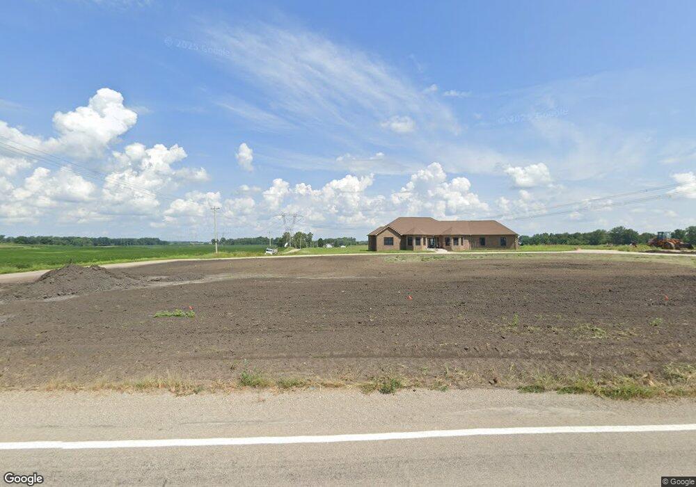
This home is located at 12226 State Road 10, Argos, IN 46501 and is currently estimated at $579,554, approximately $206 per square foot. 12226 State Road 10 is a home located in Marshall County with nearby schools including Argos Community Elementary School and Argos Community Junior-Senior High School.
Ownership History
Date
Name
Owned For
Owner Type
Purchase Details
Closed on
May 13, 2015
Sold by
Hayn Merl J and Hayn Susan G
Bought by
Hayn Merl J and Liv Susan
Current Estimated Value
Purchase Details
Closed on
Jul 29, 2011
Sold by
Federal Home Loan Mortgage Corporation
Bought by
Hayn Merl J and Hayn Susan G
Purchase Details
Closed on
May 24, 2011
Sold by
Shock Michael E and Shock Kimberly
Bought by
Federal Home Loan Mortgage Corporation
Purchase Details
Closed on
Oct 16, 2007
Sold by
Hayn Merl J
Bought by
Hayn Merl J and Hayn Susan G
Create a Home Valuation Report for This Property
The Home Valuation Report is an in-depth analysis detailing your home's value as well as a comparison with similar homes in the area
Home Values in the Area
Average Home Value in this Area
Purchase History
| Date | Buyer | Sale Price | Title Company |
|---|---|---|---|
| Hayn Merl J | -- | None Available | |
| Hayn Merl J | -- | Statewide Title Company Inc | |
| Federal Home Loan Mortgage Corporation | $59,056 | None Available | |
| Hayn Merl J | -- | None Available |
Source: Public Records
Tax History Compared to Growth
Tax History
| Year | Tax Paid | Tax Assessment Tax Assessment Total Assessment is a certain percentage of the fair market value that is determined by local assessors to be the total taxable value of land and additions on the property. | Land | Improvement |
|---|---|---|---|---|
| 2024 | $9,426 | $550,500 | $90,200 | $460,300 |
| 2022 | $9,426 | $501,900 | $65,300 | $436,600 |
| 2021 | $6,284 | $308,700 | $55,600 | $253,100 |
| 2020 | $715 | $37,600 | $37,600 | $0 |
| 2019 | $845 | $46,800 | $46,800 | $0 |
| 2018 | $796 | $48,200 | $48,200 | $0 |
| 2017 | $900 | $55,200 | $55,200 | $0 |
| 2016 | $939 | $58,400 | $58,400 | $0 |
| 2014 | $931 | $62,700 | $62,700 | $0 |
| 2013 | $868 | $53,800 | $53,800 | $0 |
Source: Public Records
Map
Nearby Homes
- 15871 18th Rd
- 735 Heritage St
- * 16th Rd
- ** 16th Rd
- *** 16th Rd
- **** 16th Rd
- 204 Fawn Ct
- 0 N Michigan Rd Unit 202531722
- 326 W Church St
- 404 Yearick St
- 333 Railroad St
- 119 Logan St
- 413 E Albert St
- 14036 20a Rd
- 11878 Ridgeview Dr
- 11901 Sunset Ct
- 14415 Lawrence Lake Dr
- 16930 16c Rd
- TBD Menominee Ln
- TBD 2 Menominee Ln
- 16631 Maple Rd
- 12461 Indiana 10
- 12461 State Road 10
- 11982 State Road 10
- 11982 S R 10
- 16133 Maple Rd
- 16156 Maple Rd
- 16171 Mulberry Rd
- 11827 State Road 10
- 16169 Mulberry Rd
- 12630 State Road 10
- 11718 Indiana 10
- 12695 State Road 10
- 12723 State Road 10
- 11661 State Road 10
- 15991 Mulberry Rd
- 15990 Mulberry Rd
- 12744 State Road 10
- 17030 Maple Rd
- 12775 State Road 10