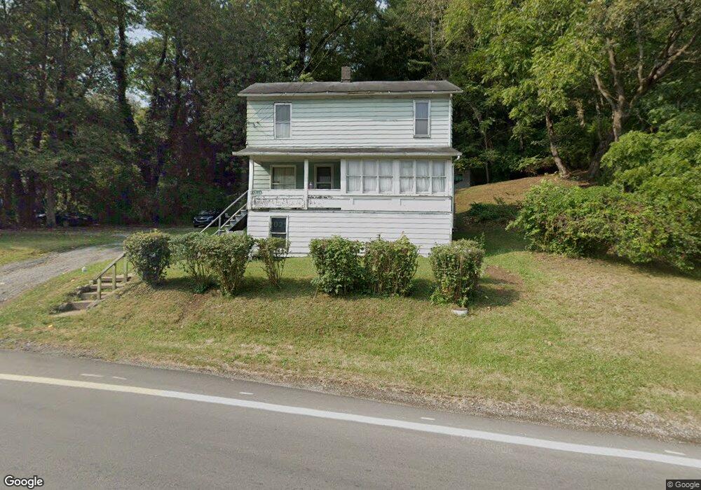
12226 State Route 43 Amsterdam, OH 43903
Estimated Value: $104,000 - $317,483
3
Beds
1
Bath
1,392
Sq Ft
$119/Sq Ft
Est. Value
About This Home
This home is located at 12226 State Route 43, Amsterdam, OH 43903 and is currently estimated at $165,371, approximately $118 per square foot. 12226 State Route 43 is a home located in Jefferson County with nearby schools including Edison High School.
Ownership History
Date
Name
Owned For
Owner Type
Purchase Details
Closed on
Jul 5, 2016
Sold by
Davis George W
Bought by
Blancato Melissa A
Current Estimated Value
Home Financials for this Owner
Home Financials are based on the most recent Mortgage that was taken out on this home.
Original Mortgage
$12,390
Outstanding Balance
$3,353
Interest Rate
3.64%
Mortgage Type
Future Advance Clause Open End Mortgage
Estimated Equity
$162,018
Purchase Details
Closed on
Jul 2, 2008
Sold by
Pilati Elizabeth
Bought by
Pilati Louise Ann and Hancock Rebecca S
Create a Home Valuation Report for This Property
The Home Valuation Report is an in-depth analysis detailing your home's value as well as a comparison with similar homes in the area
Home Values in the Area
Average Home Value in this Area
Purchase History
| Date | Buyer | Sale Price | Title Company |
|---|---|---|---|
| Blancato Melissa A | $160,000 | None Available | |
| Pilati Louise Ann | -- | -- |
Source: Public Records
Mortgage History
| Date | Status | Borrower | Loan Amount |
|---|---|---|---|
| Open | Blancato Melissa A | $12,390 |
Source: Public Records
Tax History Compared to Growth
Tax History
| Year | Tax Paid | Tax Assessment Tax Assessment Total Assessment is a certain percentage of the fair market value that is determined by local assessors to be the total taxable value of land and additions on the property. | Land | Improvement |
|---|---|---|---|---|
| 2024 | $536 | $16,685 | $2,639 | $14,046 |
| 2023 | $536 | $12,530 | $2,268 | $10,262 |
| 2022 | $440 | $12,530 | $2,268 | $10,262 |
| 2021 | $441 | $12,530 | $2,268 | $10,262 |
| 2020 | $394 | $10,525 | $1,890 | $8,635 |
| 2019 | $397 | $0 | $0 | $0 |
| 2018 | $406 | $0 | $0 | $0 |
| 2017 | $393 | $0 | $0 | $0 |
| 2016 | $405 | $0 | $0 | $0 |
| 2015 | $397 | $0 | $0 | $0 |
| 2014 | $398 | $0 | $0 | $0 |
| 2012 | $166 | $9,345 | $2,415 | $6,930 |
Source: Public Records
Map
Nearby Homes
- 12078 Ohio 43
- 502 S Main St
- 0 Township Rd 472
- 122 Euclid St
- 218 High St
- 6142 Steubenville Rd SE
- 5696 Steubenville Rd SE Unit 20
- 5659 Steubenville Rd SE
- 71 Township Road 1075
- 5103 Brocade Rd SE
- 430 Township Road 261
- 381 3rd St
- 9100 Post Rd
- 469 4th
- 441 4th St
- 9100 Post Rd SE
- 5620 County Road 58
- 4018 Steubenville Rd SE Unit 3
- 4240 Apollo Rd SE Unit 3
- 265 Lynnwood Ave
- 12162 State Route 43
- 12198 State Route 43
- 12211 State Route 43
- 532 S Main St
- 530 S Main St
- 12078 State Route 43
- 528 S Main St
- 280 Hess Ln
- 524 S Main St
- 521 S Main St
- 0 Tr 472
- 522 S Main St
- 12052 State Route 43
- 520 S Main St
- 260 Worthington St
- 282 Ridgewood Dr
- 240 Worthington St
- 276 Ridgewood Dr
- 518 S Main St
- 517 S Main St