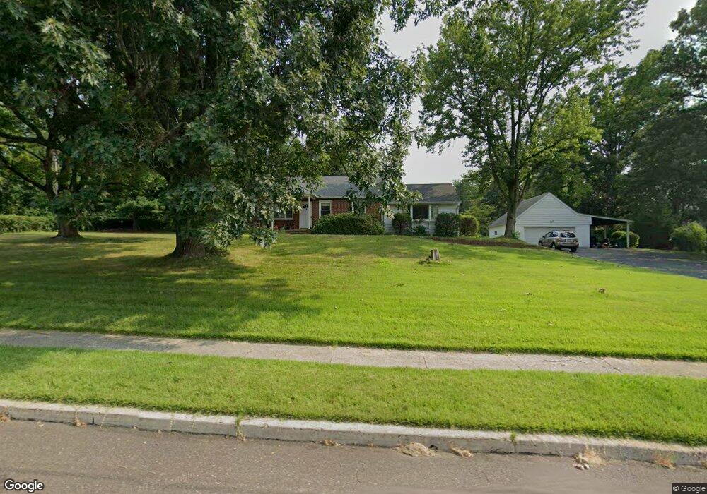
1223 Anders Rd Lansdale, PA 19446
Estimated Value: $400,000 - $448,869
3
Beds
2
Baths
1,440
Sq Ft
$293/Sq Ft
Est. Value
About This Home
This home is located at 1223 Anders Rd, Lansdale, PA 19446 and is currently estimated at $421,217, approximately $292 per square foot. 1223 Anders Rd is a home located in Montgomery County with nearby schools including Gwynedd Square Elementary School, Penndale Middle School, and North Penn Senior High School.
Ownership History
Date
Name
Owned For
Owner Type
Purchase Details
Closed on
Feb 14, 2008
Sold by
Becker Michael and Becker Nancy
Bought by
Rossi Matthew T and Rossi Nicole M
Current Estimated Value
Home Financials for this Owner
Home Financials are based on the most recent Mortgage that was taken out on this home.
Original Mortgage
$131,500
Outstanding Balance
$81,812
Interest Rate
5.8%
Estimated Equity
$339,405
Purchase Details
Closed on
Feb 15, 2007
Sold by
Kriebel Mildred S and Glenn Kriebel H
Bought by
Becker Nancy and Becker Michael
Create a Home Valuation Report for This Property
The Home Valuation Report is an in-depth analysis detailing your home's value as well as a comparison with similar homes in the area
Home Values in the Area
Average Home Value in this Area
Purchase History
| Date | Buyer | Sale Price | Title Company |
|---|---|---|---|
| Rossi Matthew T | $216,500 | None Available | |
| Becker Nancy | $310,000 | None Available |
Source: Public Records
Mortgage History
| Date | Status | Borrower | Loan Amount |
|---|---|---|---|
| Open | Rossi Matthew T | $131,500 |
Source: Public Records
Tax History Compared to Growth
Tax History
| Year | Tax Paid | Tax Assessment Tax Assessment Total Assessment is a certain percentage of the fair market value that is determined by local assessors to be the total taxable value of land and additions on the property. | Land | Improvement |
|---|---|---|---|---|
| 2025 | $6,008 | $148,330 | $60,280 | $88,050 |
| 2024 | $6,008 | $148,330 | $60,280 | $88,050 |
| 2023 | $5,753 | $148,330 | $60,280 | $88,050 |
| 2022 | $5,400 | $148,330 | $60,280 | $88,050 |
| 2021 | $5,244 | $148,330 | $60,280 | $88,050 |
| 2020 | $5,007 | $148,330 | $60,280 | $88,050 |
| 2019 | $4,920 | $148,330 | $60,280 | $88,050 |
| 2018 | $964 | $148,330 | $60,280 | $88,050 |
| 2017 | $4,724 | $148,330 | $60,280 | $88,050 |
| 2016 | $4,666 | $148,330 | $60,280 | $88,050 |
| 2015 | $4,472 | $148,330 | $60,280 | $88,050 |
| 2014 | $4,472 | $148,330 | $60,280 | $88,050 |
Source: Public Records
Map
Nearby Homes
- 1653 Bridle Path Dr
- 172 Oberlin Terrace
- 144 Oberlin Terrace Unit 15-B
- 210 Berwick Place Unit 20E
- 177 Oberlin Terrace Unit 18-L
- 1040 Hunter Hill Dr
- 980 Jacks Ln
- 1627 Clearbrook Rd
- 108 Hickory Ct
- 1808 Beth Ln
- 911 Tricorn Dr
- 1959 Supplee Rd
- 2272 Locust Dr
- 1622 Samantha Ct
- 1381 Village Way
- 846 Fulton Ave
- 2234 Locust Dr
- 1231 Meadowview Cir
- 2806 Morris Rd
- 1107 Jarvis Ln
- 1798 Meadow Glen Dr
- 1241 Anders Rd
- 1229 Anders Rd
- 1790 Meadow Glen Dr
- 1180 Anders Rd
- 1190 Anders Rd
- 1235 Anders Rd
- 1770 Meadow Glen Dr
- 1245 Anders Rd
- 1750 Meadow Glen Dr
- 1220 Anders Rd
- 1150 Anders Rd
- 1785 Meadow Glen Dr
- 1247 Anders Rd
- 1767 Meadow Glen Dr
- 1730 Meadow Glen Dr
- 1800 Flintlock Cir
- 1117 Anders Rd
- 1130 Anders Rd
- 1165 Archer Ln