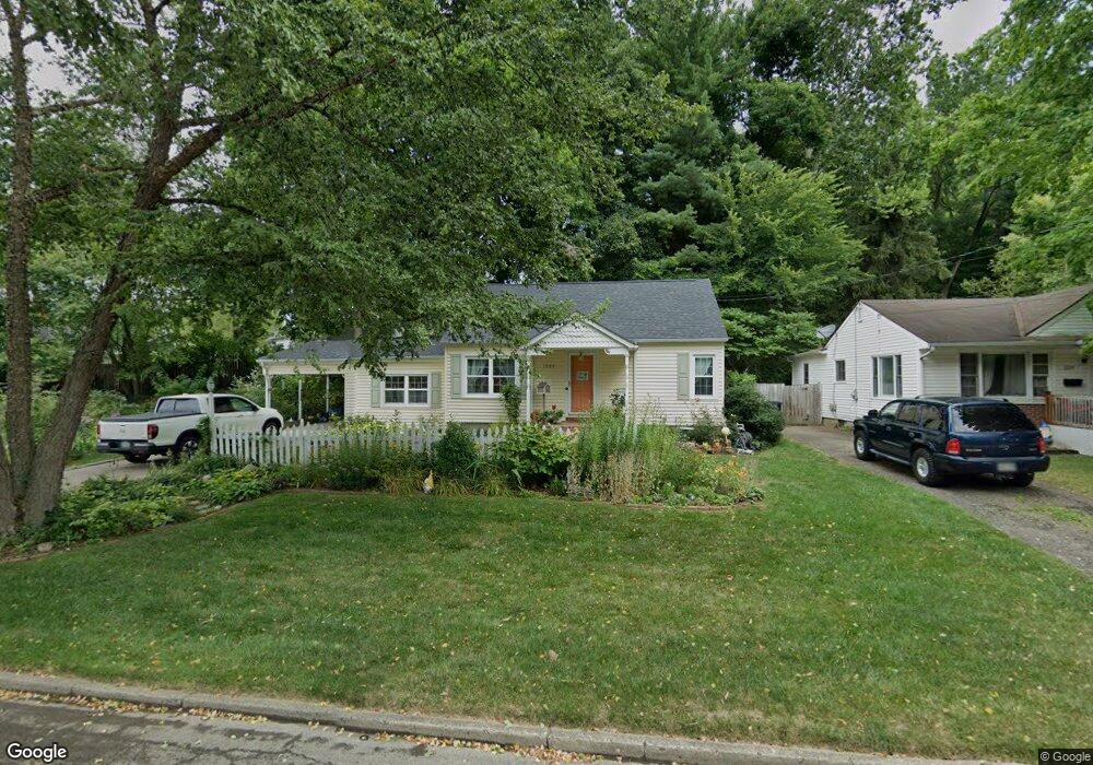
1223 E Allen St Lancaster, OH 43130
Estimated Value: $241,948 - $256,000
3
Beds
2
Baths
1,600
Sq Ft
$157/Sq Ft
Est. Value
About This Home
This home is located at 1223 E Allen St, Lancaster, OH 43130 and is currently estimated at $250,737, approximately $156 per square foot. 1223 E Allen St is a home located in Fairfield County with nearby schools including Medill Elementary School, Thomas Ewing Junior High School, and Lancaster High School.
Ownership History
Date
Name
Owned For
Owner Type
Purchase Details
Closed on
Jun 20, 2001
Sold by
Smeck Carolyn S
Bought by
Miller Teresa A
Current Estimated Value
Home Financials for this Owner
Home Financials are based on the most recent Mortgage that was taken out on this home.
Original Mortgage
$40,000
Outstanding Balance
$14,481
Interest Rate
7.11%
Mortgage Type
New Conventional
Estimated Equity
$236,256
Purchase Details
Closed on
Jan 8, 1993
Sold by
Smith Chester W
Bought by
Smeck Carolyn S
Purchase Details
Closed on
Nov 1, 1989
Create a Home Valuation Report for This Property
The Home Valuation Report is an in-depth analysis detailing your home's value as well as a comparison with similar homes in the area
Home Values in the Area
Average Home Value in this Area
Purchase History
| Date | Buyer | Sale Price | Title Company |
|---|---|---|---|
| Miller Teresa A | $95,000 | -- | |
| Smeck Carolyn S | $63,000 | -- | |
| -- | $50,500 | -- |
Source: Public Records
Mortgage History
| Date | Status | Borrower | Loan Amount |
|---|---|---|---|
| Open | Miller Teresa A | $40,000 |
Source: Public Records
Tax History
| Year | Tax Paid | Tax Assessment Tax Assessment Total Assessment is a certain percentage of the fair market value that is determined by local assessors to be the total taxable value of land and additions on the property. | Land | Improvement |
|---|---|---|---|---|
| 2025 | $5,484 | $77,350 | $15,280 | $62,070 |
| 2024 | $5,484 | $61,000 | $12,170 | $48,830 |
| 2023 | $1,885 | $61,000 | $12,170 | $48,830 |
| 2022 | $1,908 | $61,000 | $12,170 | $48,830 |
| 2021 | $1,433 | $45,510 | $10,150 | $35,360 |
| 2020 | $1,373 | $45,510 | $10,150 | $35,360 |
| 2019 | $1,305 | $45,510 | $10,150 | $35,360 |
| 2018 | $1,109 | $34,240 | $10,150 | $24,090 |
| 2017 | $1,110 | $38,420 | $10,150 | $28,270 |
| 2016 | $1,081 | $38,420 | $10,150 | $28,270 |
| 2015 | $1,066 | $37,150 | $10,150 | $27,000 |
| 2014 | $1,328 | $37,150 | $10,150 | $27,000 |
| 2013 | $1,328 | $37,150 | $10,150 | $27,000 |
Source: Public Records
Map
Nearby Homes
- 630 Sheridan Dr
- 641 Sheridan Dr
- 1281 E Allen St
- 627 Sheridan Dr
- 627 Harding Ave
- 1285 Huffer Ave
- 632 N Eastwood Ave
- 1006 King St
- 810 N Eastwood Ave
- 869 E Mulberry St
- 736 E Allen St
- 1306 Shumaker Ave
- 867 E Wheeling St
- 705 Madison Ave
- 274 Kanawha Rd
- 844 E Wheeling St
- 245 Overlook Dr NE
- 1066 Lanreco Blvd
- 1560 E Main St
- 846 E Main St
- 1229 E Allen St
- 708 Sheridan Dr
- 712 Sheridan Dr
- 704 Sheridan Dr
- 1235 E Allen St
- 716 Sheridan Dr
- 1224 E Allen St
- 1214 E Allen St
- 640 Sheridan Dr
- 1241 E Allen St
- 1234 E Allen St
- 720 Sheridan Dr
- 1244 E Allen St
- 636 Sheridan Dr
- 1245 E Allen St
- 738 Sheridan Dr
- 709 Sheridan Dr
- 711 Sheridan Dr
- 705 Sheridan Dr
- 740 Sheridan Dr
Your Personal Tour Guide
Ask me questions while you tour the home.