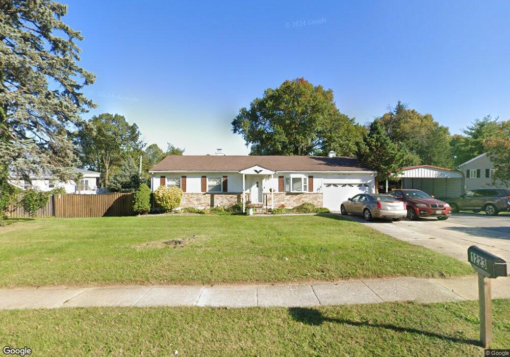
1223 N Rolling Rd Catonsville, MD 21228
Estimated Value: $358,000 - $426,000
3
Beds
1
Bath
1,092
Sq Ft
$351/Sq Ft
Est. Value
About This Home
This home is located at 1223 N Rolling Rd, Catonsville, MD 21228 and is currently estimated at $383,674, approximately $351 per square foot. 1223 N Rolling Rd is a home located in Baltimore County with nearby schools including Johnnycake Elementary School, Southwest Academy, and Woodlawn High School.
Ownership History
Date
Name
Owned For
Owner Type
Purchase Details
Closed on
Dec 17, 2010
Sold by
Department Of Housing & Urban Developmen
Bought by
Pinkney Matthews Shaudon Terese
Current Estimated Value
Purchase Details
Closed on
Mar 2, 2010
Sold by
Carter Willie A
Bought by
The Secretary Of Housing And Urban Devel
Purchase Details
Closed on
Jan 9, 1997
Sold by
Derrenberger Mae I
Bought by
Carter Willie A and Carter Betty J
Create a Home Valuation Report for This Property
The Home Valuation Report is an in-depth analysis detailing your home's value as well as a comparison with similar homes in the area
Home Values in the Area
Average Home Value in this Area
Purchase History
| Date | Buyer | Sale Price | Title Company |
|---|---|---|---|
| Pinkney Matthews Shaudon Terese | $151,000 | Title Professionals Ltd | |
| The Secretary Of Housing And Urban Devel | $328,935 | -- | |
| Carter Willie A | $114,000 | -- |
Source: Public Records
Tax History Compared to Growth
Tax History
| Year | Tax Paid | Tax Assessment Tax Assessment Total Assessment is a certain percentage of the fair market value that is determined by local assessors to be the total taxable value of land and additions on the property. | Land | Improvement |
|---|---|---|---|---|
| 2025 | $3,559 | $265,167 | -- | -- |
| 2024 | $3,559 | $243,400 | $77,500 | $165,900 |
| 2023 | $1,812 | $232,567 | $0 | $0 |
| 2022 | $3,618 | $221,733 | $0 | $0 |
| 2021 | $3,114 | $210,900 | $77,500 | $133,400 |
| 2020 | $3,114 | $203,933 | $0 | $0 |
| 2019 | $3,198 | $196,967 | $0 | $0 |
| 2018 | $3,155 | $190,000 | $64,700 | $125,300 |
| 2017 | $3,013 | $186,733 | $0 | $0 |
| 2016 | $2,735 | $183,467 | $0 | $0 |
| 2015 | $2,735 | $180,200 | $0 | $0 |
| 2014 | $2,735 | $180,200 | $0 | $0 |
Source: Public Records
Map
Nearby Homes
- 6263 Gilston Park Rd
- 6200 Gilston Park Rd
- 1111 Cummings Ave
- 1019 Cummings Ave
- 1013 Cummings Ave
- 6031 Burnt Oak Rd
- 3 Mcgrady Square
- 2100 Chantilla Rd
- 67 Walden Mill Way
- 353 N Beaumont Ave
- 343 N Beaumont Ave
- 5926 Old Frederick Rd
- 2120 Cedar Circle Dr
- 800 Crosby Rd
- 6028 Moorehead Rd
- 1916 Old Frederick Rd
- 908 Vanderwood Rd
- 206 Winters Ln
- 627 Meyers Dr Unit PARCEL 108
- 627 Meyers Dr
- 1225 N Rolling Rd
- 1221 N Rolling Rd
- 1206 Redcliffe Rd
- 1204 Redcliffe Rd
- 1227 N Rolling Rd
- 1219 N Rolling Rd
- 1202 Redcliffe Rd
- 1208 Redcliffe Rd
- 1214 N Rolling Rd
- 1222 N Rolling Rd
- 6262 Gilston Park Rd
- 1226 Canberwell Rd
- 1210 Redcliffe Rd
- 6260 Gilston Park Rd
- 1203 Redcliffe Rd
- 6264 Gilston Park Rd
- 1224 N Rolling Rd
- 1229 N Rolling Rd
- 6266 Gilston Park Rd
- 1224 Canberwell Rd