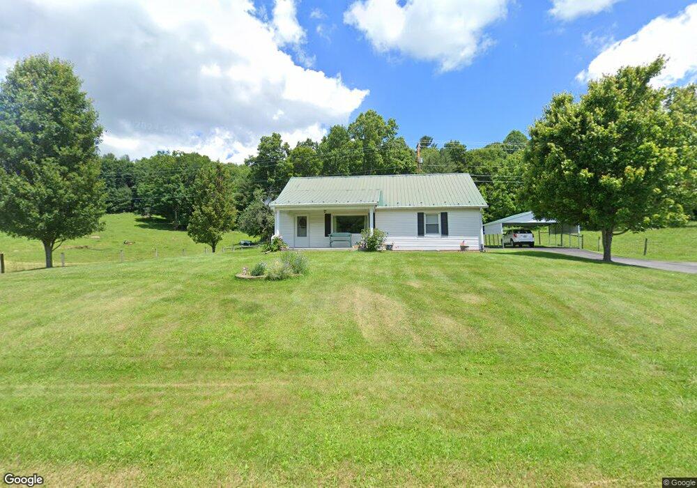
1223 Red Stone Rd Chilhowie, VA 24319
Estimated Value: $118,000 - $126,494
3
Beds
1
Bath
1,249
Sq Ft
$97/Sq Ft
Est. Value
About This Home
This home is located at 1223 Red Stone Rd, Chilhowie, VA 24319 and is currently estimated at $121,498, approximately $97 per square foot. 1223 Red Stone Rd is a home located in Smyth County with nearby schools including Chilhowie Elementary School, Chilhowie Middle School, and Chilhowie High School.
Ownership History
Date
Name
Owned For
Owner Type
Purchase Details
Closed on
Jun 13, 2018
Sold by
Sturgill Carolyn P
Bought by
Stamper Eddie Lee and Stamper Vickie Kay
Current Estimated Value
Purchase Details
Closed on
Aug 28, 2009
Sold by
Homesales Inc
Bought by
Shook Stephen E and Shook Brenda J
Home Financials for this Owner
Home Financials are based on the most recent Mortgage that was taken out on this home.
Original Mortgage
$73,200
Interest Rate
6%
Mortgage Type
New Conventional
Purchase Details
Closed on
Jun 17, 2009
Sold by
Hamm James David and Harrington Jennifer L
Bought by
Homesales Inc
Purchase Details
Closed on
Nov 22, 2006
Sold by
Sturgill Roger C and Sturgill Carolyn P
Bought by
Hamm James David and Harrington Jennifer L
Home Financials for this Owner
Home Financials are based on the most recent Mortgage that was taken out on this home.
Original Mortgage
$92,600
Interest Rate
6.37%
Mortgage Type
New Conventional
Create a Home Valuation Report for This Property
The Home Valuation Report is an in-depth analysis detailing your home's value as well as a comparison with similar homes in the area
Home Values in the Area
Average Home Value in this Area
Purchase History
| Date | Buyer | Sale Price | Title Company |
|---|---|---|---|
| Stamper Eddie Lee | $40,000 | Blue Rdg Title&Stlmnt Agency | |
| Shook Stephen E | $67,000 | -- | |
| Homesales Inc | $88,825 | -- | |
| Hamm James David | $85,000 | -- |
Source: Public Records
Mortgage History
| Date | Status | Borrower | Loan Amount |
|---|---|---|---|
| Previous Owner | Shook Stephen E | $73,200 | |
| Previous Owner | Hamm James David | $92,600 |
Source: Public Records
Tax History Compared to Growth
Tax History
| Year | Tax Paid | Tax Assessment Tax Assessment Total Assessment is a certain percentage of the fair market value that is determined by local assessors to be the total taxable value of land and additions on the property. | Land | Improvement |
|---|---|---|---|---|
| 2025 | $607 | $102,800 | $15,000 | $87,800 |
| 2024 | $595 | $100,800 | $15,000 | $85,800 |
| 2023 | $501 | $67,700 | $12,500 | $55,200 |
| 2022 | $501 | $67,700 | $12,500 | $55,200 |
| 2021 | $501 | $67,700 | $12,500 | $55,200 |
| 2020 | $501 | $67,700 | $12,500 | $55,200 |
| 2019 | $463 | $62,600 | $12,500 | $50,100 |
| 2018 | $463 | $62,600 | $12,500 | $50,100 |
| 2017 | $463 | $62,600 | $12,500 | $50,100 |
| 2016 | $463 | $62,600 | $12,500 | $50,100 |
| 2015 | $463 | $0 | $0 | $0 |
| 2014 | $456 | $0 | $0 | $0 |
Source: Public Records
Map
Nearby Homes
- 625 Belle Hollow Rd
- TBD Granite Ln
- 450 Stoney Battery Rd
- 556 Stoney Battery Rd
- 244 Rosenbaum Hollow Ln
- 265 Flatwoods Rd
- 1055 Saint Clairs Creek Rd
- TBD Saint Clairs Creek Rd
- 1364 Saint Clairs Creek Rd
- 0.46 AC Brentwood Ln
- 251 Ramblewood Rd
- 182 Saint Johns Way
- tbd Chestnut Ridge Rd
- 454 Old Airport Rd
- 1295 Chestnut Ridge Rd
- 1219 Chestnut Ridge Rd
- 513 Adwolfe Rd
- 139 Brooke St
- 38 Brooke St
- TBD Lot#19 Christin Ln
- 1180 Red Stone Rd
- 1207 Dartmouth St
- 1279 Red Stone Rd
- 1166 Red Stone Rd
- 1268 Red Stone Rd
- 1247 Dartmouth St
- 1147 Red Stone Rd
- 1146 Red Stone Rd
- 1304 Red Stone Rd
- 1134 Red Stone Rd
- 106 Belle Hollow Rd
- 165 Belle Hollow Rd
- 1357 Red Stone Rd
- 1041 Red Stone Rd
- 1125 Sutton Ln
- 144 Belle Hollow Rd
- 1376 Red Stone Rd
- 0 Belle Hollow Rd
- 1356 Red Stone Rd
- 199 Belle Hollow Rd