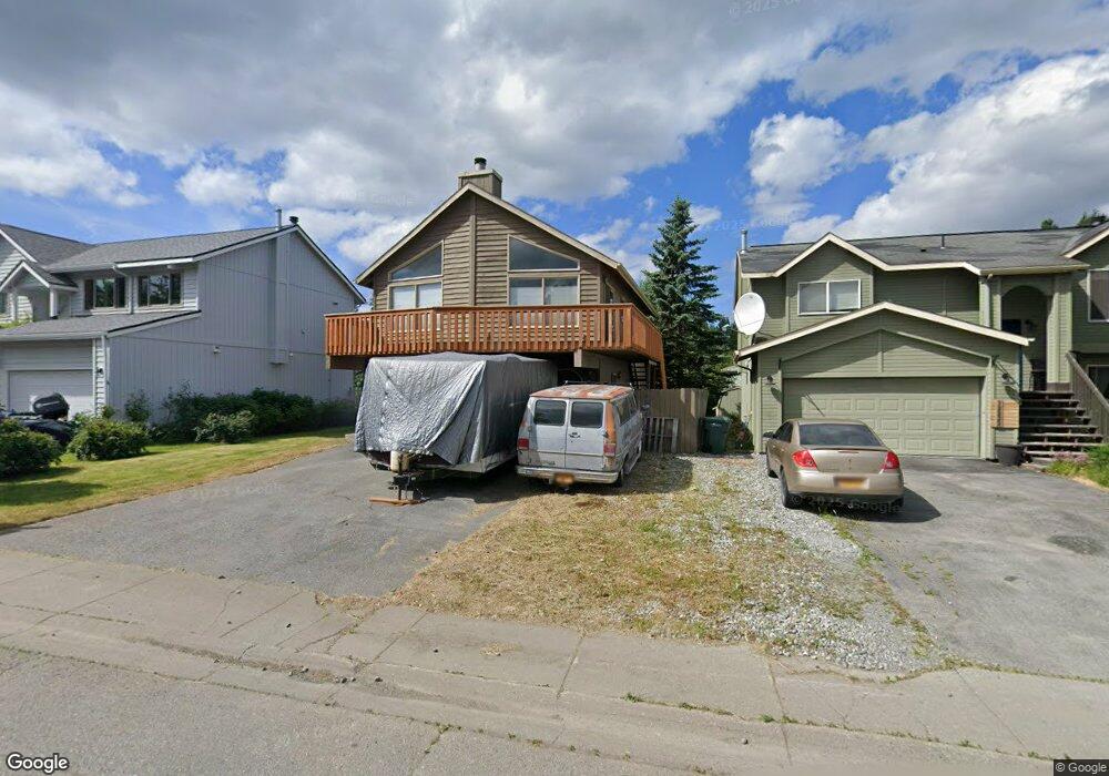
12232 Woodward Dr Anchorage, AK 99516
Huffman-O'Malley NeighborhoodEstimated Value: $264,000 - $497,000
3
Beds
3
Baths
1,690
Sq Ft
$247/Sq Ft
Est. Value
About This Home
This home is located at 12232 Woodward Dr, Anchorage, AK 99516 and is currently estimated at $417,722, approximately $247 per square foot. 12232 Woodward Dr is a home located in Anchorage Municipality with nearby schools including Bowman Elementary School, Hanshew Middle School, and Service High School.
Ownership History
Date
Name
Owned For
Owner Type
Purchase Details
Closed on
Dec 31, 2003
Sold by
Palacio Roger and Salvador Ann M
Bought by
Wayman John W
Current Estimated Value
Home Financials for this Owner
Home Financials are based on the most recent Mortgage that was taken out on this home.
Original Mortgage
$222,870
Outstanding Balance
$103,576
Interest Rate
5.81%
Mortgage Type
VA
Estimated Equity
$314,146
Purchase Details
Closed on
Aug 26, 2002
Sold by
Holmes Sarah E and Holmes Wayne G
Bought by
Palacio Roger C and Salvador Ann M
Home Financials for this Owner
Home Financials are based on the most recent Mortgage that was taken out on this home.
Original Mortgage
$203,800
Interest Rate
6.52%
Mortgage Type
FHA
Purchase Details
Closed on
Jan 20, 1998
Sold by
Wesevich John W and Wesevich Fondi C
Bought by
Holmes Sarah E and Holmes Wayne G
Purchase Details
Closed on
May 21, 1996
Sold by
Johnston Walter Gene and Johnston Lori
Bought by
Wesevich John W and Wesevich Fondi C
Home Financials for this Owner
Home Financials are based on the most recent Mortgage that was taken out on this home.
Original Mortgage
$163,800
Interest Rate
8.07%
Mortgage Type
FHA
Purchase Details
Closed on
Nov 21, 1991
Sold by
Spinell Homes Inc
Bought by
Johnston Walter Gene and Johnston Lori
Home Financials for this Owner
Home Financials are based on the most recent Mortgage that was taken out on this home.
Original Mortgage
$140,130
Interest Rate
8.9%
Mortgage Type
FHA
Create a Home Valuation Report for This Property
The Home Valuation Report is an in-depth analysis detailing your home's value as well as a comparison with similar homes in the area
Home Values in the Area
Average Home Value in this Area
Purchase History
| Date | Buyer | Sale Price | Title Company |
|---|---|---|---|
| Wayman John W | -- | Alyeska Title Guaranty Agenc | |
| Palacio Roger C | -- | -- | |
| Holmes Sarah E | -- | -- | |
| Holmes Sarah E | -- | -- | |
| Wesevich John W | -- | -- | |
| Johnston Walter Gene | -- | -- |
Source: Public Records
Mortgage History
| Date | Status | Borrower | Loan Amount |
|---|---|---|---|
| Open | Wayman John W | $222,870 | |
| Previous Owner | Palacio Roger C | $203,800 | |
| Previous Owner | Wesevich John W | $163,800 | |
| Previous Owner | Johnston Walter Gene | $140,130 | |
| Closed | Holmes Sarah E | $0 |
Source: Public Records
Tax History Compared to Growth
Tax History
| Year | Tax Paid | Tax Assessment Tax Assessment Total Assessment is a certain percentage of the fair market value that is determined by local assessors to be the total taxable value of land and additions on the property. | Land | Improvement |
|---|---|---|---|---|
| 2025 | $6,618 | $423,600 | $105,800 | $317,800 |
| 2024 | $6,618 | $409,900 | $105,800 | $304,100 |
| 2023 | $6,517 | $382,700 | $105,800 | $276,900 |
| 2022 | $6,030 | $358,100 | $105,800 | $252,300 |
| 2021 | $6,026 | $334,400 | $105,800 | $228,600 |
| 2020 | $5,540 | $325,900 | $105,800 | $220,100 |
| 2019 | $5,238 | $320,200 | $105,800 | $214,400 |
| 2018 | $5,225 | $318,600 | $105,800 | $212,800 |
| 2017 | $2,413 | $324,100 | $105,800 | $218,300 |
| 2016 | $1,745 | $326,200 | $105,800 | $220,400 |
| 2015 | $1,745 | $318,300 | $105,800 | $212,500 |
| 2014 | $1,745 | $305,000 | $101,100 | $203,900 |
Source: Public Records
Map
Nearby Homes
- 2521 Winterchase Cir
- 12283 Timberwood Cir
- 2048 Meander Dr
- 1677 Circlewood Dr
- 12241 Gander St
- 2020 Steeple Dr
- 3025 Huffman Rd
- 2735 Meadow Wood Cir
- 2701 Kempton Hills Dr
- 000 Wagner St
- 12101 Wagner St
- 13105 Stephenson St
- 11335 Tulin Park Loop
- 11359 Tulin Park Loop
- 2640 E 112th Ave
- 12496 Silver Fox Ln Unit 6
- 11483 Moonrise Ridge Place Unit 10
- 11418 Moonrise Ridge Place Unit 19
- 11135 Red Sky Cir
- 13322 Diggins Dr
- 12222 Woodward Dr
- 12242 Woodward Dr
- 12212 Woodward Dr
- 12252 Woodward Dr
- 12281 Silver Spruce Cir
- 12275 Silver Spruce Cir
- 12289 Silver Spruce Cir
- 12302 Woodward Dr
- 12202 Woodward Dr
- 12295 Silver Spruce Cir
- 12271 Silver Spruce Cir
- 12233 Woodward Dr
- 12223 Woodward Dr
- 12243 Woodward Dr
- 12312 Woodward Dr
- 12301 Silver Spruce Cir
- 12213 Woodward Dr
- 12253 Woodward Dr
- 12270 Silver Spruce Cir
- 12203 Woodward Dr