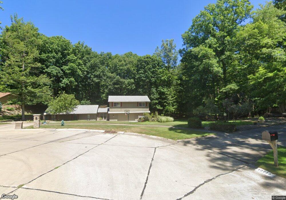
12233 Moss Point Rd Strongsville, OH 44136
Estimated Value: $450,000 - $709,000
3
Beds
3
Baths
4,644
Sq Ft
$126/Sq Ft
Est. Value
About This Home
This home is located at 12233 Moss Point Rd, Strongsville, OH 44136 and is currently estimated at $585,583, approximately $126 per square foot. 12233 Moss Point Rd is a home located in Cuyahoga County with nearby schools including Strongsville High School and Sts Joseph & John Interparochial School.
Ownership History
Date
Name
Owned For
Owner Type
Purchase Details
Closed on
Apr 19, 2005
Sold by
Gladys Robert W
Bought by
Colograssi Louis A and Arnold Beth M
Current Estimated Value
Home Financials for this Owner
Home Financials are based on the most recent Mortgage that was taken out on this home.
Original Mortgage
$271,600
Interest Rate
5.89%
Mortgage Type
Purchase Money Mortgage
Purchase Details
Closed on
Dec 17, 1998
Sold by
Strawn Robertson I
Bought by
Strawn Robertson I
Purchase Details
Closed on
May 5, 1988
Sold by
Strawn Robertson I
Bought by
Strawn Robertson I
Purchase Details
Closed on
Oct 13, 1983
Bought by
Strawn Robertson I
Purchase Details
Closed on
Apr 25, 1983
Sold by
Shaver Thomas W
Bought by
General Motors Corp
Purchase Details
Closed on
Jun 26, 1981
Sold by
Neiheiser Barbara A
Bought by
Shaver Thomas W
Purchase Details
Closed on
Jan 1, 1980
Bought by
Neiheiser Barbara A
Create a Home Valuation Report for This Property
The Home Valuation Report is an in-depth analysis detailing your home's value as well as a comparison with similar homes in the area
Home Values in the Area
Average Home Value in this Area
Purchase History
| Date | Buyer | Sale Price | Title Company |
|---|---|---|---|
| Colograssi Louis A | $280,000 | Lakeside Title | |
| Strawn Robertson I | -- | -- | |
| Strawn Robertson I | -- | -- | |
| Strawn Robertson I | $195,000 | -- | |
| General Motors Corp | $197,500 | -- | |
| Shaver Thomas W | $195,000 | -- | |
| Neiheiser Barbara A | -- | -- |
Source: Public Records
Mortgage History
| Date | Status | Borrower | Loan Amount |
|---|---|---|---|
| Previous Owner | Colograssi Louis A | $271,600 |
Source: Public Records
Tax History Compared to Growth
Tax History
| Year | Tax Paid | Tax Assessment Tax Assessment Total Assessment is a certain percentage of the fair market value that is determined by local assessors to be the total taxable value of land and additions on the property. | Land | Improvement |
|---|---|---|---|---|
| 2024 | $8,564 | $178,150 | $22,855 | $155,295 |
| 2023 | $8,761 | $136,960 | $23,450 | $113,510 |
| 2022 | $8,699 | $136,955 | $23,450 | $113,505 |
| 2021 | $8,638 | $136,960 | $23,450 | $113,510 |
| 2020 | $8,001 | $112,250 | $19,220 | $93,030 |
| 2019 | $7,772 | $320,700 | $54,900 | $265,800 |
| 2018 | $7,232 | $112,250 | $19,220 | $93,030 |
| 2017 | $7,528 | $110,640 | $16,000 | $94,640 |
| 2016 | $7,468 | $110,640 | $16,000 | $94,640 |
| 2015 | $7,355 | $110,640 | $16,000 | $94,640 |
| 2014 | $7,355 | $107,420 | $15,540 | $91,880 |
Source: Public Records
Map
Nearby Homes
- 12101 The Bluffs
- 17945 Cliffside Dr
- 17809 Cliffside Dr Unit 4926
- 11650 River Moss Rd
- 18336 Falling Water Rd
- 18248 Meadow Ln
- 17289 Akita Ct Unit 4508
- 17281 Akita Ct Unit 4506
- 13513 Suncrest Ct
- 16519 Albion Rd
- 11499 Pearl Rd Unit A106
- 11479 Pearl Rd Unit A101
- 11432 Pearl Rd
- 19240 Briarwood Ln
- 10369 Council Bluff
- 10471 Royal Oak Dr Unit 38-A
- 13099 Olympus Way
- 10560 Stapleton Dr
- 12539 Olympus Way
- 13066 Olympus Way
- 12229 Moss Point Rd
- 12235 Moss Point Rd
- 12243 Moss Point Rd
- 12225 Moss Point Rd
- 12249 Moss Point Rd
- 12221 Moss Point Rd
- 12253 Moss Point Rd
- 12184 The Bluff
- 12224 The Bluff
- 12130 The Bluff
- 12264 The Bluff
- 12220 Moss Point Rd
- 12088 The Bluff
- 12257 Moss Point Rd
- 12224 Moss Point Rd
- 12306 The Bluff
- 12048 The Bluff
- 12228 Moss Point Rd
- 12232 Moss Point Rd
- 12336 The Bluff