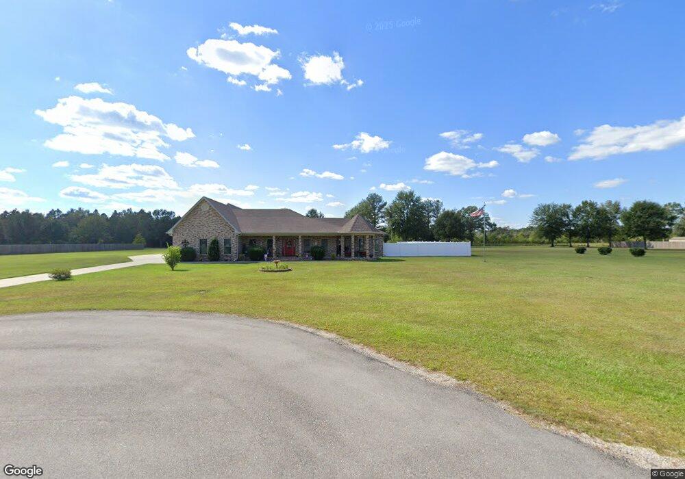
12235 E Pointe Dr Picayune, MS 39466
Estimated Value: $479,000 - $582,000
About This Home
This home is located at 12235 E Pointe Dr, Picayune, MS 39466 and is currently estimated at $546,015, approximately $130 per square foot. 12235 E Pointe Dr is a home with nearby schools including West Hancock Elementary School, Hancock Middle School, and Hancock High School.
Ownership History
We collect this data history from publicly available records. To have your information removed, we recommend requesting removal directly through your county’s website.
Purchase Details
Purchase Details
Purchase Details
Purchase History
We collect this data history from publicly available records. To have your information removed, we recommend requesting removal directly through your county’s website.
| Date | Buyer | Sale Price | Title Company |
|---|---|---|---|
| -- | None Listed On Document | ||
| -- | None Listed On Document | ||
| -- | Reso Melissa Nunley | ||
| -- | None Listed On Document | ||
| -- | Pilger David B | ||
| -- | Pilger David B |
Tax History
We collect this data history from publicly available records. To have your information removed, we recommend requesting removal directly through your county’s website.
| Year | Tax Paid | Tax Assessment Tax Assessment Total Assessment is a certain percentage of the fair market value that is determined by local assessors to be the total taxable value of land and additions on the property. | Land | Improvement |
|---|---|---|---|---|
| 2025 | $3,367 | $35,357 | $2,611 | $32,746 |
| 2024 | $3,367 | $35,357 | $2,611 | $32,746 |
| 2023 | $3,367 | $35,357 | $2,611 | $32,746 |
| 2022 | $2,587 | $34,661 | $2,611 | $32,050 |
| 2021 | $2,587 | $34,661 | $2,611 | $32,050 |
| 2020 | $2,339 | $31,177 | $2,611 | $28,566 |
| 2019 | $2,339 | $31,177 | $2,611 | $28,566 |
| 2018 | $2,419 | $31,986 | $2,611 | $29,375 |
| 2017 | $2,350 | $31,287 | $2,611 | $28,676 |
| 2016 | $2,572 | $29,817 | $2,611 | $27,206 |
| 2015 | $2,216 | $27,540 | $2,807 | $24,733 |
| 2014 | $3,496 | $39,079 | $1,980 | $37,099 |
| 2013 | $171 | $1,980 | $1,980 | $0 |
Map
- 24094 Rester Rd
- 24327 Rester Rd
- 24433 Catahoula Ln
- 23463 N Benville Rd
- S Leetown and Highway 43
- 0 S Leetown and Highway 43 Hwy Unit 4067215
- 00 Werner Rd
- 26230 Longvue Dr
- f Rd
- 25 Bryan Cir
- 26340 Strickland Rd
- 4 Arbor Bend Dr
- 11084 Road 231
- 11083 & 11080 Road 231 None
- 11083 & 11080 Road 231
- 11080 Road 231
- 521 Old Kiln Rd
- 11080 Road 231 None
- 11519 Old Kiln Rd
- 27019 Leetown Rd
- 12241 E East Pointe Dr
- 12241 E Pointe Dr
- 12239 E Pointe Dr
- 20 E Pointe Dr
- Lot 20 E Pointe Dr
- 19 E Pointe Dr
- 13 E Pointe Dr
- 11 E Pointe Dr
- 8 E Pointe Dr
- 6 E Pointe Dr
- 3 E Pointe Dr
- 2 E Pointe Dr
- 29 E Pointe Dr
- 1 E Pointe Dr
- 31 E Pointe Dr
- 32 E Pointe Dr
- 30 E Pointe Dr
- 28 E Pointe Dr
- 27 E Pointe Dr
- 26 E Pointe Dr
Ask me questions while you tour the home.