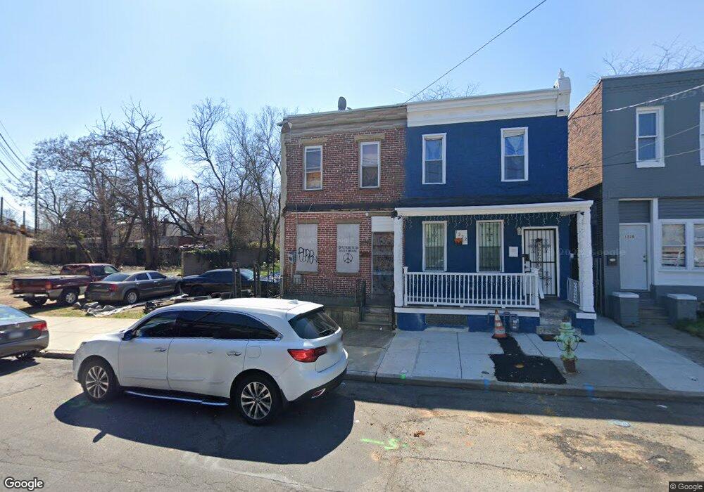
1224 Atlantic Ave Camden, NJ 08104
Whitman Park NeighborhoodEstimated Value: $82,000 - $99,306
2
Beds
1
Bath
1,064
Sq Ft
$88/Sq Ft
Est. Value
About This Home
This home is located at 1224 Atlantic Ave, Camden, NJ 08104 and is currently estimated at $93,327, approximately $87 per square foot. 1224 Atlantic Ave is a home located in Camden County with nearby schools including Camden High School and Freedom Prep Charter School.
Ownership History
Date
Name
Owned For
Owner Type
Purchase Details
Closed on
Jul 25, 2005
Sold by
Hunter William
Bought by
Berkman Michael R
Current Estimated Value
Home Financials for this Owner
Home Financials are based on the most recent Mortgage that was taken out on this home.
Original Mortgage
$30,400
Interest Rate
5.84%
Purchase Details
Closed on
Jan 10, 2005
Sold by
Rhoda Pou Est Of
Bought by
Hunter William
Home Financials for this Owner
Home Financials are based on the most recent Mortgage that was taken out on this home.
Original Mortgage
$20,000
Interest Rate
5.66%
Create a Home Valuation Report for This Property
The Home Valuation Report is an in-depth analysis detailing your home's value as well as a comparison with similar homes in the area
Home Values in the Area
Average Home Value in this Area
Purchase History
| Date | Buyer | Sale Price | Title Company |
|---|---|---|---|
| Berkman Michael R | $38,000 | -- | |
| Hunter William | $25,000 | -- |
Source: Public Records
Mortgage History
| Date | Status | Borrower | Loan Amount |
|---|---|---|---|
| Previous Owner | Berkman Michael R | $30,400 | |
| Previous Owner | Hunter William | $20,000 |
Source: Public Records
Tax History Compared to Growth
Tax History
| Year | Tax Paid | Tax Assessment Tax Assessment Total Assessment is a certain percentage of the fair market value that is determined by local assessors to be the total taxable value of land and additions on the property. | Land | Improvement |
|---|---|---|---|---|
| 2025 | $1,332 | $37,600 | $5,400 | $32,200 |
| 2024 | $1,288 | $37,600 | $5,400 | $32,200 |
| 2023 | $1,288 | $37,600 | $5,400 | $32,200 |
| 2022 | $1,264 | $37,600 | $5,400 | $32,200 |
| 2021 | $1,259 | $37,600 | $5,400 | $32,200 |
| 2020 | $1,196 | $37,600 | $5,400 | $32,200 |
| 2019 | $1,145 | $37,600 | $5,400 | $32,200 |
| 2018 | $1,139 | $37,600 | $5,400 | $32,200 |
| 2017 | $1,111 | $37,600 | $5,400 | $32,200 |
| 2016 | $1,076 | $37,600 | $5,400 | $32,200 |
| 2015 | $1,036 | $37,600 | $5,400 | $32,200 |
| 2014 | $1,011 | $37,600 | $5,400 | $32,200 |
Source: Public Records
Map
Nearby Homes
- 1218 1/2 Atlantic Ave
- 1169 Lansdowne Ave
- 1167 Lansdowne Ave
- 1165 Lansdowne Ave
- 1275 Everett St
- 1476 Mount Ephraim Ave Unit 3
- 1327 Lansdowne Ave
- 1238 Haddon Ave
- 1140 Kaighn Ave
- 1386 Haddon Ave
- 1165 Morton St
- 1433 Haddon Ave
- 1216 Morton St
- 1218 Morton St
- 1326 Princess Ave
- 1183 Chase St
- 1257 Chase St
- 1224 Chestnut St
- 1361 Kaighns Ave
- 1261 Kenwood Ave
- 1222 Atlantic Ave
- 1220 Atlantic Ave
- 1226 Atlantic Ave
- 1241 Lansdowne Ave
- 1235 Lansdowne Ave
- 1233 Lansdowne Ave
- 1247 Lansdowne Ave
- 1231 Lansdowne Ave
- 1249 Lansdowne Ave
- 1229 Lansdowne Ave
- 1239 Lansdowne Ave
- 1251 Lansdowne Ave
- 1227 Lansdowne Ave
- 1232 Atlantic Ave
- 1253 Lansdowne Ave
- 1225 Lansdowne Ave
- 1255 Lansdowne Ave
- 1221 Atlantic Ave
- 1223 Lansdowne Ave