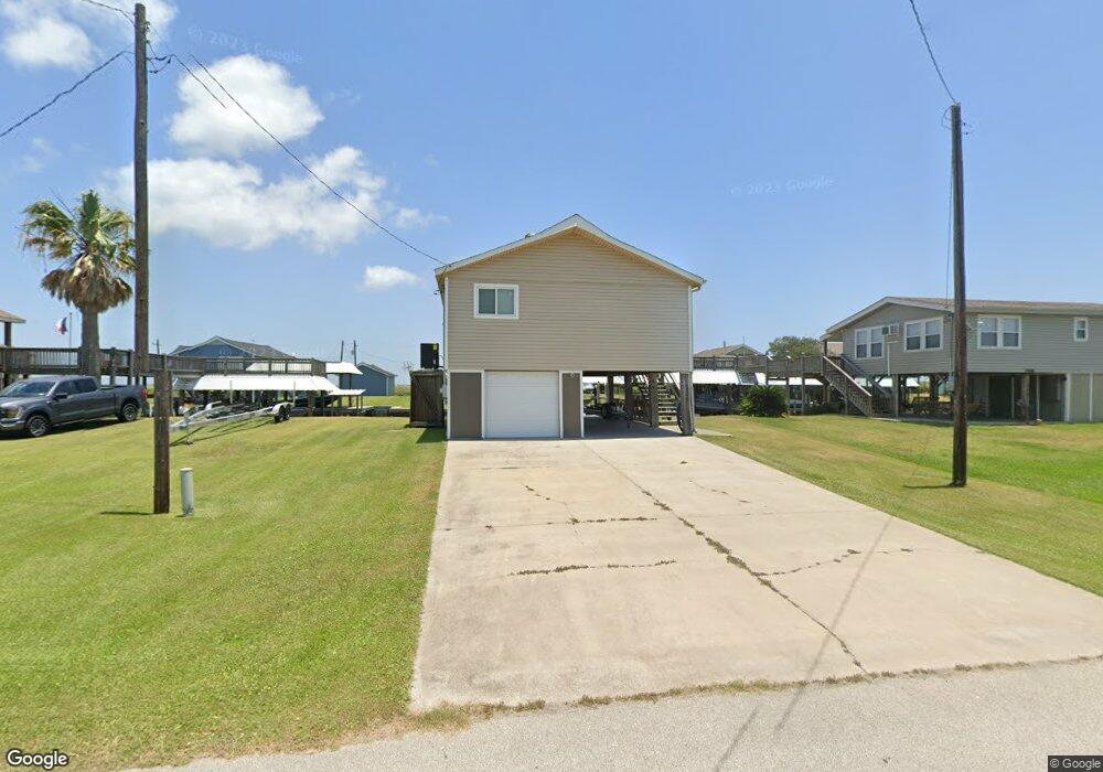
1224 Boyt Rd Port Bolivar, TX 77650
Crystal Beach NeighborhoodEstimated Value: $199,745 - $406,000
--
Bed
--
Bath
884
Sq Ft
$356/Sq Ft
Est. Value
About This Home
This home is located at 1224 Boyt Rd, Port Bolivar, TX 77650 and is currently estimated at $314,936, approximately $356 per square foot. 1224 Boyt Rd is a home with nearby schools including Morgan Elementary Magnet School, Burnet STREAM Magnet School, and Parker Elementary School.
Ownership History
Date
Name
Owned For
Owner Type
Purchase Details
Closed on
Oct 31, 2024
Sold by
Turrentine Vince and Turrentine Vincent
Bought by
Turrentine Ryan Matthew and Turrentine Marisa Annette
Current Estimated Value
Home Financials for this Owner
Home Financials are based on the most recent Mortgage that was taken out on this home.
Original Mortgage
$212,500
Outstanding Balance
$210,373
Interest Rate
6.09%
Mortgage Type
New Conventional
Estimated Equity
$104,563
Purchase Details
Closed on
Apr 22, 2002
Sold by
Newman T A and Newman Joyce
Bought by
Turrentine Vincent and Turrentine Laura
Create a Home Valuation Report for This Property
The Home Valuation Report is an in-depth analysis detailing your home's value as well as a comparison with similar homes in the area
Home Values in the Area
Average Home Value in this Area
Purchase History
| Date | Buyer | Sale Price | Title Company |
|---|---|---|---|
| Turrentine Ryan Matthew | -- | None Listed On Document | |
| Turrentine Vincent | -- | Stewart Title Company |
Source: Public Records
Mortgage History
| Date | Status | Borrower | Loan Amount |
|---|---|---|---|
| Open | Turrentine Ryan Matthew | $212,500 |
Source: Public Records
Tax History Compared to Growth
Tax History
| Year | Tax Paid | Tax Assessment Tax Assessment Total Assessment is a certain percentage of the fair market value that is determined by local assessors to be the total taxable value of land and additions on the property. | Land | Improvement |
|---|---|---|---|---|
| 2025 | $1,194 | $204,010 | $58,950 | $145,060 |
| 2024 | $1,194 | $187,940 | $40,500 | $147,440 |
| 2023 | $1,194 | $214,242 | $0 | $0 |
| 2022 | $3,138 | $194,765 | $0 | $0 |
| 2021 | $3,089 | $214,570 | $40,500 | $174,070 |
| 2020 | $2,988 | $167,580 | $40,500 | $127,080 |
| 2019 | $2,847 | $146,330 | $40,500 | $105,830 |
| 2018 | $2,849 | $147,730 | $40,500 | $107,230 |
| 2017 | $2,589 | $149,170 | $40,500 | $108,670 |
| 2016 | $2,353 | $120,310 | $40,500 | $79,810 |
| 2015 | $1,503 | $120,310 | $40,500 | $79,810 |
| 2014 | $1,485 | $103,760 | $40,500 | $63,260 |
Source: Public Records
Map
Nearby Homes
- 1188 Boyt Rd
- 1/2 Acre E Bay Dr N
- 0.502 E Bay Dr N
- 1131 Boyt Rd Unit 14
- 1133 E Bay Dr
- 1125 E Bay Dr N
- 1321 Bay
- 1354 Boyt Rd
- 1358 Boyt Rd
- 1059 Boyt Rd
- 1116 E Bay Dr
- 4418 E Bay Dr
- 169 Ocean Breeze Dr Unit 55
- TBD Bush Rd
- 4123 Bush Rd
- 122 Ocean Breeze Dr
- 4124 Bush Rd
- 108 Ocean Breeze Dr
- 112 Ocean Breeze Dr
- 109 Ocean Tide Dr