Estimated Value: $378,311 - $423,000
4
Beds
2
Baths
2,018
Sq Ft
$198/Sq Ft
Est. Value
About This Home
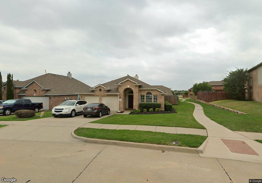
This home is located at 1224 Cedar Branch Dr, Wylie, TX 75098 and is currently estimated at $398,828, approximately $197 per square foot. 1224 Cedar Branch Dr is a home located in Collin County with nearby schools including Wally Watkins Elementary School, AB Harrison Intermediate School, and Grady Burnett J High School.
Ownership History
Date
Name
Owned For
Owner Type
Purchase Details
Closed on
Feb 1, 2006
Sold by
Rh Of Texas Lp
Bought by
Johnson Damian and Johnson Latonya M
Current Estimated Value
Home Financials for this Owner
Home Financials are based on the most recent Mortgage that was taken out on this home.
Original Mortgage
$155,670
Outstanding Balance
$87,376
Interest Rate
6.15%
Mortgage Type
FHA
Estimated Equity
$311,452
Create a Home Valuation Report for This Property
The Home Valuation Report is an in-depth analysis detailing your home's value as well as a comparison with similar homes in the area
Home Values in the Area
Average Home Value in this Area
Purchase History
| Date | Buyer | Sale Price | Title Company |
|---|---|---|---|
| Johnson Damian | -- | Rtc |
Source: Public Records
Mortgage History
| Date | Status | Borrower | Loan Amount |
|---|---|---|---|
| Open | Johnson Damian | $155,670 |
Source: Public Records
Tax History Compared to Growth
Tax History
| Year | Tax Paid | Tax Assessment Tax Assessment Total Assessment is a certain percentage of the fair market value that is determined by local assessors to be the total taxable value of land and additions on the property. | Land | Improvement |
|---|---|---|---|---|
| 2025 | $5,544 | $381,326 | $110,250 | $284,207 |
| 2024 | $5,544 | $346,660 | $110,250 | $280,468 |
| 2023 | $5,544 | $315,145 | $99,750 | $282,118 |
| 2022 | $6,285 | $286,495 | $84,000 | $250,715 |
| 2021 | $6,128 | $260,450 | $73,500 | $186,950 |
| 2020 | $6,227 | $250,776 | $63,000 | $187,776 |
| 2019 | $6,464 | $245,978 | $63,000 | $182,978 |
| 2018 | $6,298 | $233,845 | $57,750 | $176,095 |
| 2017 | $5,766 | $217,559 | $47,250 | $170,309 |
| 2016 | $5,408 | $201,137 | $42,000 | $159,137 |
| 2015 | $4,297 | $182,230 | $42,000 | $140,230 |
Source: Public Records
Map
Nearby Homes
- 1318 Chestnut Hill Dr
- 1320 Cedar Branch Dr
- 1321 Iron Horse St
- 1210 Iron Horse St
- 1201 E Stone Rd
- 1323 Canyon Creek Rd
- 1316 Taren Trail
- 1318 Taren Trail
- 407 Sparrow Dr
- 1330 Canyon Creek Rd
- 306 Foxwood Ct
- 312 Maltese Cir
- 1503 E Collins Blvd
- 1210 Troy Rd
- 1115 Nighthawk Dr
- 1209 Surrey Cir
- 1613 Saddle Ridge Dr
- 825 Forest Edge Ln
- 1605 Roberts Ravine Rd
- 409 Cedar Ridge Dr
- 1226 Cedar Branch Dr
- 1222 Cedar Branch Dr
- 1228 Cedar Branch Dr
- 1303 Chestnut Hill Dr
- 1301 Chestnut Hill Dr
- 1305 Chestnut Hill Dr
- 1219 Chestnut Hill Dr
- 1220 Cedar Branch Dr
- 1300 Cedar Branch Dr
- 1231 Cedar Branch Dr
- 1307 Chestnut Hill Dr
- 1217 Chestnut Hill Dr
- 1229 Cedar Branch Dr
- 1302 Cedar Branch Dr
- 1218 Cedar Branch Dr
- 1215 Chestnut Hill Dr
- 1309 Chestnut Hill Dr
- 1303 Clear Creek Dr
- 1227 Cedar Branch Dr
- 1304 Cedar Branch Dr