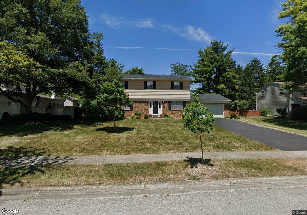
1224 Langston Dr Columbus, OH 43220
Estimated Value: $617,930 - $792,000
4
Beds
3
Baths
1,989
Sq Ft
$351/Sq Ft
Est. Value
About This Home
This home is located at 1224 Langston Dr, Columbus, OH 43220 and is currently estimated at $698,983, approximately $351 per square foot. 1224 Langston Dr is a home located in Franklin County with nearby schools including Greensview Elementary School, Hastings Middle School, and Upper Arlington High School.
Ownership History
Date
Name
Owned For
Owner Type
Purchase Details
Closed on
Jul 24, 1996
Sold by
Layton Albert F
Bought by
Butler Eugene Robert and Butler Kendall D
Current Estimated Value
Home Financials for this Owner
Home Financials are based on the most recent Mortgage that was taken out on this home.
Original Mortgage
$150,000
Outstanding Balance
$7,801
Interest Rate
8.43%
Mortgage Type
New Conventional
Estimated Equity
$691,182
Purchase Details
Closed on
May 1, 1985
Create a Home Valuation Report for This Property
The Home Valuation Report is an in-depth analysis detailing your home's value as well as a comparison with similar homes in the area
Home Values in the Area
Average Home Value in this Area
Purchase History
| Date | Buyer | Sale Price | Title Company |
|---|---|---|---|
| Butler Eugene Robert | $205,000 | -- | |
| -- | $57,500 | -- |
Source: Public Records
Mortgage History
| Date | Status | Borrower | Loan Amount |
|---|---|---|---|
| Open | Butler Eugene Robert | $150,000 |
Source: Public Records
Tax History
| Year | Tax Paid | Tax Assessment Tax Assessment Total Assessment is a certain percentage of the fair market value that is determined by local assessors to be the total taxable value of land and additions on the property. | Land | Improvement |
|---|---|---|---|---|
| 2025 | $11,191 | $190,300 | $86,030 | $104,270 |
| 2024 | $11,191 | $190,300 | $86,030 | $104,270 |
| 2023 | $11,055 | $190,300 | $86,030 | $104,270 |
| 2022 | $12,303 | $120,860 | $50,230 | $70,630 |
| 2021 | $7,876 | $120,860 | $50,230 | $70,630 |
| 2020 | $7,548 | $120,860 | $50,230 | $70,630 |
| 2019 | $7,095 | $102,310 | $50,230 | $52,080 |
| 2018 | $7,157 | $102,310 | $50,230 | $52,080 |
| 2017 | $7,051 | $102,310 | $50,230 | $52,080 |
| 2016 | $7,102 | $107,420 | $41,270 | $66,150 |
| 2015 | $7,096 | $107,420 | $41,270 | $66,150 |
| 2014 | $7,104 | $107,420 | $41,270 | $66,150 |
| 2013 | $3,392 | $97,650 | $37,520 | $60,130 |
Source: Public Records
Map
Nearby Homes
- 4305 Castleton Rd
- 1165 Highland Dr
- 1594 Lafayette Dr Unit 1594
- 1094 Merrimar Cir S Unit A
- 4692 Charecote Ln Unit E
- 1224 Kenbrook Hills Dr Unit 25
- 1022 Galliton Ct Unit D
- 4710 Charecote Ln Unit D
- 1046 Merrimar Cir N Unit I
- 1046 Merrimar Cir N Unit B
- 1030 Galliton Ct Unit H
- 4818 Winterset Dr Unit 820
- 1466 Weybridge Rd
- 4803 Wynwood Ct
- 3857 Patricia Dr
- 1196 Francisco Rd
- 1239 Bradshire Dr
- 1234 Bradshire Dr
- 1242 Bradshire Dr
- 723 Drummond Ct
- 1212 Langston Dr
- 1225 Darcann Dr
- 1237 Darcann Dr
- 1248 Langston Dr
- 1233 Langston Dr
- 1221 Langston Dr
- 1200 Langston Dr
- 1251 Darcann Dr
- 1245 Langston Dr
- 1211 Langston Dr
- 4249 Castleton Rd
- 1260 Langston Dr
- 1257 Langston Dr
- 4261 Castleton Rd
- 1263 Darcann Dr
- 1201 Langston Dr
- 1236 Darcann Dr
- 1224 Darcann Dr
- 1248 Darcann Dr
- 1240 Carron Dr
Your Personal Tour Guide
Ask me questions while you tour the home.