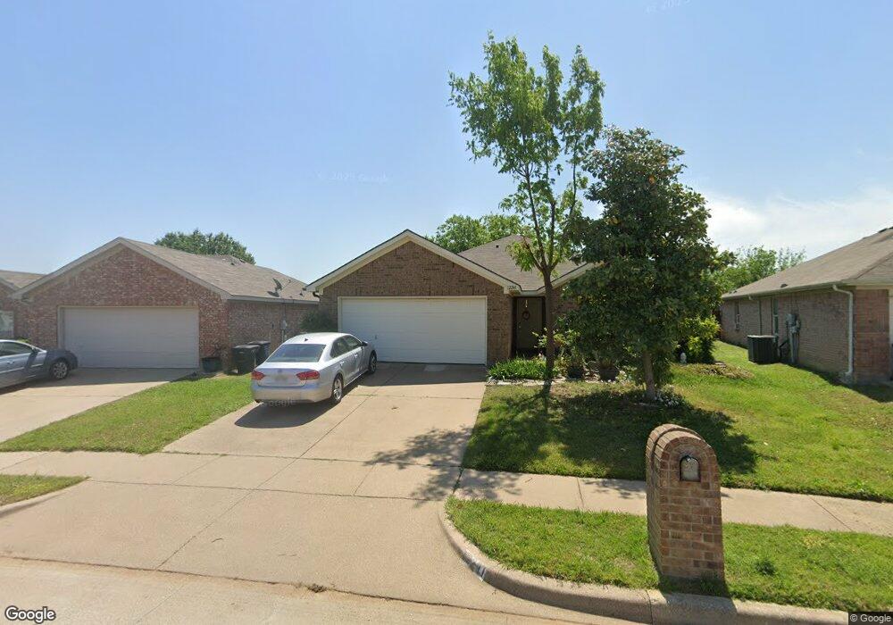
12241 Rolling Ridge Dr Burleson, TX 76028
Garden Acres NeighborhoodEstimated Value: $268,265 - $291,000
3
Beds
2
Baths
1,567
Sq Ft
$179/Sq Ft
Est. Value
About This Home
This home is located at 12241 Rolling Ridge Dr, Burleson, TX 76028 and is currently estimated at $280,316, approximately $178 per square foot. 12241 Rolling Ridge Dr is a home located in Tarrant County with nearby schools including Ann Brock Elementary at Oak Grove, Nick Kerr Middle School, and Burleson Centennial High School.
Ownership History
Date
Name
Owned For
Owner Type
Purchase Details
Closed on
Apr 19, 2004
Sold by
Classic Century Homes Ltd
Bought by
Taylor Darla
Current Estimated Value
Home Financials for this Owner
Home Financials are based on the most recent Mortgage that was taken out on this home.
Original Mortgage
$66,950
Outstanding Balance
$30,977
Interest Rate
5.42%
Mortgage Type
Purchase Money Mortgage
Estimated Equity
$249,339
Purchase Details
Closed on
Aug 11, 2003
Sold by
Classic Century Homes Inc
Bought by
Classic Century Homes Ltd
Home Financials for this Owner
Home Financials are based on the most recent Mortgage that was taken out on this home.
Original Mortgage
$70,000
Interest Rate
5.35%
Mortgage Type
Purchase Money Mortgage
Purchase Details
Closed on
Feb 7, 1995
Sold by
Gsm Corp
Bought by
Jal Real Estate Inc
Create a Home Valuation Report for This Property
The Home Valuation Report is an in-depth analysis detailing your home's value as well as a comparison with similar homes in the area
Home Values in the Area
Average Home Value in this Area
Purchase History
| Date | Buyer | Sale Price | Title Company |
|---|---|---|---|
| Taylor Darla | -- | Commonwealth Land | |
| Classic Century Homes Ltd | -- | Commonwealth Land Title | |
| Jal Real Estate Inc | $133,453 | -- |
Source: Public Records
Mortgage History
| Date | Status | Borrower | Loan Amount |
|---|---|---|---|
| Open | Taylor Darla | $66,950 | |
| Previous Owner | Classic Century Homes Ltd | $70,000 |
Source: Public Records
Tax History Compared to Growth
Tax History
| Year | Tax Paid | Tax Assessment Tax Assessment Total Assessment is a certain percentage of the fair market value that is determined by local assessors to be the total taxable value of land and additions on the property. | Land | Improvement |
|---|---|---|---|---|
| 2025 | $1,327 | $247,835 | $50,000 | $197,835 |
| 2024 | $1,327 | $247,835 | $50,000 | $197,835 |
| 2023 | $5,923 | $270,047 | $50,000 | $220,047 |
| 2022 | $6,048 | $235,554 | $35,000 | $200,554 |
| 2021 | $5,782 | $204,306 | $35,000 | $169,306 |
| 2020 | $5,310 | $181,048 | $35,000 | $146,048 |
| 2019 | $5,083 | $175,901 | $35,000 | $140,901 |
| 2018 | $1,249 | $150,562 | $35,000 | $115,562 |
| 2017 | $4,166 | $144,938 | $25,000 | $119,938 |
| 2016 | $3,787 | $128,011 | $25,000 | $103,011 |
| 2015 | $2,926 | $113,960 | $25,000 | $88,960 |
| 2014 | $2,926 | $109,400 | $25,000 | $84,400 |
Source: Public Records
Map
Nearby Homes
- 12200 Rolling Ridge Dr
- 1305 Pepperfield Ct
- 12252 Shadow Wood Trail
- 1312 Pepperfield Ct
- 12300 Hunters Knoll Dr
- 12131 Rowsley Ln
- 1505 Wickham Dr
- 11916 Long Stone Dr
- 5547 Highway 1187
- 12013 Rowsley Ln
- 11917 Hassop Ln
- 1704 Village Park Ct
- 1609 Village Park Trail
- 1016 Brownford Dr
- 1841 Wickham Dr
- 1037 Doe Meadow Dr
- 1324 Sierra Blanca Dr
- 12109 Lunar Ln
- 1120 Nelson Place
- 1233 Nicole Way
- 12245 Rolling Ridge Dr
- 12237 Rolling Ridge Dr
- 12249 Rolling Ridge Dr
- 12320 Silver Mist Trail
- 12233 Rolling Ridge Dr
- 12316 Silver Mist Trail
- 12312 Silver Mist Trail
- 12240 Rolling Ridge Dr
- 1309 Pepperfield Ct
- 12229 Rolling Ridge Dr
- 12253 Rolling Ridge Dr
- 12308 Silver Mist Trail
- 12257 Shadow Wood Trail
- 12228 Rolling Ridge Dr
- 1313 Pepperfield Ct
- 1301 Pepperfield Ct
- 12304 Silver Mist Trail
- 12225 Rolling Ridge Dr
- 12249 Shadow Wood Trail
- 12301 Rolling Ridge Dr