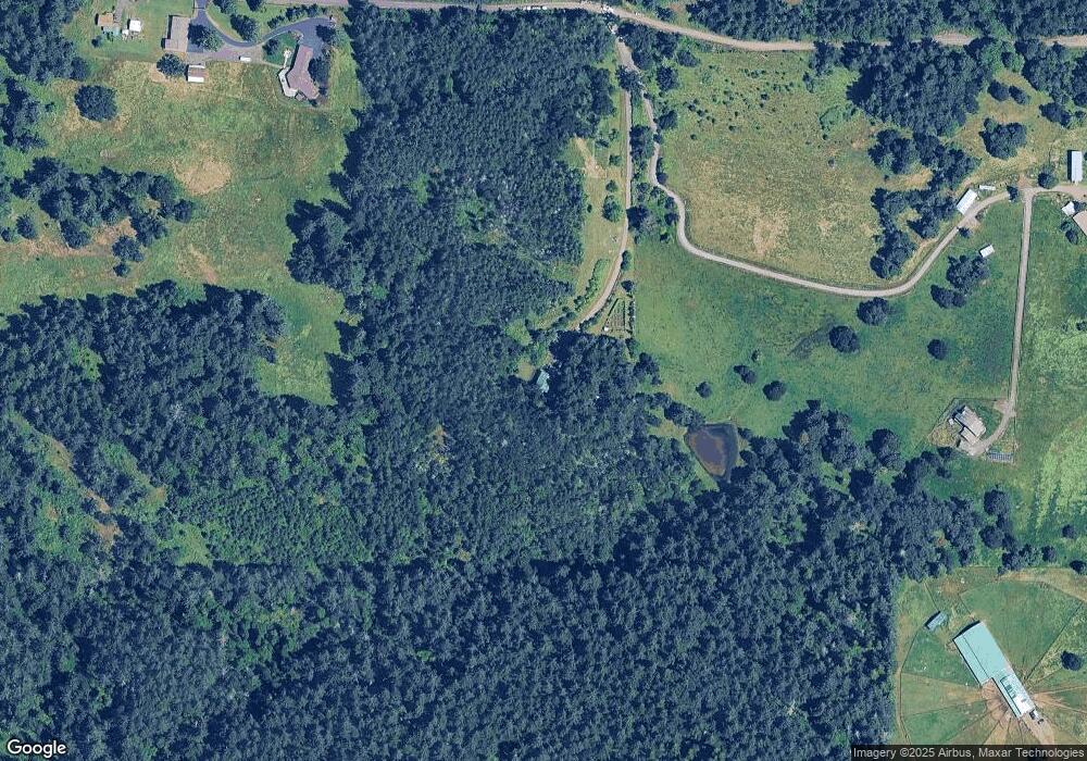
12244 S Quinn Rd Molalla, OR 97038
Estimated Value: $949,088 - $1,004,000
3
Beds
3
Baths
3,998
Sq Ft
$242/Sq Ft
Est. Value
About This Home
This home is located at 12244 S Quinn Rd, Molalla, OR 97038 and is currently estimated at $968,363, approximately $242 per square foot. 12244 S Quinn Rd is a home located in Clackamas County.
Ownership History
Date
Name
Owned For
Owner Type
Purchase Details
Closed on
Jun 16, 2010
Sold by
Saunders David R and Saunders Barbara M
Bought by
Saunders David R and Saunders Barbara M
Current Estimated Value
Home Financials for this Owner
Home Financials are based on the most recent Mortgage that was taken out on this home.
Original Mortgage
$120,500
Interest Rate
4.99%
Mortgage Type
New Conventional
Purchase Details
Closed on
Jun 19, 2002
Sold by
Saunders David Ronald and Saunders Barbara Marlene
Bought by
Saunders David R and Saunders Barbara M
Create a Home Valuation Report for This Property
The Home Valuation Report is an in-depth analysis detailing your home's value as well as a comparison with similar homes in the area
Home Values in the Area
Average Home Value in this Area
Purchase History
| Date | Buyer | Sale Price | Title Company |
|---|---|---|---|
| Saunders David R | -- | Accommodation | |
| Saunders David R | -- | First Amer Title Ins Co Or | |
| Saunders David R | -- | -- |
Source: Public Records
Mortgage History
| Date | Status | Borrower | Loan Amount |
|---|---|---|---|
| Closed | Saunders David R | $120,500 |
Source: Public Records
Tax History Compared to Growth
Tax History
| Year | Tax Paid | Tax Assessment Tax Assessment Total Assessment is a certain percentage of the fair market value that is determined by local assessors to be the total taxable value of land and additions on the property. | Land | Improvement |
|---|---|---|---|---|
| 2025 | $6,201 | $452,568 | -- | -- |
| 2024 | $5,995 | $439,504 | -- | -- |
| 2023 | $5,995 | $426,821 | $0 | $0 |
| 2022 | $5,019 | $414,506 | $0 | $0 |
| 2021 | $4,794 | $402,546 | $0 | $0 |
| 2020 | $4,666 | $390,934 | $0 | $0 |
| 2019 | $4,534 | $379,668 | $0 | $0 |
| 2018 | $4,412 | $368,729 | $0 | $0 |
| 2017 | $4,171 | $358,105 | $0 | $0 |
| 2016 | $3,918 | $347,794 | $0 | $0 |
| 2015 | $3,810 | $337,778 | $0 | $0 |
| 2014 | $3,669 | $328,058 | $0 | $0 |
Source: Public Records
Map
Nearby Homes
- 9924 S Wildcat Rd
- 35267 S Acer Ln
- 0 S Wilhoit Rd
- 10285 S Rosewood Way
- 36451 S Sawtell Rd Unit 16
- 36451 S Sawtell Rd Unit 10
- 36451 S Sawtell Rd
- 36175 S Highway 213
- 0 Crooked Finger Rd NE Unit 827344
- 0 Crooked Finger Rd NE Unit 265826977
- 37212 S Sawtell Rd
- 000 Crooked Finger Rd NE
- Lot 1600 Crooked Finger Rd NE
- 0 Off of Crooked Finge Rd
- 35517 S Aqua Springs Rd
- 15776 S Pierce Rd
- 15634 S Fawn View Way
- 15646 S Fawn View Way
- 35556 S Aqua Springs Rd
- 35544 S Aqua Springs Rd
- 12232 S Quinn Rd
- 12380 S Quinn Rd
- 12940 S Wyland Rd
- 12202 S Quinn Rd
- 12201 S Quinn Rd
- 12954 S Wyland Rd
- 12379 S Quinn Rd
- 12000 S Quinn Rd
- 36951 S Blair Rd
- 12506 S Wildcat Rd
- 0 S Wyland Rd
- 36720 S Blair Rd
- 12960 S Wyland Rd
- 12502 S Wildcat Rd
- 11831 S Wildcat Rd
- 37051 S Blair Rd
- 12012 S Wildcat Rd
- 36880 S Blair Rd
- 11786 S Wildcat Rd
- 36821 S Wilhoit Rd
